 Mon GéoSource
Observation par transect
Type of resources
Available actions
INSPIRE themes
Provided by
Years
Representation types
Update frequencies
status
Scale
-
The objective of this cruise, which has been taking place in the English Channel - Baie de somme since 1980, over 5 days in September, is to evaluate the natural multi-year fluctuations of the stands and to analyze the possible impact of the nuclear power plant on the marine environment and resources. It makes it possible to determine annual indices of abundance and distribution of flatfish and other species (shrimp, pout, whiting).
-
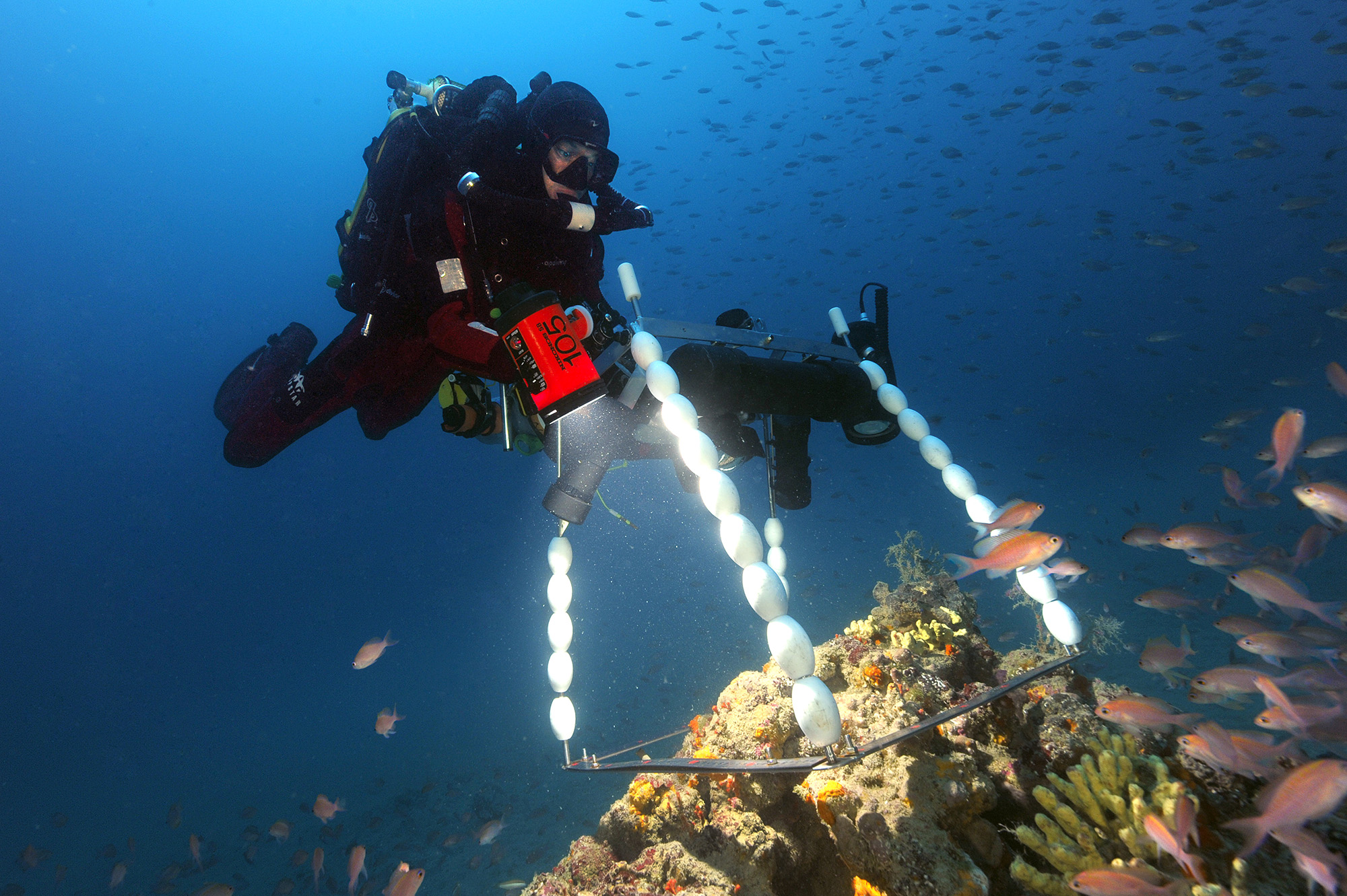
Suivi de descripteurs pour la caractérisation des assemblages de communautés du coralligène
-
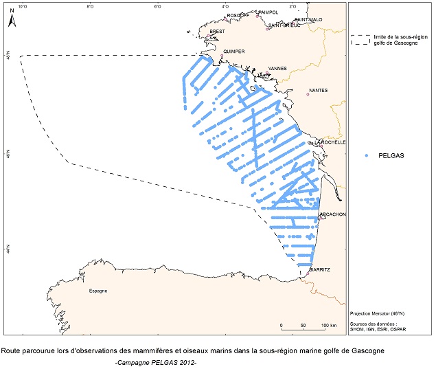
The objective of the PELGAS cruise is to monitor distribution and abundance of pelagic species fished in the Bay of Biscay, using two direct evaluation methods: acoustics and spawning estimates. The cruise was conducted in coordination with France, Spain and Portugal, in the framework of the European council regulations (EC No 1543/2000 of 29 June 2000 and No 1639/2001 of 25 July 2001).
-
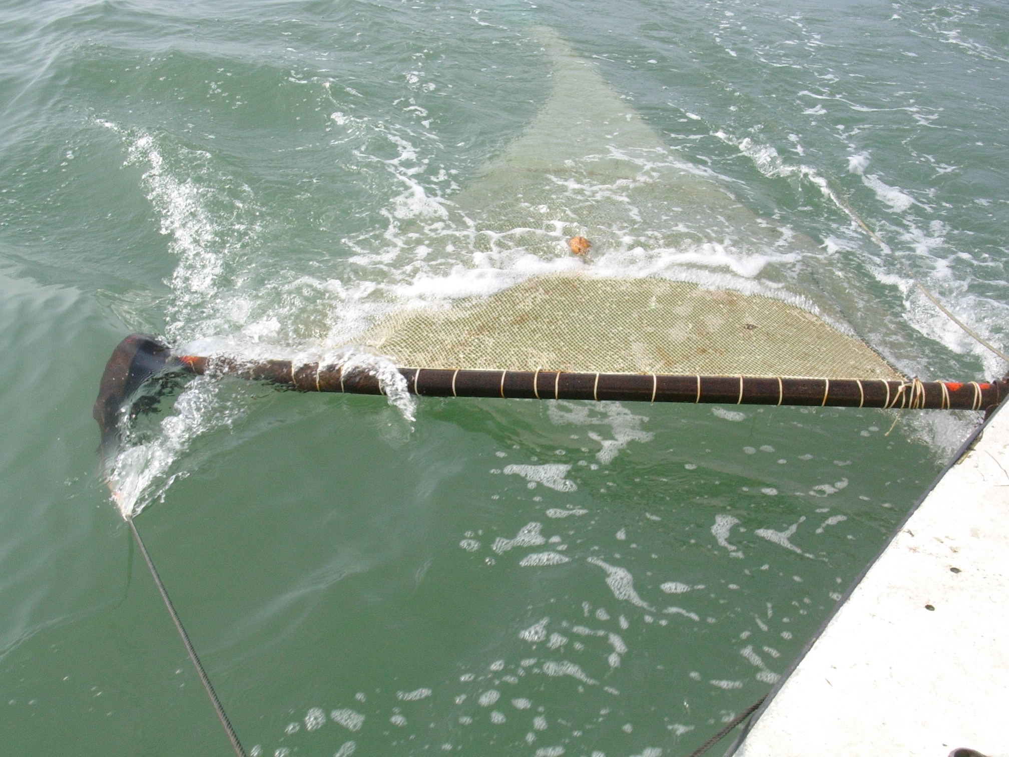
The observation of ecosystems by Ifremer's Fisheries Information System (SIH) is based on a network of sea cruises. It aims to assess the state of stocks of the various species fished in France and Europe. It also enables the characterisation of the marine ecosystem in which the populations evolve. 23 scientific cruises take place each year at sea, enabling data to be collected for more than 30 years for the oldest. Thanks to the use of standardised fishing gear, the data acquired each year on board scientific vessels or professional fishing vessels contribute to the calculation of the index of abundance, with thousands of fish taken during timed trawls. The fish are measured and their age is assessed by measuring their otoliths (small bones located in the inner ear of the fish).
-
The definitive coastal information system, Quadrige stores coastal observation and monitoring network data. In order to manage coastal monitoring data, Ifremer developed the Quadrige² information system. Quadrige is one element of the Water Information System (SIE) http:// www.eaufrance.fr, et à ce titre, contribue aux travaux du Secrétariat d'Administration National des Données Relatives à l'Eau (SANDRE) http://www.sandre.eaufrance.fr. Quadrige Marine Zones is a reference source unique to the Quadrige system. It is used to break down the coast of the French mainland and overseas territories into large areas and to connect each one with observation and monitoring locations.