 Mon GéoSource
/Metropolitan France/Western Mediterranean
Type of resources
Available actions
INSPIRE themes
Provided by
Years
Representation types
Update frequencies
status
Scale
-
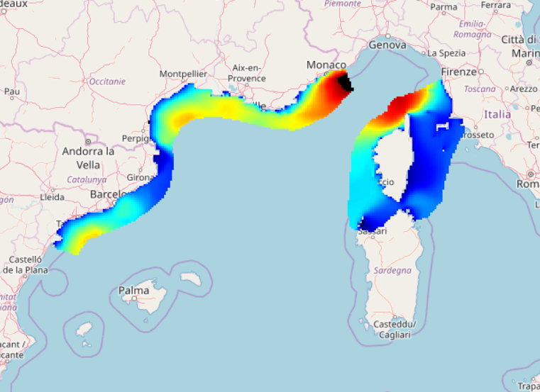
IOWAGA sea-states hindcast database generated by the wave model WAVEWATCH-III and forced by ECMWF winds on the North mediterranean grid over 2004-2017 period.
-
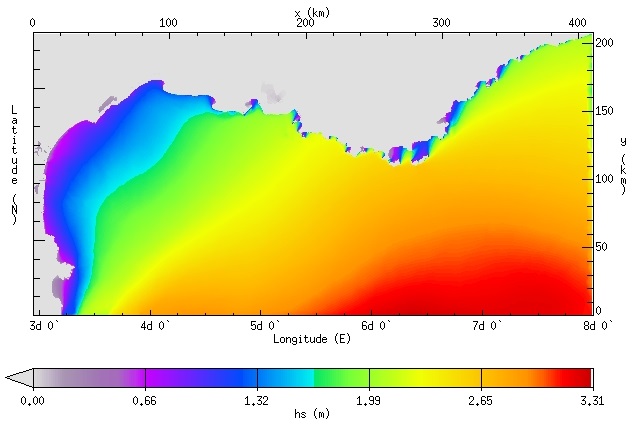
IOWAGA sea-states hindcast database generated by the wave model WAVEWATCH-III and forced by ECMWF winds on the North mediterranean unstructured grid over 2009-2010 period.
-
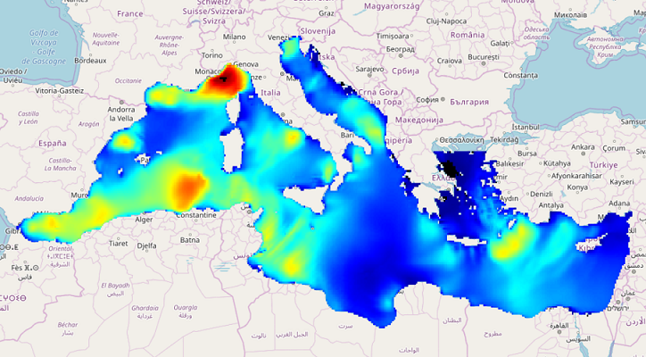
IOWAGA sea-states hindcast database generated by the wave model WAVEWATCH-III and forced by ECMWF winds on the Mediterranean grid over 2005-2017 period.
-
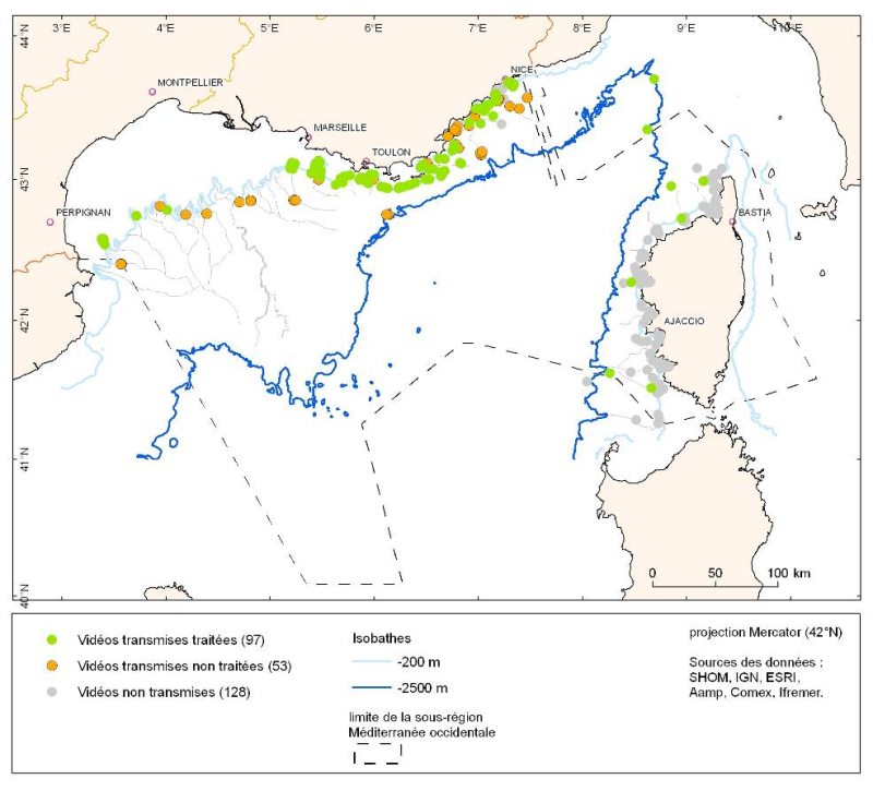
Les données sont fournies sous forme de couche de points représentant les plongées en submersible en Méditerranée française.
-
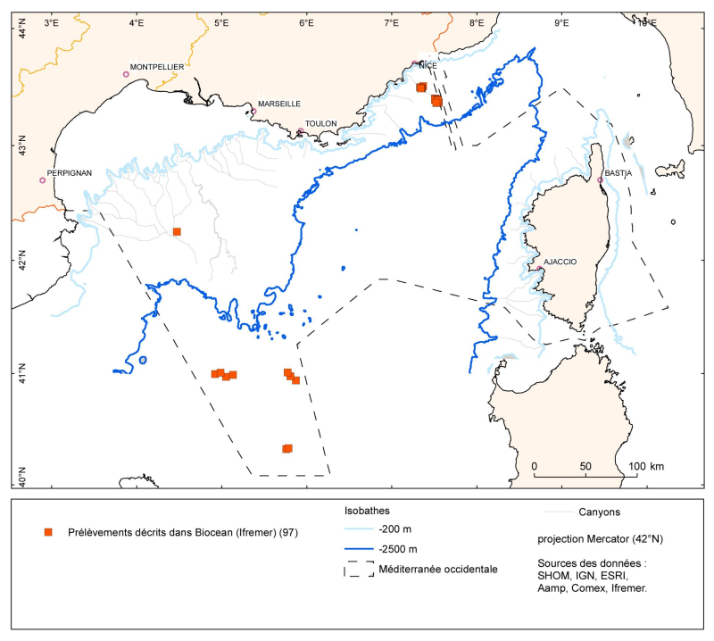
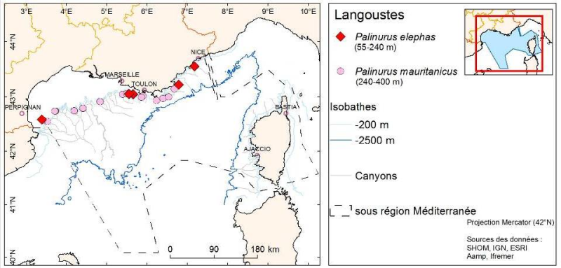
Les données sont fournies sous forme de couche de points représentant les prélèvements (opérations) en Méditerranée française. Les listes d'espèces identifiées correspondant à ces points de prélèvements sont dans la base Biocean.
-
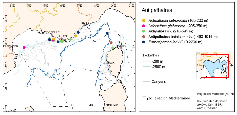
La répartition des espèces est fournie sous forme de couche de points représentant les observations in situ des organismes observés pendant des plongées en submersible dans les canyons de Méditerranée continentale.
-
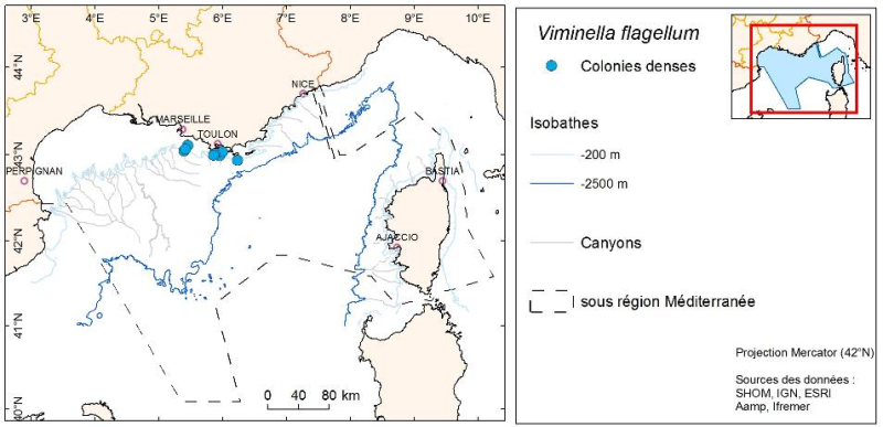
La répartition des espèces est fournie sous forme de couche de points représentant les observations in situ des organismes observés pendant des plongées en submersible dans les canyons de Méditerranée continentale.
-
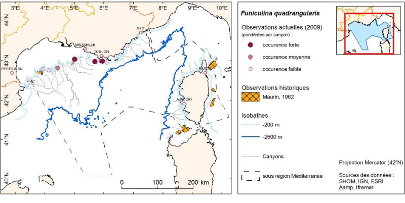
Couche de polygones représentant la répartition des organismes décrite dans la bibliographie par Maurin 1962 et obtenue par chalutage dans les canyons de Méditerranée française.
-
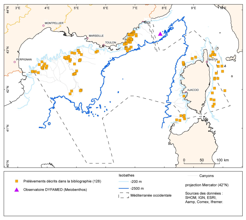
Les données sont fournies sous forme de couche de points représentant les prélèvements (opérations) benthiques en Méditerranée française. Les listes d'espèces identifiées correspondant à ces points de prélèvements sont dans les références bibliographiques indiquées dans la couche.
-
La répartition des espèces est fournie sous forme de couche de points représentant les observations in situ des organismes observés pendant des plongées en submersible dans les canyons de Méditerranée continentale.