 Mon GéoSource
/Activités humaines/Divers
Type of resources
Available actions
INSPIRE themes
Provided by
Years
Formats
Representation types
Update frequencies
status
Scale
-
Evaluation réalisée en juin 2010 par le Capitaine Pierre Henri Bidet (Conseiller et expert technique, MEEDDM/DGITM/DST/PTF4) et fournie à l'AAMP dans le cadre de l'évaluation initiale DCSMM des vecteurs d'introduction et des impacts des espèces marines non indigènes. L'évaluation est réalisée à partir des chiffres publics produits par la direction des services de transport du MEEDDM sur les entrées/sorties des ports français à partir des données des autorités portuaires. Les rejets d’eaux de ballast correspondent essentiellement à des opérations d’équilibrage des navires qui chargent des marchandises dans des ports français (export). Voir la partie généalogie pour la méthodologie de calcul des volumes d'eaux déballastées. Description des champs de la table attributaire : REGION : sous-région marine DCSMM PORTS : nom des ports français concernés par l'étude ; T_EXP_VS : tonnage exporté par la filière vrac sec ; VS_EAB40 : estimation tonnage d'eau déballastée par la filière vrac sec, 40 % de T_EXP_VS ; T_EXP_VL : tonnage exporté par la filière vrac liquide ; VL_EAB30 : estimation tonnage d'eau déballastée par la filière vrac liquide, 30 % de T_EXP_VL ; T_EAB_total : estimation du tonnage total d'eau déballastée par port, VS_EAB40+VL_EAB30.
-
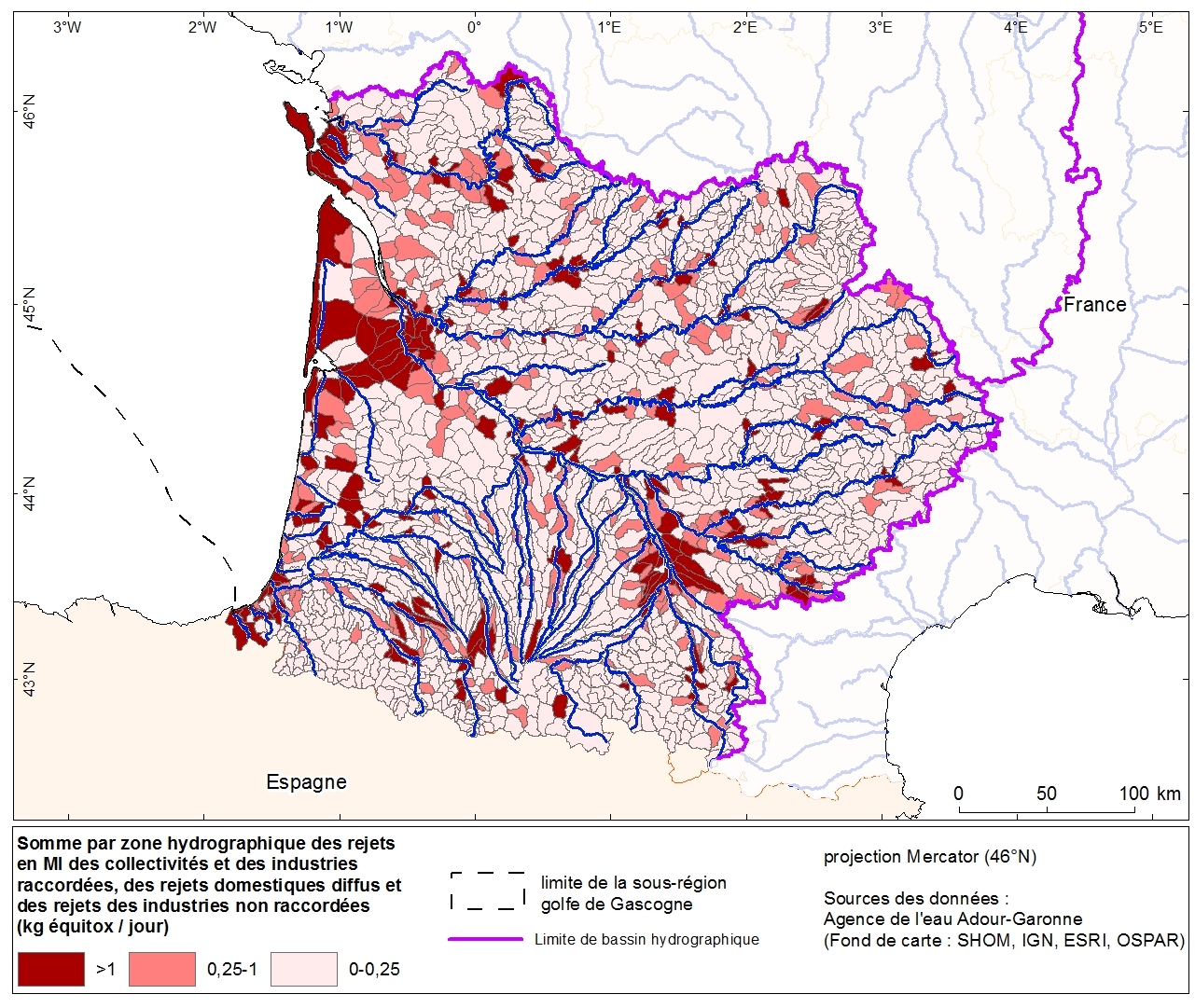
Discharges of nutrients (nitrogen, phosphorus and organic matter) and toxic releases (MI) per hydrographic zone from industries and communities of the Adour-Garonne basin. This data was collected as part of the initial assessment of the MSFD with the Water Agency of Adour-Garonne. Referent expert AAMP: Aurélie Blanck.
-
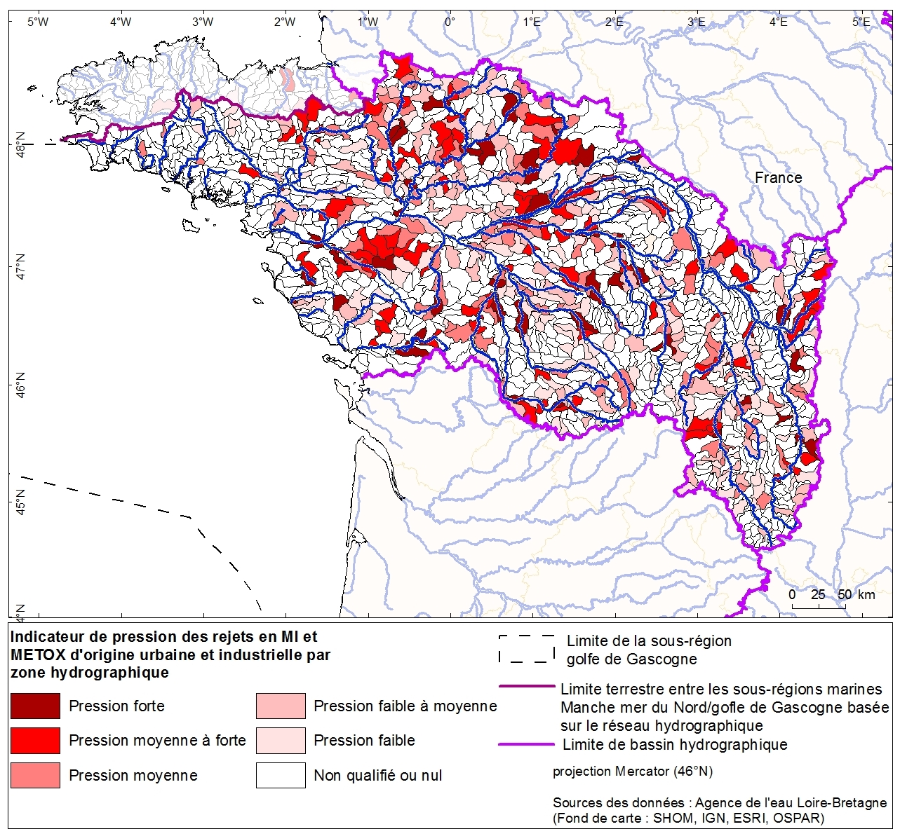
Toxic discharges from urban and industrial sources per hydrographic zone of the Loire Bretagne basin. This data was collected as part of the initial assessment of the MSFD with the Water Agency of Loire-Bretagne. Referent expert AAMP: Aurélie Blanck.
-
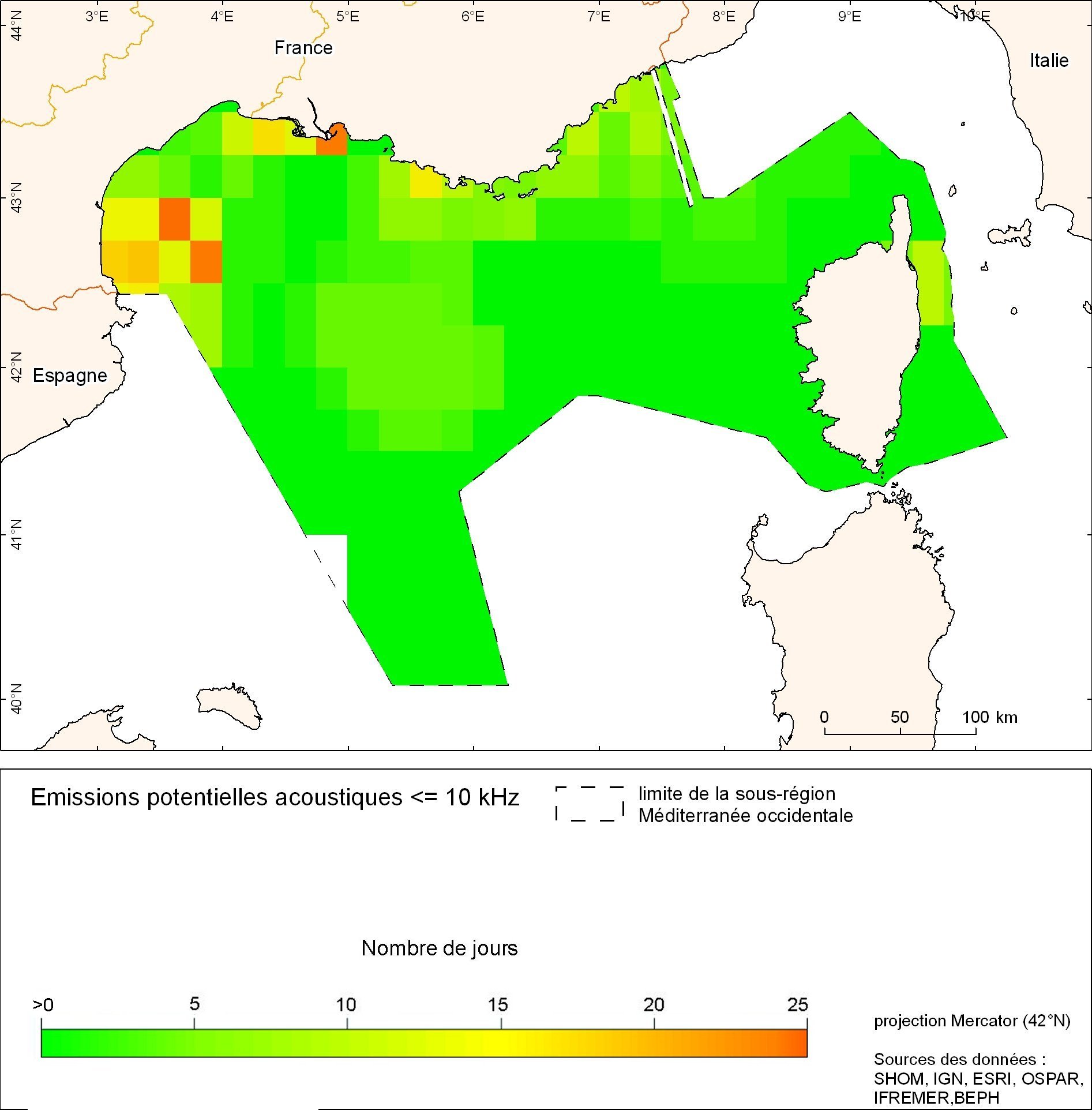
La cartographie des bruits impulsifs est une cartographie du nombre de jours potentiels d'émissions sonores sous-marines, sur la bande de fréquences de 10 Hz à 10 kHz, cumulés de 2004 à 2010, en ZEE française métropolitaine (sur des mailles de 15’ de côté).
-
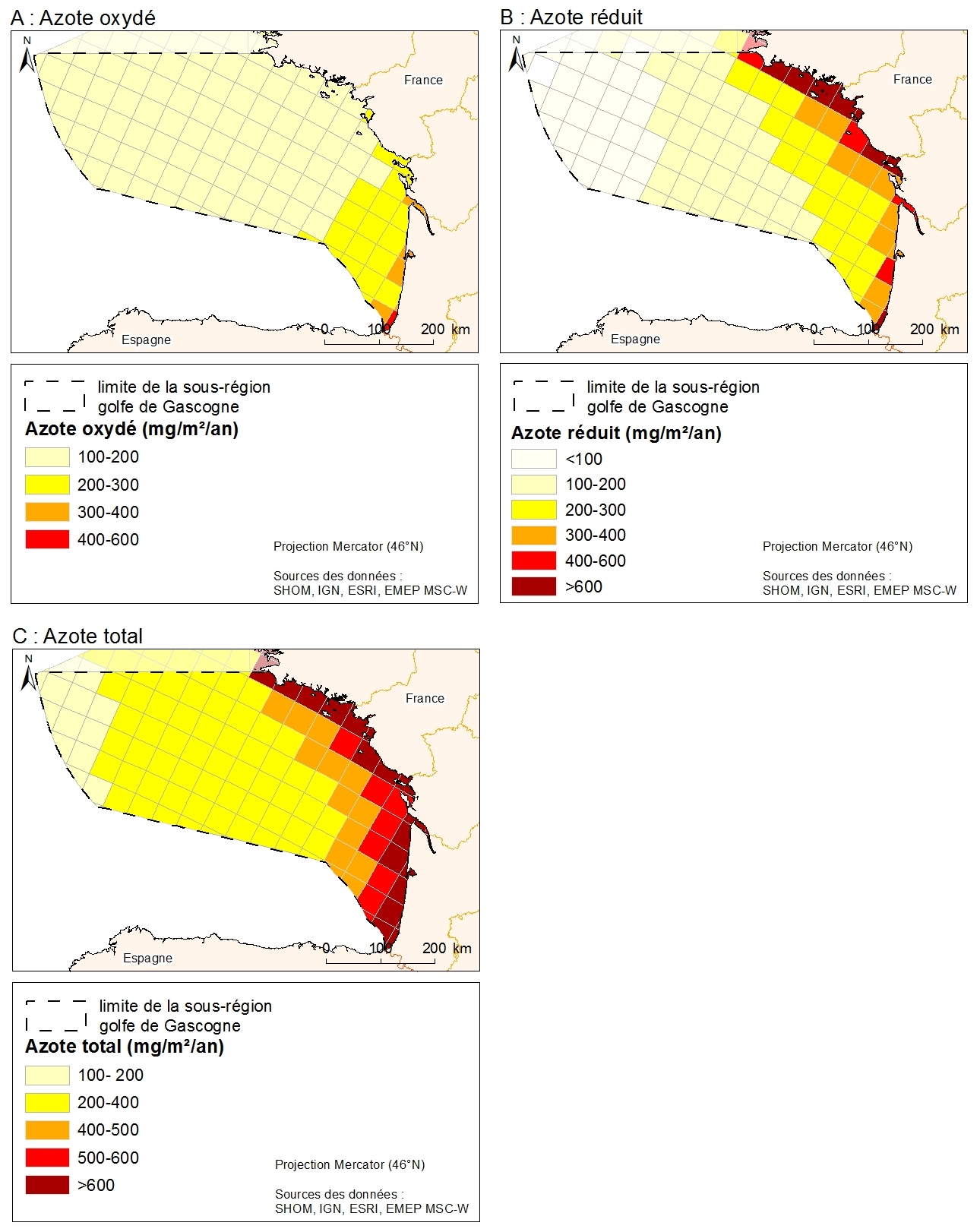
Data from atmospheric deposition of nitrogen are calculated from emissions data coupled with an atmospheric chemical transport model. Emissions data are from the EMEP program. They are public and available on the EMEP database and are based on emissions data (combustion, waste, transport, agriculture) collected by country. The models estimate atmospheric deposition of oxidized nitrogen, reduced nitrogen and total nitrogen for the period 1995-2008 from the emissions data and meteorological data. Models are driven by EMEP MSC-W (Meteorological Synthesizing Centre West). From the data downloaded from the EMEP, the MPA produced a GIS data format in shp by projecting the data on the EMEP grid projected in North Pole Stereographic
-
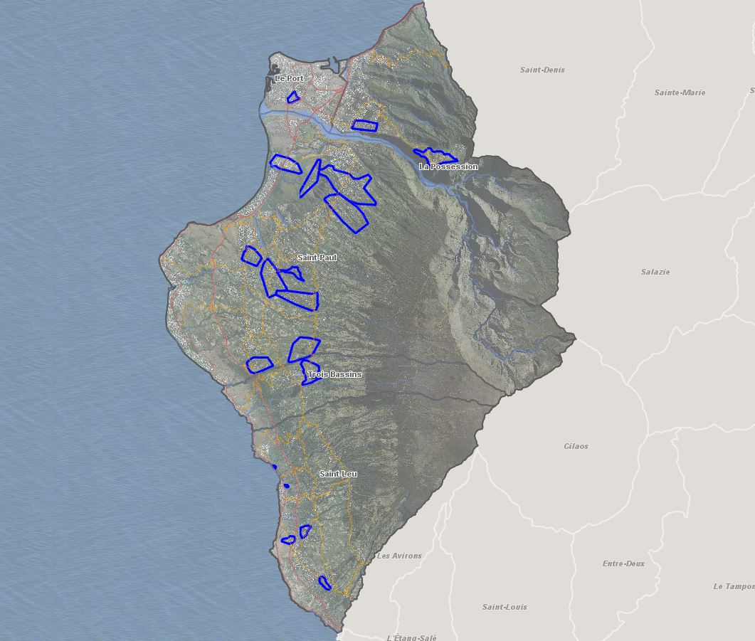
Localisation des sites d'intervention prioritaire du PILHI Programme Intercommunal de Lutte contre l'Habitat Indigne sur les cinq communes du territoire du TCO de l'île de la Réunion (Le Port, La Possession, Saint-Paul, Saint-Leu, Trois Bassins).
-
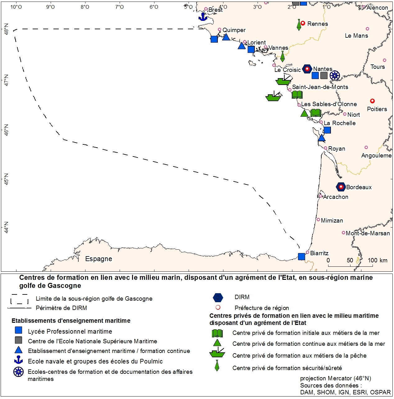
Agencies education in marine trades geolocalized to municipality. This information was produced as part of the initial assessment of the MSFD. Referent expert Sophie Devergie. WARNING: the spatial structure of the data must be improved because it contains superpositions of points (several training agencies per commune). Here the tool "Representation" of ArcGIS was used to facilitate the mapping of the data that does not meet basic standards of the topology. Ultimately, the quality of the data can be improved by refining the address geolocation.
-
Zones corresponding to the delimitation of major watersheds and related marine areas in the Seine-Normandy basin for the assessment of pressures on the different water masses on the Normandy coast and marine sub region English Channel - North Sea. Nutrient discharges from industries and communities.
-
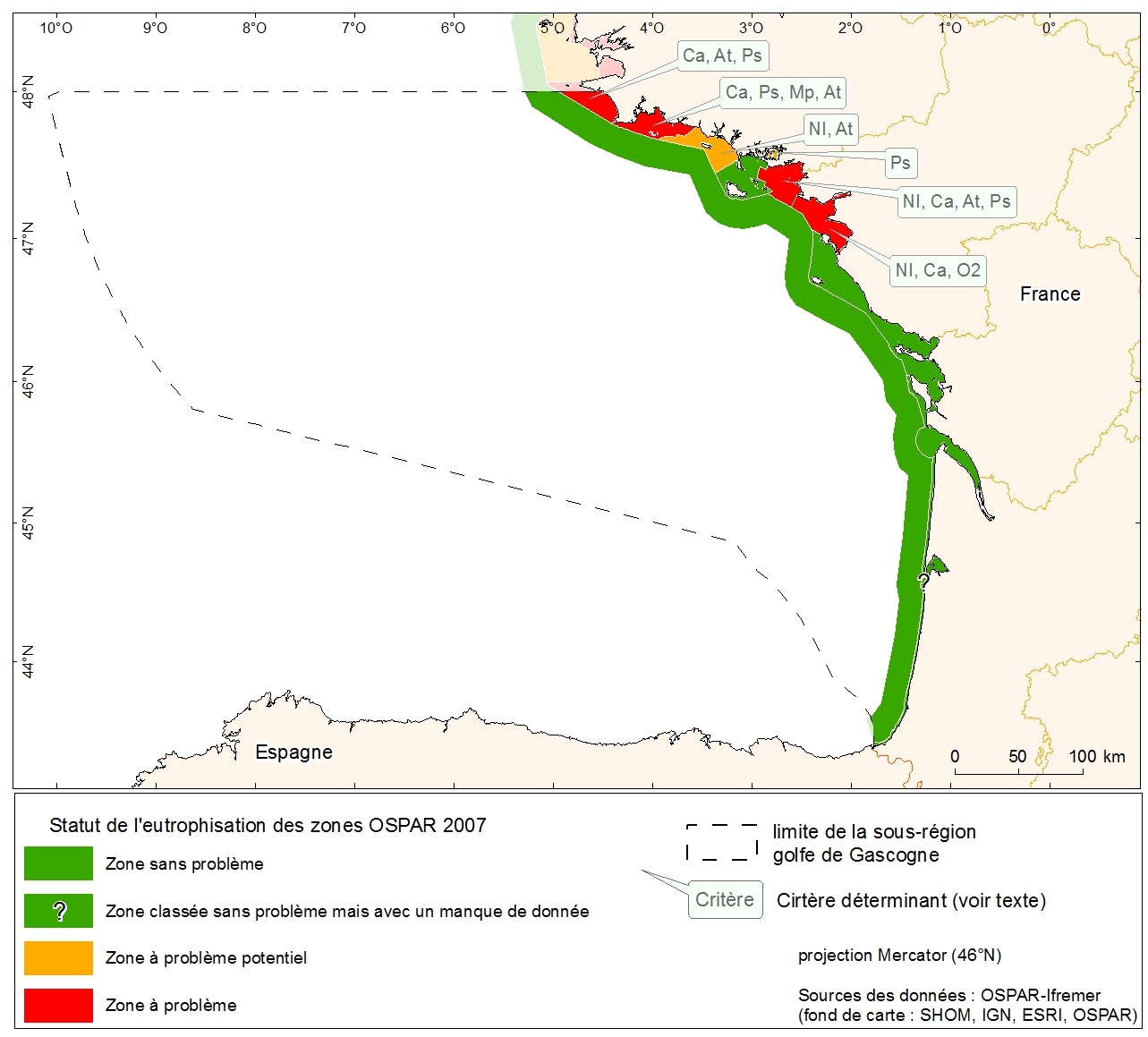
Eutrophication status of the OSPAR of 2007 zones of metropolitan France. Data collected in the course of "initial assessment" phase of the MSFD.
-
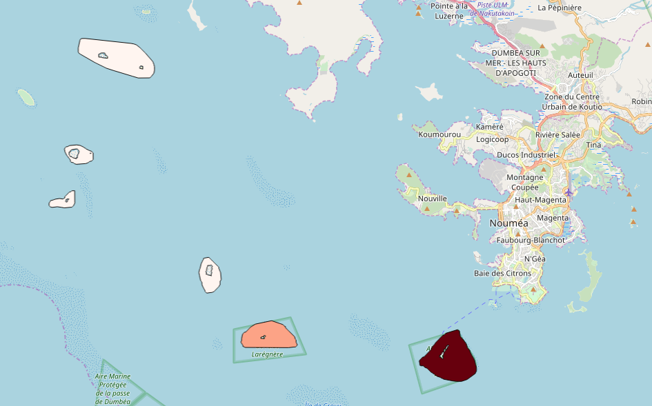
Ces résultats sont issus de l'extrapolation statistique de données récoltées lors de comptages effectués lors d'enquêtes sur les îlots en 2015, en nombre de groupe de personne par secteur du Référentiel spatial cumulé à l'année.