 Mon GéoSource
/Milieu physique/Géologie sédimentologie/Géomorphologie
Type of resources
Available actions
INSPIRE themes
Provided by
Years
Formats
Representation types
Update frequencies
status
Scale
-
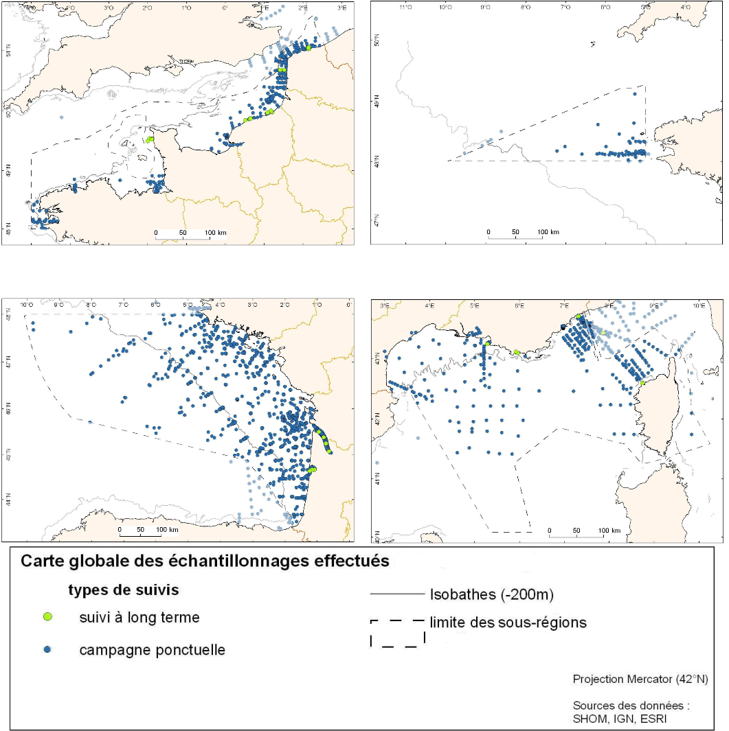
Couche de points représentant l'ensemble des jeux de données liés aux études anciennes et récentes sur les communautés du zooplancton. Les données issues de ce recensement représentent la répartition spatiale des prélèvements effectués depuis 1964 ainsi que les types et engins de prélèvement.
-
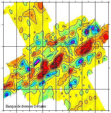
Magnetic data of the ridge axis of Mohn's ridge (NE Atlantic) in order to study the mecanisms of the oceanic accretion.
-
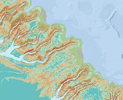
Géomorphologie du canyon de Penmarc'h au canyon de Saint-Nazaire (projet CoralFISH, 2012). Echelle 1/100 000. Bourillet Jean-Francois, De Chambure Laurent, Loubrieu Benoit,Breton Cécile,MazéJean-Pierre. Référencesbibliographiques: Bourillet Jean-Francois, De Chambure Laurent, Loubrieu Benoit (2012). Sur les traces des coraux d'eau froide du golfe de Gascogne. 8 cartes bathymorphologiques et géomorphologiques au 1/100.000 / Cold water corals of the Bay of Biscay: 8 bathymorphological and geomorphological maps at 1:100,000. Editions Quae. https://archimer.ifremer.fr/doc/00320/43162/De Chambure Laurent, Bourillet Jean-Francois, Bartel Claire (2013). Geomorphological classification in Bay of Biscay. Morpho-sedimentary mapping of the seabed in selected areas. REM/GM/LES 2013. https://archimer.ifremer.fr/doc/00249/36033/
-
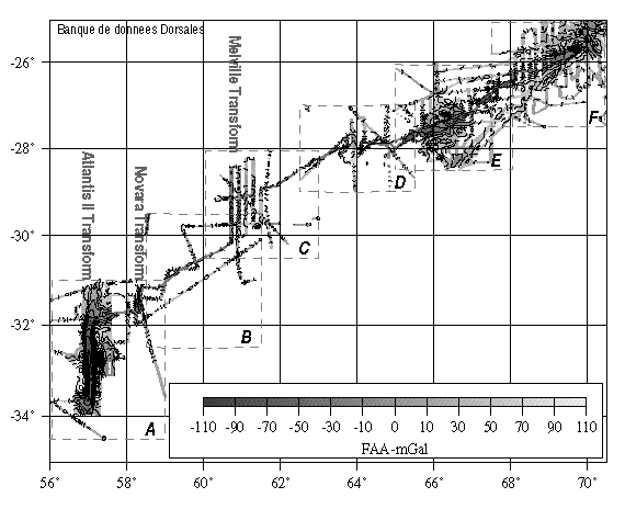
Compilation of gravimetric data between 1973 and 1994
-
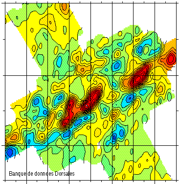
Magnetic data of the ridge axis of Mohn's ridge (NE Atlantic) in order to study the mecanisms of the oceanic accretion.
-
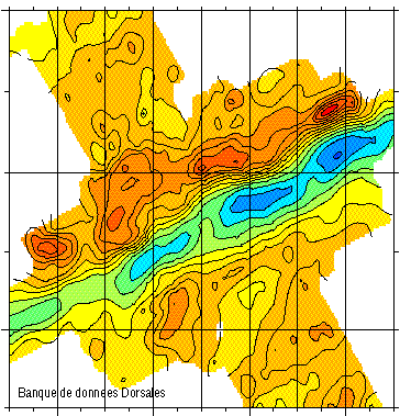
Gravimetry data of the ridge axis of Mohn's ridge (NE Atlantic) in order to study the mecanisms of the oceanic accretion.
-
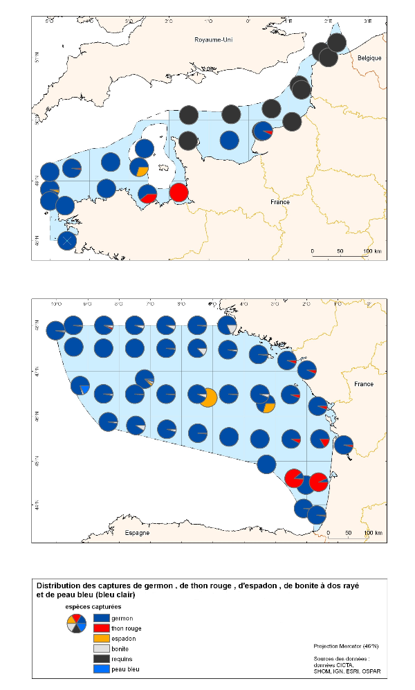
Cette carte correspond à la distributions des captures des grands pélagiques (thon rouge, espadon, germon, requin). Les données proviennent exclusivement des données de pêche.
-
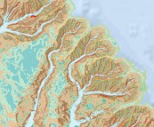
Géomorphologie du canyon des Sables d'Olonne au canyon d'Ars (projet CoralFISH, 2012). Echelle 1/100 000. Bourillet Jean-Francois, De Chambure Laurent, Loubrieu Benoit,Breton Cécile,MazéJean-Pierre. Référencesbibliographiques: Bourillet Jean-Francois, De Chambure Laurent, Loubrieu Benoit (2012). Sur les traces des coraux d'eau froide du golfe de Gascogne. 8 cartes bathymorphologiques et géomorphologiques au 1/100.000 / Cold water corals of the Bay of Biscay: 8 bathymorphological and geomorphological maps at 1:100,000. Editions Quae. https://archimer.ifremer.fr/doc/00320/43162/De Chambure Laurent, Bourillet Jean-Francois, Bartel Claire (2013). Geomorphological classification in Bay of Biscay. Morpho-sedimentary mapping of the seabed in selected areas. REM/GM/LES 2013. https://archimer.ifremer.fr/doc/00249/36033/
-

Carte des chenaux de l'édifice axial - fleuve Congo (Picot M., 2015) réalisée pendant les travaux de thèse de : Picot Marie (2015). Cycles sédimentaires dans le système turbiditique du Congo : nature et origine. PhD Thesis, Université de Bretagne Occidentale.http://archimer.ifremer.fr/doc/00312/42275/ ; et publiée dans "Controls on turbidite sedimentation: Insights from a quantitative approach of submarine channel and lobe architecture (Late Quaternary Congo Fan)". M. Picot,L. Droz,T. Marsset,B. Dennielou,M. Bez. Marine and Petroleum Geology. April 2016.http://dx.doi.org/10.1016/j.marpetgeo.2016.02.004
-
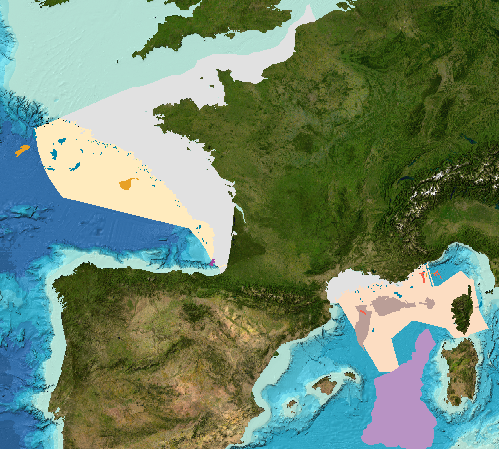
Landslides and gravitational features mapped within French metropolitan EEZ at 1 : 250 000 in the framework of work-package 6 of the european project EMODNet Geology phase 2.