 Mon GéoSource
Celtic Seas
Type of resources
Available actions
INSPIRE themes
Provided by
Representation types
Update frequencies
status
Scale
-
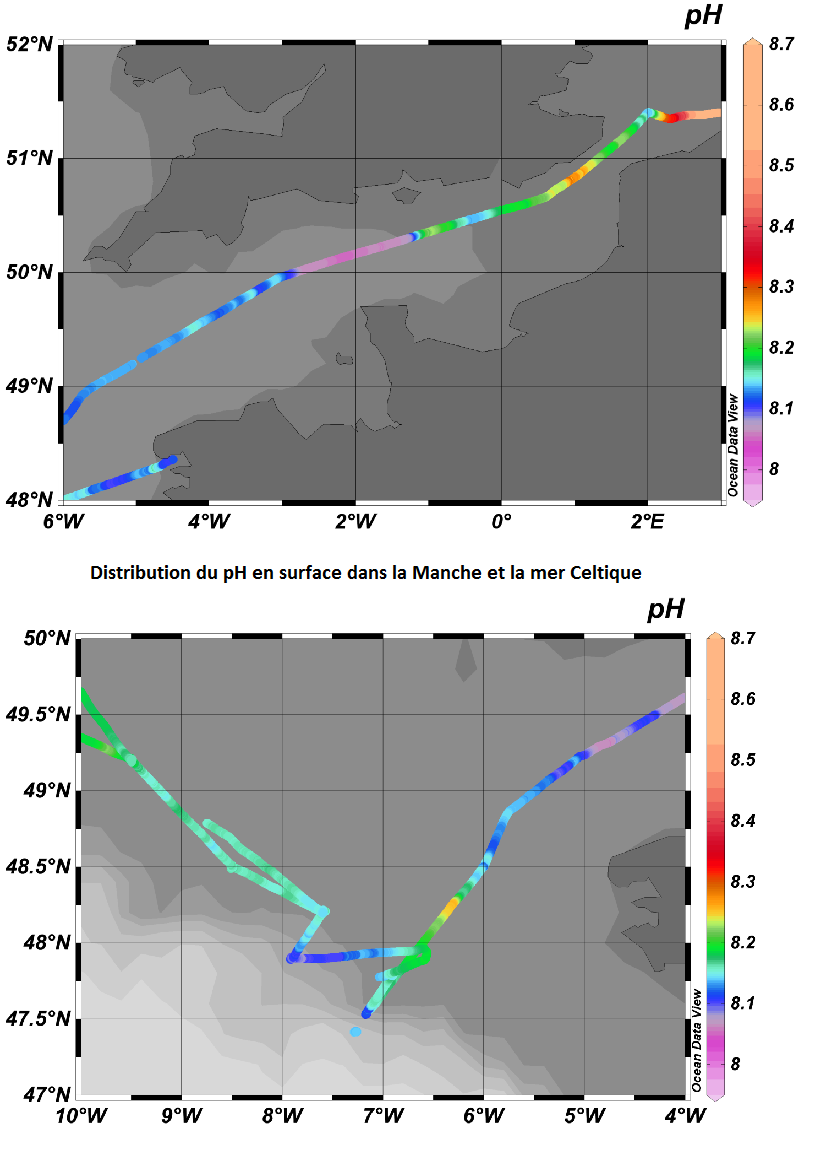
Variations spatio-temporelles des flux air-mer de CO2 et du pH dans les sous-région marine Manche-mer du Nord et mer Celtique
-
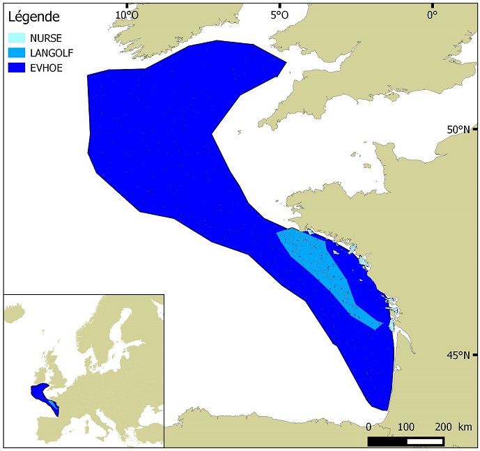
Distribution des espèces invertébrés benthiques en Atlantique établie à partir des données de densité d'abondance relative cumulées et krigées, issues des campagnes halieutiques EVHOE (2008-2013), LANGOLF (2011-2013), NURSE (2000-2013), ORHAGO (2011-2015)
-
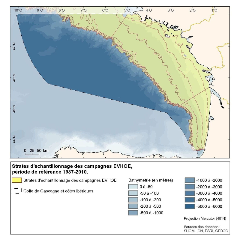
Polygones définis pour la répartition des points d'échantillonnage des campagnes Evhoe dans le golfe de Gascogne et en mer Celtique
-
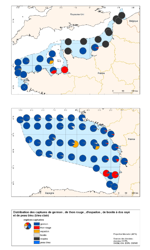
Cette carte correspond à la distributions des captures des grands pélagiques (thon rouge, espadon, germon, requin). Les données proviennent exclusivement des données de pêche.
-
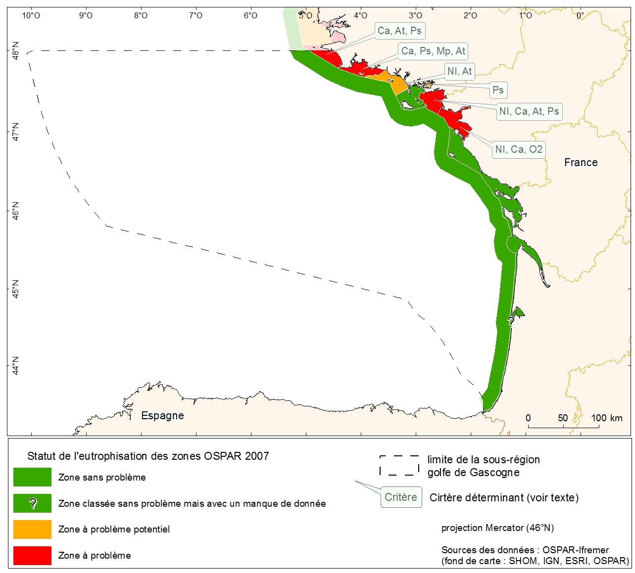
Statut d'eutrophisation des zones OSPAR 2007 sur la métropole. Donnée collectée dans le cadre de l'évaluation initiale de la DCSMM.
-
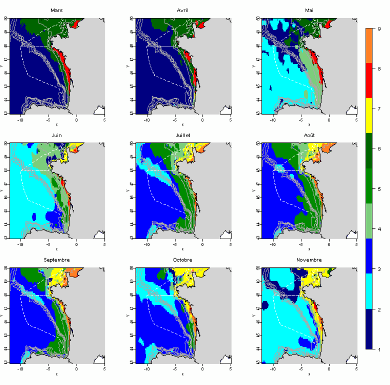
L'analyse statistique utilisée (Analyse en composantes principales suivie d’une méthode de classification) permet d’identifier des groupes communs à l’ensemble des mois et de décrire l’évolution de ces groupes au cours de l’année. Les données utilisées permettent de disposer de tables mensuelles présentant les paramètres sélectionnés, calculés sur toute la zone géographique à une résolution de 0.1°. Cette méthode permet d’identifier 10 paysages hydrologiques présents à différentes périodes de l’année, et caractérisés par des conditions hydrologiques homogènes.
-
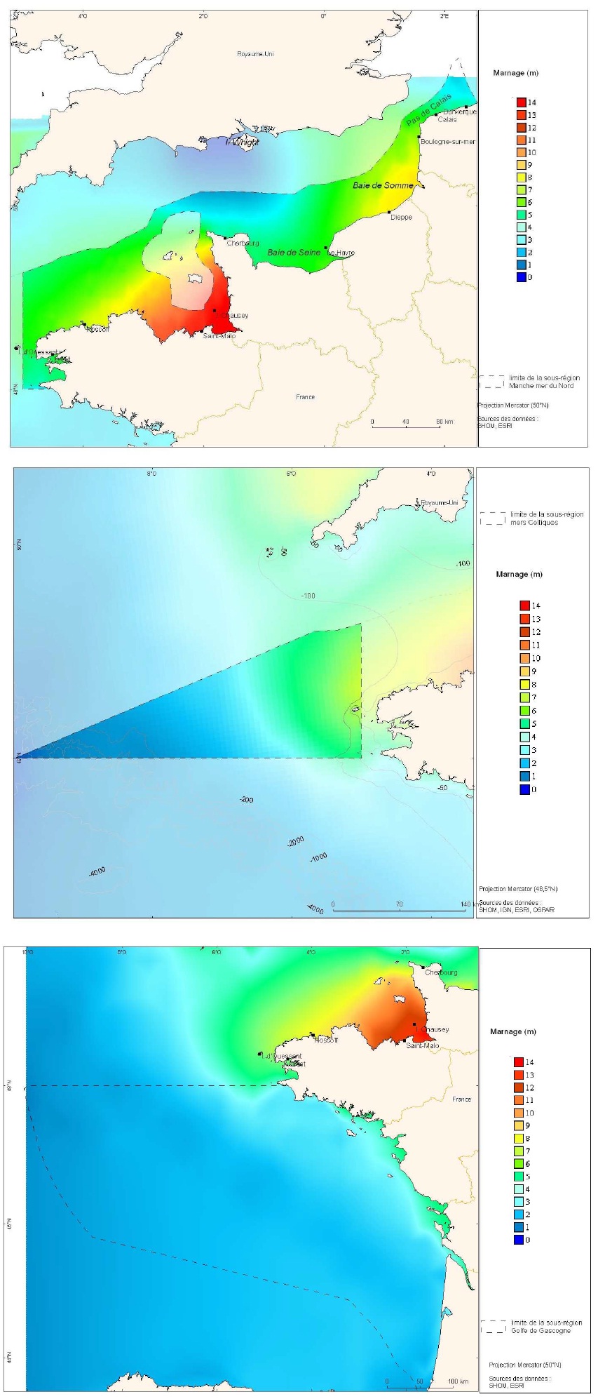
Cartes des marnages issues de la modélisation de marée CSTFRANCE pour les trois sous-régions marines Manche-mer du Nord, mers Celtiques et golfe de Gascogne.
-
Distribution spatiale trimestrielle des phoques gris (Halichoerus grypus) recensés par l'ONCFS sur leurs reposoirs terrestres des roches de Portsall en 2010.
-
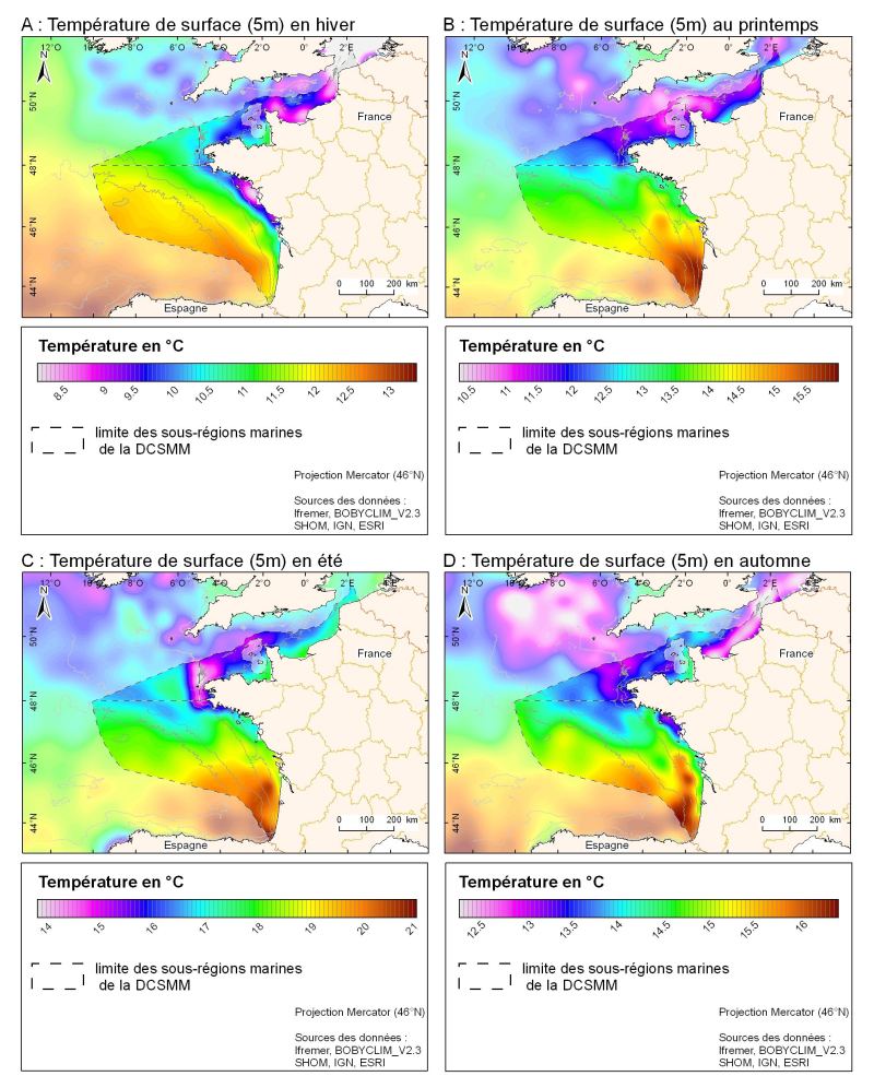
Champ de température de surface (en °C) saisonnié 3D obtenu par analyse objective (interpolation) de la donnée brute in situ, à 5 m de profondeur. Dans le cadre du Défi Golfe de Gascogne et du programme d'Océanographie Côtière Operationnelle Prévimer, les services SISMER et DYNECO-PHYSED de l'IFREMER ont constitué une base de données hydrologiques unique du Golfe de Gascogne, à partir de mesures CTD, Bouteilles, XBT/ MBT et Profileurs provenant de plusieurs centres de données mondiaux, afin de réaliser un atlas climatologique de la région en température et salinité.
-
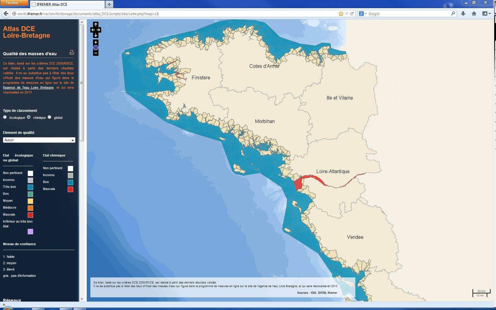
L’état chimique d'une masse d'eau littorale (eau côtière ou eau de transition) est déterminé par le plus déclassant des états définis pour les métaux lourds, les pesticides, les polluants industriels et les autres polluants pris en compte par la DCE. L'évaluation est faite 1 fois par plan de gestion (une fois tous les six ans). L'évaluation la plus récente de l’état de l'état chimique est présentée dans l’atlas DCE Loire-Bretagne. Les états antérieurs sont accessibles dans des archives annuelles.