 Mon GéoSource
Geoscientific information
Type of resources
Available actions
Topics
INSPIRE themes
Keywords
Contact for the resource
Provided by
Years
Formats
Representation types
Update frequencies
status
Scale
-
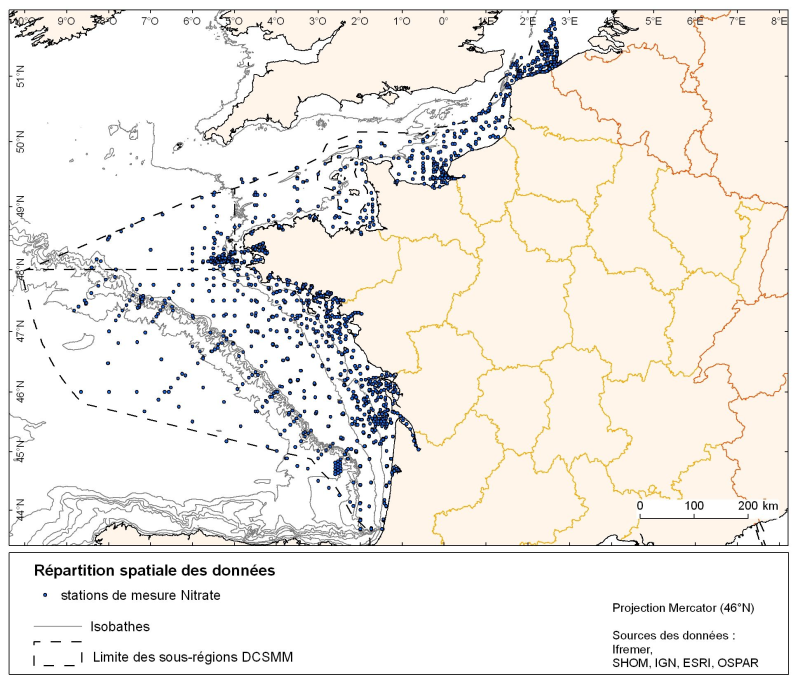
Spatial distribution for nutrients data (silicate, nitrate, nitrite, ammonium and phosphate) for all maritime regions in the English Channel and North Sea, the Celtic Seas and the Bay of Biscay. The temporal extent of the data is from 1930 to 2010, most being between 1974 and 2007 with a peak in 1999.
-
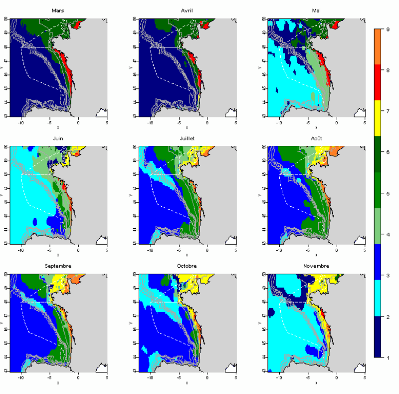
The statistical analysis used (Principal Component Analysis followed by a classification method) to identify groups common to all months and describe the evolution of these groups during the year. The data used allows for monthly tables showing the selected parameters, calculated over the entire geographic area with a resolution of 0.1 °. This method identifies 10 hydrological landscapes present at various times of the year, and characterized by homogeneous hydrological conditions.
-
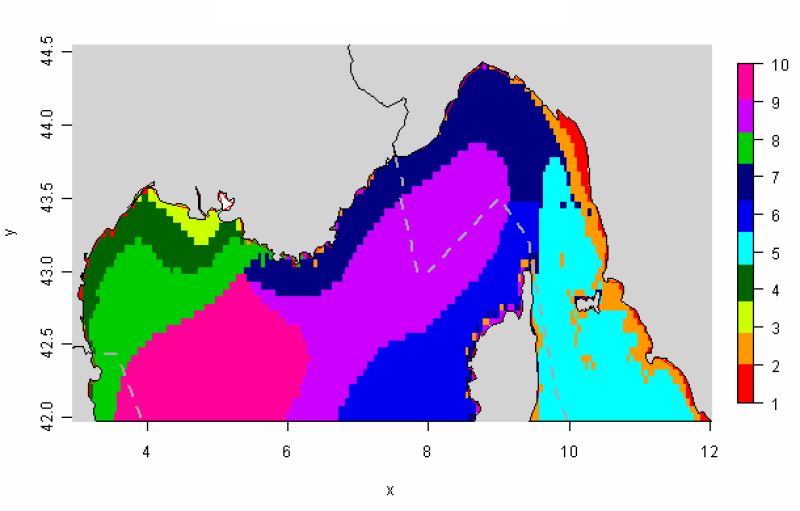
The distribution of hydrological landscapes is determined by a method of comparing multi-tables, to identify groups of individuals with similar variability of hydrological conditions during the year. The data used provides monthly tables showing the five selected physical parameters (SS, Phi, SST, MES et CHLA), calculated over the entire geographical area, a common resolution of 0.05°. This method identifies 10 hydrological landscapes showing a similar annual variability of hydrological conditions.
-
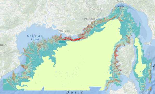
Censuses of nutrient salt monitoring stations in the western Mediterranean sub-region (1962 to 2010)
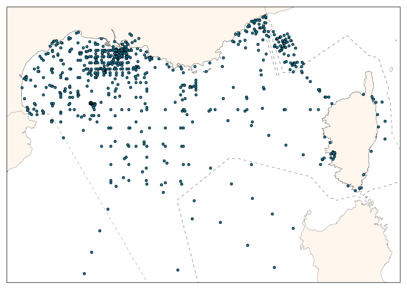
The consolidated database shows the spatial distribution of sampling effort by French and Monaco oceanographic campaigns. The measures are divided between the mouth of the Rhone, the Gulf of Lions, and Ligurian and Provence seas. The database contains 55 campaigns or time series, over 5 decades from 1962 to 2010. 28 are oceanographic campaigns of spatial strategy (some were revisited), 14 of temporal strategy, 2 of spatio-temporal strategy, and 1 one-time campaign. In total, it has 24,886 entries including: 19,027 nitrate data - 13,826 nitrite data - 11,452 ammonium data – 20,936 phosphates data – 14,605 silicates data. The majority (92%) of associated temperature and salinity data is available.
-
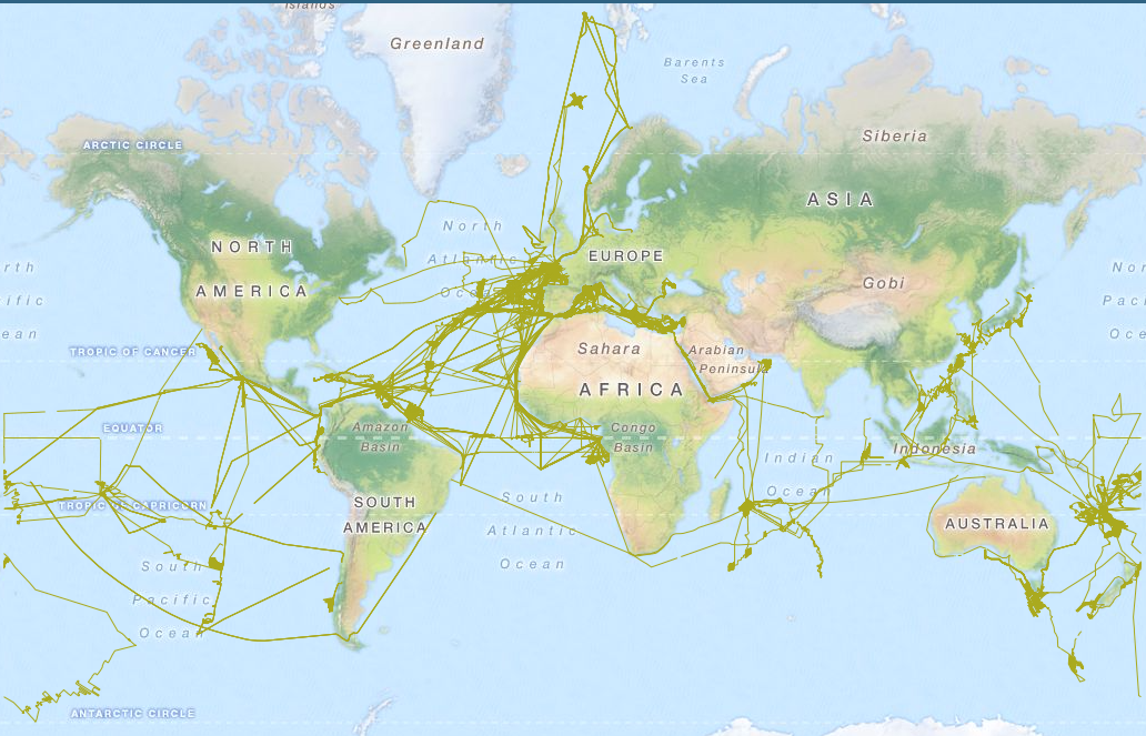
Raw underway marine gravity data from the French civil Research vessels and archived at SISMER (IFREMER)
-
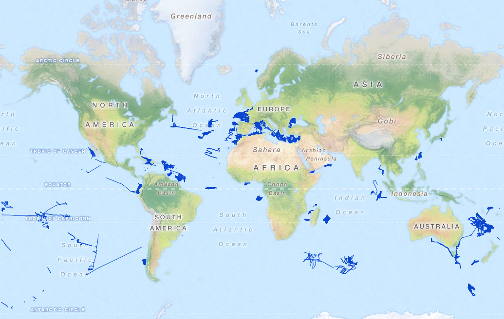
Raw seismic reflexion data collected on board of the French oceanographic fleet managed by IFREMER and archived at SISMER.
-
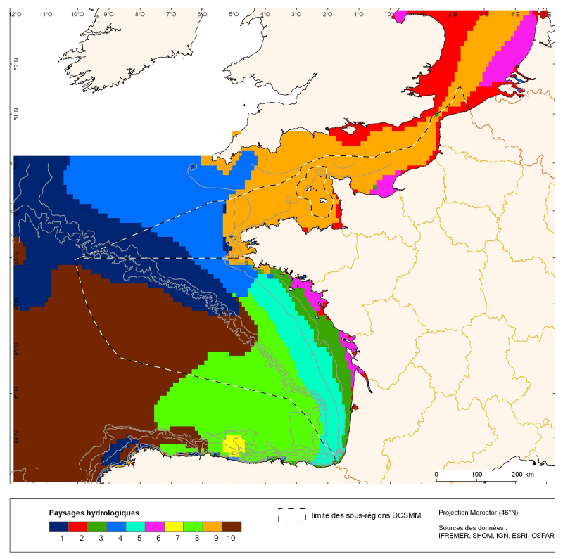
The distribution of hydrological landscapes is determined by a method of comparing multi-tables, to identify groups of individuals with similar variability of hydrological conditions during the year. The data used provides monthly tables showing the selected parameters, calculated over the entire geographic area with a resolution of 0.1 °. The variable chlorophyll-a is extra: it does not contribute to the discrimination of groups. This method identifies 10 hydrological landscapes with a similar annual variability of hydrological conditions.
-
Geomorphological analysis of the continental slope of the Mediterranean sea based on a 100m Data Terrain Model (DTM). This DTM is a synthesis of data acquired during sea surveys.
-
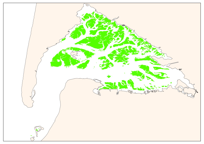
Map of the maximum extent of the seagrass Zostera noltti of Arcachon acquired in 2007-2008, under the supervisory control of the WFD (EU Water Framework Directive). Funded by the AEAG (Agence de l'Eau Adour Garonne) and Ifremer.
-
Map of surficial sediments in the English Channel area known as "Larsonneur."