 Mon GéoSource
shape ESRI
Type of resources
Available actions
Topics
INSPIRE themes
Keywords
Contact for the resource
Provided by
Years
Formats
Representation types
Scale
Resolution
-
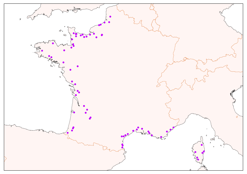
Les données sont fournies sous forme de couche de points représentant les plongées en submersible en Méditerranée française.
-
Teneurs pour une selection de métaux (Plomb, Cadmium, Mercure), organochlorés (PCB153 et HCHg Lindane), HAP (Fluoranthène) dans les moules et les huîtres du littoral de la sous-région Manche et mer du Nord.
-
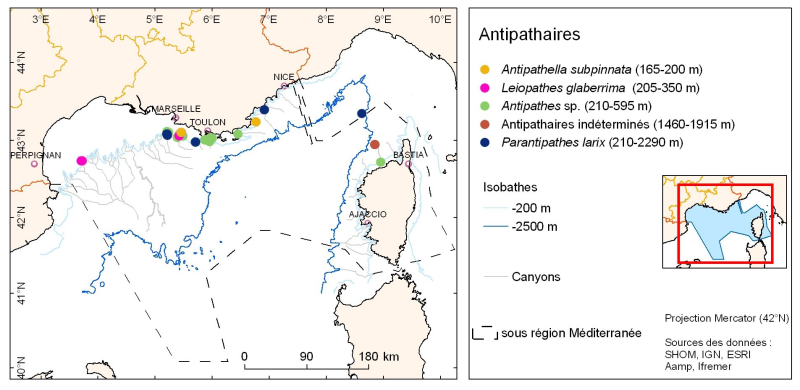
La répartition des espèces est fournie sous forme de couche de points représentant les observations in situ des organismes observés pendant des plongées en submersible dans les canyons de Méditerranée continentale.
-
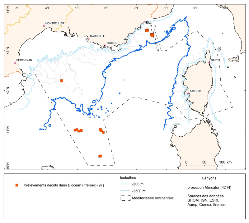
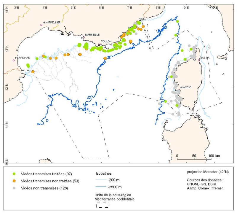
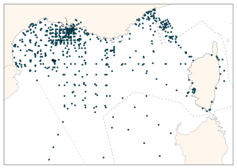
Les données sont fournies sous forme de couche de points représentant les prélèvements (opérations) en Méditerranée française. Les listes d'espèces identifiées correspondant à ces points de prélèvements sont dans la base Biocean.
-
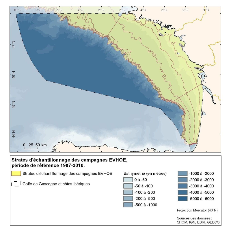
Polygones définis pour la répartition des points d'échantillonnage des campagnes Evhoe dans le golfe de Gascogne et en mer Celtique
-
La base de données consolidée présente la répartition spatiale de l’effort d’échantillonnage des campagnes océanographiques françaises et monégasques. Les mesures sont réparties entre l’embouchure du Rhône, le Golfe du Lion, les mers Provence et Ligure. La base de données ainsi constituée contient 55 campagnes ou séries temporelles, réparties sur 5 décades de 1962 à 2010. 28 sont des campagnes océanographiques à stratégie spatiale (certaines ayant donné lieu à des revisites), 14 à stratégie temporelle, 2 à stratégies spatio-temporelle et 1 campagne ponctuelle. Au total, elle compte 24 886 entrées comprenant : 19 027 données de nitrate – 13 826 données de nitrite – 11 452 données d’ammonium – 20 936 données de phosphates – 14 605 données de silicates. La majorité (92%) des données de température et salinité associées est disponible.
-
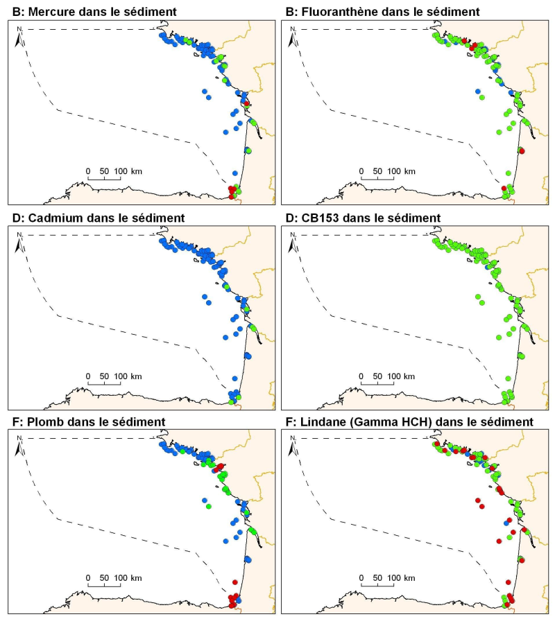
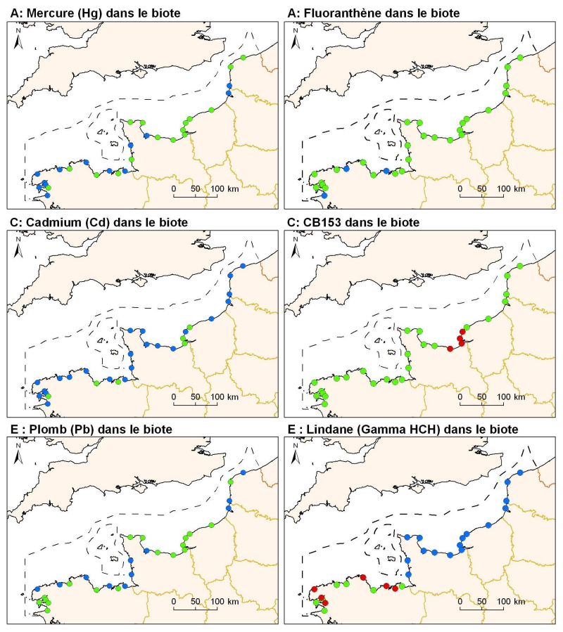
Teneurs pour une selection de métaux (Plomb, Cadmium, Mercure), organochlorés (PCB153 et HCHg Lindane), HAP (Fluoranthène) dans les sédiments superficiels (1er cm) de la sous-région golfe de Gascogne et côtes ibériques.
-
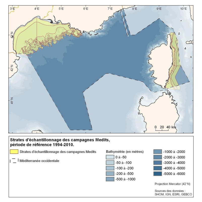
Polygones définis pour la répartition des points d'échantillonnage des campagnes Medits. MEDITS, 2007. International bottom trawl survey in the Mediterranean (Medits). Instruction manual. Version 5. Ifremer, Nantes. http://archimer.ifremer.fr/doc/00002/11321/. 60 p.
-
Les stations de surveillance physico-chimique (ou monitoring) font partie de réseaux sous la responsabilité des agences de l'eau. En ce qui concerne le périmètre strict de la contribution thématique "hydrologie", les stations de monitoring ne rentre pas en ligne de compte car ne mesure que la qualité physico-chimique des cours d'eau. Ces stations ne servent qu'aux calculs d'apports fluviaux au sens apports de polluants/nutriments.
-
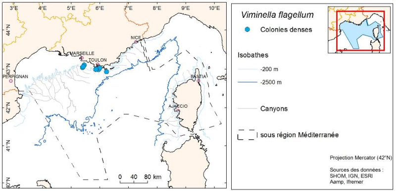
La répartition des espèces est fournie sous forme de couche de points représentant les observations in situ des organismes observés pendant des plongées en submersible dans les canyons de Méditerranée continentale.