 Mon GéoSource
Bay of Biscay
Type of resources
Available actions
INSPIRE themes
Provided by
Representation types
Update frequencies
status
Scale
-
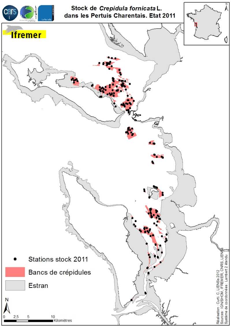
Les stocks (abondance et biomasse) de la crépidule Crepidula fornicata Linné, 1758 sur les petits fonds des Pertuis Charentais ont été estimés en 2011 et cartographiés (Sauriau et al., 2011). L’emprise de l’estimation comprend le Pertuis Breton, la partie Est du Pertuis d’Antioche, la presqu’île de Fouras et la baie de Marennes-Oléron où pour cette dernière baie des estimations antérieures sont disponibles. Les contours et superficies des bancs de crépidules ont été déterminés préalablement par imagerie acoustique réalisés à bord de la VO/Haliotis en 2008 et 2009, interprétés puis validés par des prélèvements ponctuels en 2009 (Curti, 2009). L’échantillonnage des stocks de 2011 s’appuie sur un échantillonnage aléatoire stratifié de 40 bancs avec une répartition proportionnelle de l’effort d’échantillonnage de 200 stations entre les bancs. Sont répertoriés pour chaque banc les stocks de crépidules (abondance en million, biomasse en tonne) aussi bien vivantes que mortes, ces dernières coquilles pouvant servir de support potentiel à de nouvelles colonisations.
-
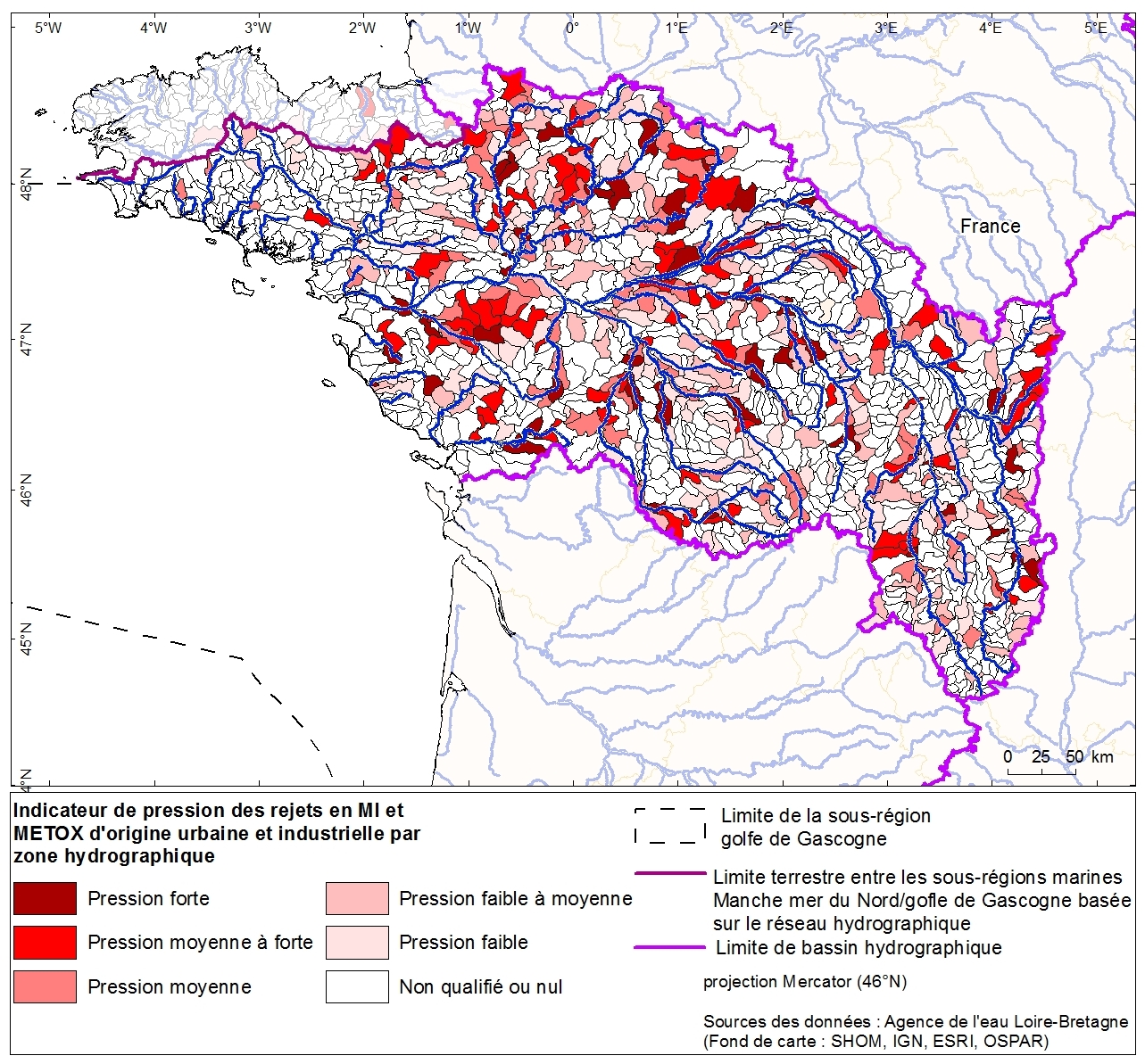
Rejets toxiques d'origine urbaine et industrielle par zone hydrographique du bassin Loire Bretagne. Cette donnée a été collectée dans le cadre de l'évaluation initiale de la DCSMM auprès de l'Agence de l'eau Loire-Bretagne. Référent expert AAMP : Aurélie Blanck.
-
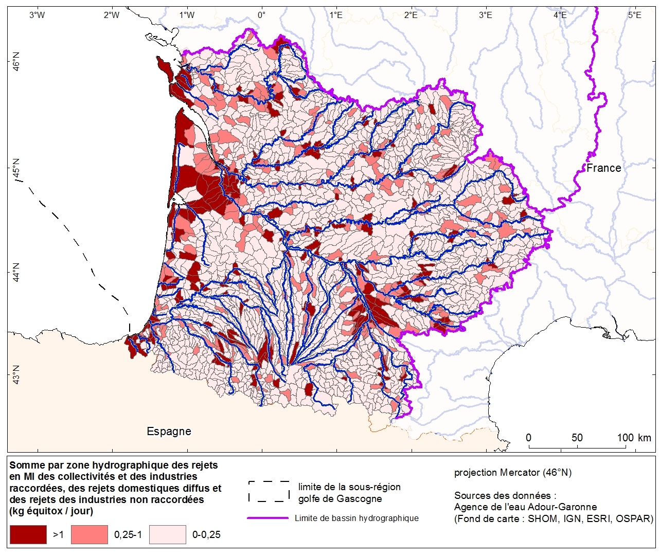
Rejets de nutriments (azote, phosphore et matière organique) et rejets toxiques (MI) par zone hydrographique issus des industries et des collectivités du bassin Adour-Garonne. Cette donnée a été collectée dans le cadre de l'évaluation initiale de la DCSMM auprès de l'Agence de l'eau Adour-Garonne. Référent expert AAMP : Aurélie Blanck.
-
Localisations des coraux profonds (Lophelia pertusa notamment) issues de la bibliographie le long de la marge continentale, Atlantique Nord-Est. Ce fichier regroupe 149 points de localisation. Le fichier excel correspondant a été transmis au Ministère de l'écologie, du développement et de l'aménagement durables le 7 janvier 2008 pour alimenter la base de données "espèces et habitats menacés et/ou en déclin" de la convention OSPAR.
-
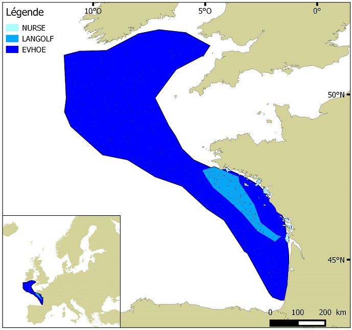
Distribution des espèces invertébrés benthiques en Atlantique établie à partir des données de densité d'abondance relative cumulées et krigées, issues des campagnes halieutiques EVHOE (2008-2013), LANGOLF (2011-2013), NURSE (2000-2013), ORHAGO (2011-2015)
-
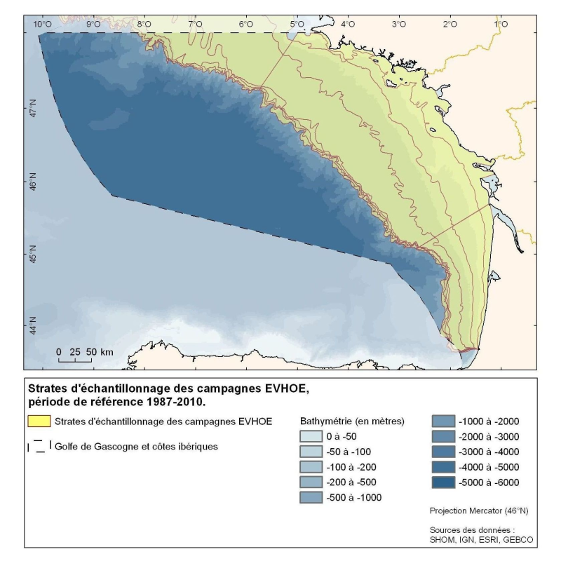
Polygones définis pour la répartition des points d'échantillonnage des campagnes Evhoe dans le golfe de Gascogne et en mer Celtique
-
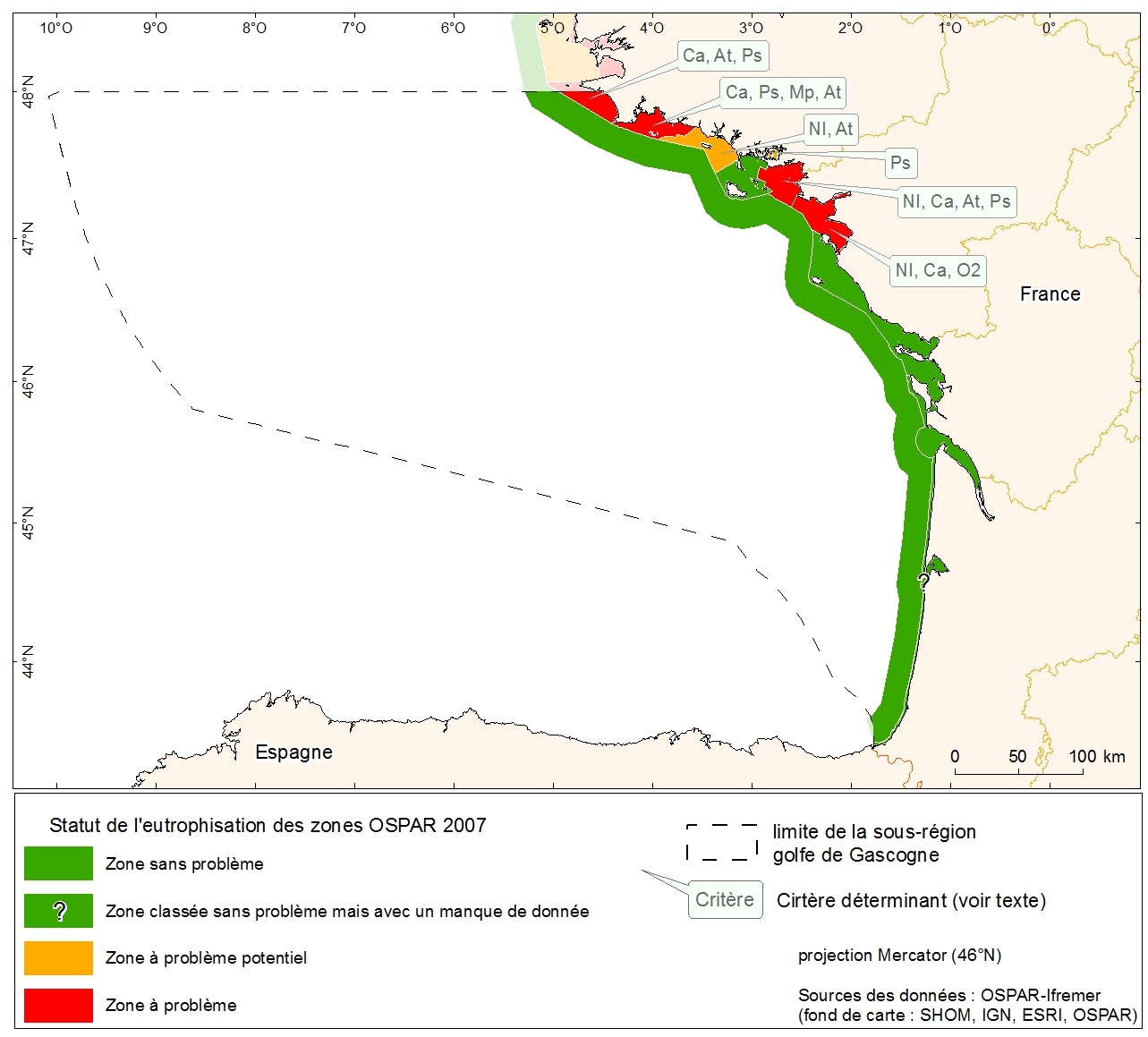
Statut d'eutrophisation des zones OSPAR 2007 sur la métropole. Donnée collectée dans le cadre de l'évaluation initiale de la DCSMM.
-
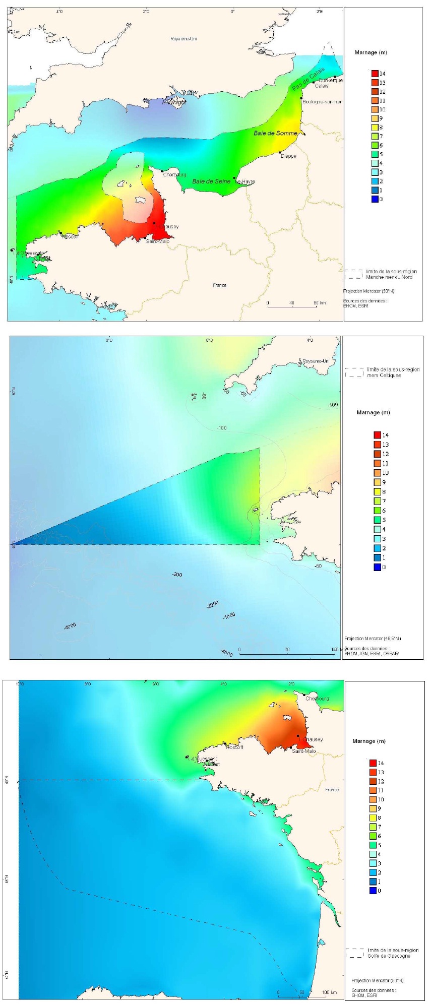
Cartes des marnages issues de la modélisation de marée CSTFRANCE pour les trois sous-régions marines Manche-mer du Nord, mers Celtiques et golfe de Gascogne.
-
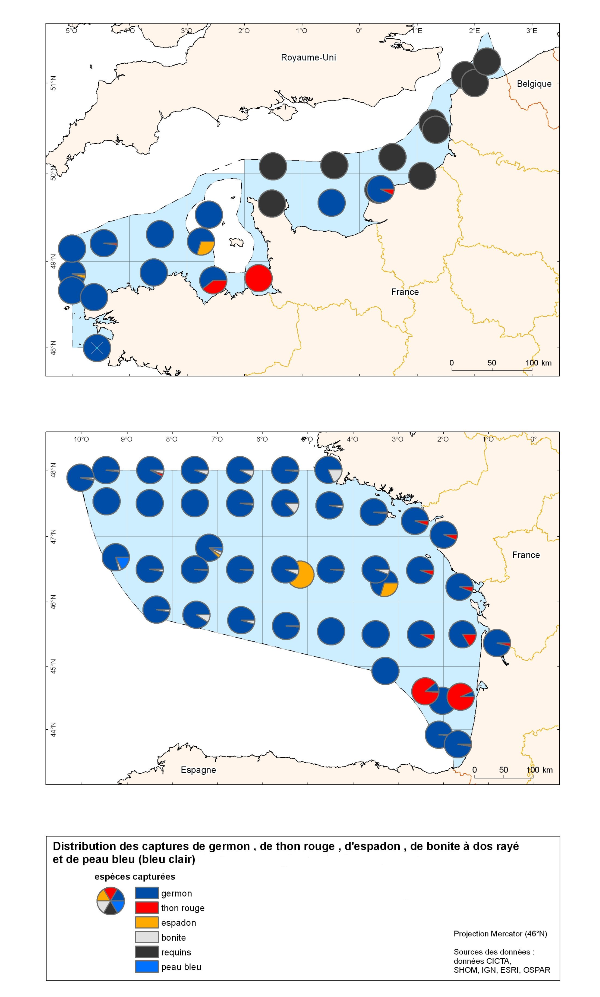
Cette carte correspond à la distributions des captures des grands pélagiques (thon rouge, espadon, germon, requin). Les données proviennent exclusivement des données de pêche.
-
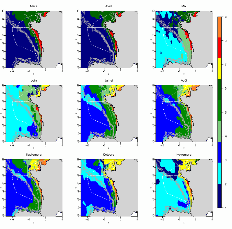
L'analyse statistique utilisée (Analyse en composantes principales suivie d’une méthode de classification) permet d’identifier des groupes communs à l’ensemble des mois et de décrire l’évolution de ces groupes au cours de l’année. Les données utilisées permettent de disposer de tables mensuelles présentant les paramètres sélectionnés, calculés sur toute la zone géographique à une résolution de 0.1°. Cette méthode permet d’identifier 10 paysages hydrologiques présents à différentes périodes de l’année, et caractérisés par des conditions hydrologiques homogènes.