 Mon GéoSource
Observation directe
Type of resources
Available actions
INSPIRE themes
Provided by
Years
Formats
Representation types
Update frequencies
status
Scale
-
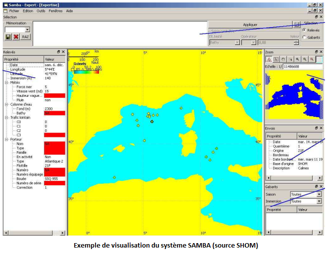
Le dispositif SAMBA constitue le système d’archivage des mesures de bruit ambiant par les bâtiment de la Marine nationale. Il comprends une base de données des mesures acoustiques et métadonnées associées ainsi qu’un logiciel d’exploitation et de visualisation. Depuis 2011, le SHOM exploite SAMBA pour l’archivadge de ses mesures scientifiques de bruit ambiant
-

Observations marines et sous-marins de l'état des paysages sous marins et des pressions
-

In order to manage coastal monitoring data, Ifremer has developed the Quadrige information system which connects a database to a wide array of tools for interpreting and designing information products. Quadrige is just one element of the Water Information System (SIE) www.eaufrance.fr and, as such, contributes toward the work of the French National Adminitrative Service for Water-Related Data (SANDRE) www.sandre.eaufrance.fr. The main aim of the Quadrige thematic databank is to manage and enhance data from coastal observation and monitoring networks. On a national level, Quadrige is today designated by the French Environment Ministry as the definitive information system for coastal waters, and the tool is therefore common to all of those working in the marine environment sector. The Quadrige databank is composed of data from the Quadrige database and products described or made available on the Envlit website. The Quadrige database contains results about most physical, chemical and biological environmental description parameters. The first data for example dates back to 1974 for the parameters relating to general water quality and contaminants, 1987 for phytoplankton and phycotoxins, 1989 for microbiology, from the early 2000s for the benthic zone. The data is permanently being updated. In Quadrige, an observation location is a geographical location where observations, measurements and/or samples will be taken. These locations can be located in a unique way thanks to their appearance on a map (polygon, line or point). A measurement location can be used by multiple programmes.
-
Quantité et localisation des déchets flottants observés, en Manche/Atlantique, suivant le protocole MEGASCOPE développé par l’UMS-PELAGIS lors des campagnes halieutiques mises en œuvre par l’Ifremer : IBTS, PELGAS, MEDITS, CGFS, EVHOE ; en Méditerranée par l’Institut ECOOcean et l’association Participe Futur. L’Evaluation 2018 de la DCSMM traite les données sur la période 2010-2016.
-
Le produit Surval "Inventaire des lieux actifs - REBENT" présente l’inventaire des lieux programmés actuellement pour un suivi. Le type de suivi est défini par le programme rattaché au lieu. Un lieu dont la période d’activité dans Quadrige inclue la date du jour est considéré actif pour le programme. L'accès aux données d'observation se réalise par lieu. Un lieu de surveillance est un lieu géographique où des observations, des mesures et/ou des prélèvements sont programmés. Il est localisé de façon unique par son emprise cartographique (surface, ligne ou point). Un lieu peut être utilisé par plusieurs programmes. Aujourd’hui, ce produit met à disposition des données issues d'une sélection de programmes. Paramètres suivis : - Angiospermes . Suivi des herbiers de Posidonies . Suivi des herbiers de Zostera marina . Suivi des herbiers de Zostera noltii . Suivi des macrophytes en lagune (angiospermes) - Invertébrés . Suivi des invertébrés des bancs de maërl . Suivi des invertébrés en zone intertidale meuble . Suivi des invertébrés en zone intertidale rocheuse . Suivi des invertébrés en zone subtidale meuble - Macroalgues . Suivi des bancs de Maërl . Suivi des blooms d'algues opportunistes . Suivi des macroalgues en zone intertidale rocheuse . Suivi des macroalgues en zone subtidale rocheuse . Suivi des macrophytes en lagune (macroalgues) Programmes nationaux : - BLOOMS : Suivi des macroalgues opportunistes - REBENT_ALG : Réseau de suivi benthique Stationnel Macroalgues - REBENT_FAU : Réseau de suivi benthique Stationnel Macrofaune - REBENT_HZM : Réseau de suivi benthique Stationnel Herbiers de Zostera marina - REBENT_HZN : Réseau de suivi benthique Stationnel Herbiers de Zostera noltei - REBENT_MAERL : Réseau de suivi benthique Maërl Programmes locaux : - POSIDONIES : Suivi des herbiers de Posidonies - RSLPHY : Réseau de Suivi des Lagunes méditerranéennes Macrophytes L'emprise géographique est nationale : uniquement la métropole.
-
The objective of this cruise, which has been taking place in the English Channel - Baie de somme since 1980, over 5 days in September, is to evaluate the natural multi-year fluctuations of the stands and to analyze the possible impact of the nuclear power plant on the marine environment and resources. It makes it possible to determine annual indices of abundance and distribution of flatfish and other species (shrimp, pout, whiting).
-
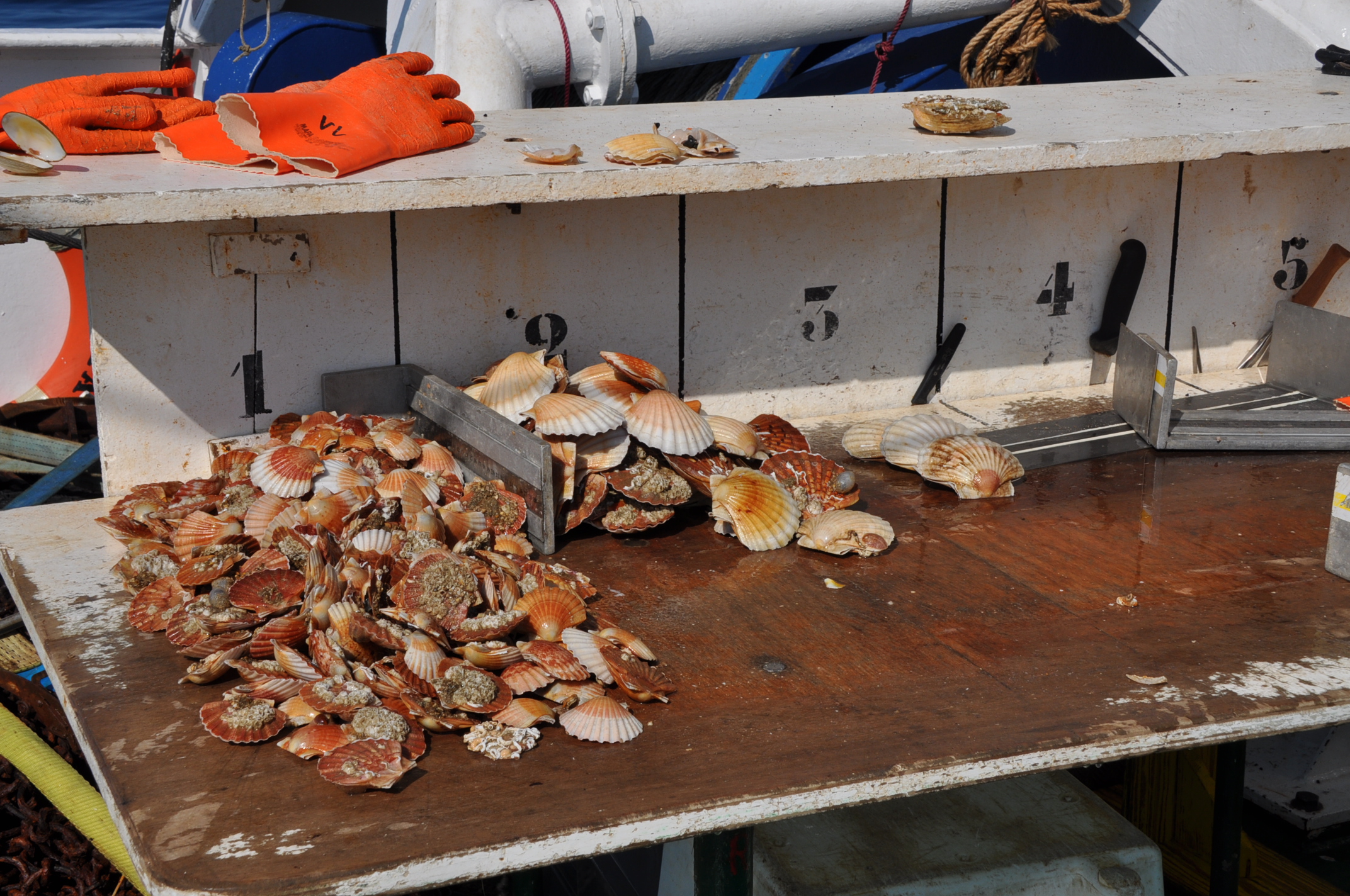
Évaluation directe du stock de coquilles saint jacques (Pecten maximus) de la baie de Seine. Le projet de rattachement est SIH.
-
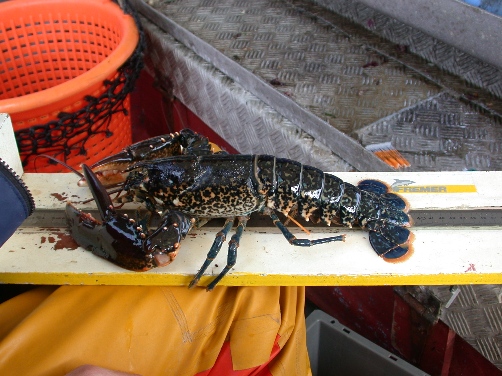
Within the framework of the establishment of a nuclear power plant on the coast of the town of Flamanville, Electricité de France has entrusted Ifremer with ecological and fishery studies on the site's surroundings. One of the expert assessments consists of conducting two shellfish fishing campaigns each year. Their objectives are to monitor the natural fluctuations of the main indicators selected during the start-up of the plant and to evaluate the impact of the plant on the surrounding fishery.
-
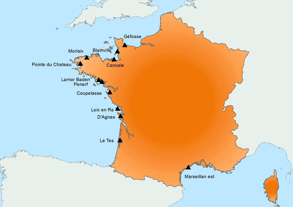
Created in 2015, it follows on from the RESCO launched in 2009, and REMORa launched in 1993. In 2015, the structure and operation of the former RESCO network was used to implement planned monitoring of oysters. More specifically, the sentinel batches used by the network, representing 3 age classes (6 months, 18 months of the previous year and 30 months of the previous year) are monitored regularly (frequency: bi-monthly or monthly). throughout the year at 12 national sites (corresponding to former RESCO sites). At each passage, counts are made to assess the mortality rate, and different types of laboratory diagnostic tests will be performed: - initially, the new spat batches (Ifremer Standardized Spats) will undergo specific PCR analyzes to search for potentially present infectious agents (OsHV-1 and Vibrio aestuarianus) but also non-specific analyzes (histology, classical bacteriology) for the possible detection of other pathogenis agents ; - for the detection of emerging diseases, the first dying batches detected for each age group, for each site, will undergo specific laboratory (OsHV-1 and Vibrio aestuarianus PCR) and non-specific (histology) diagnostic tests in order to detect as early as possible emerging diseases in these sentinel batches; - for the detection of exotic diseases, in the absence of a hierarchy of exotic diseases being available for oysters, it was decided to monitor the parasite Mikrocytos mackini because infection with this parasite is regulated at European level, on one of the RESCOII sites (Loix en Ré) previously identified as a site at risk with respect to the introduction of this parasite. In addition to these mortality follow-ups and the laboratory diagnoses, each site is equipped with a probe to allow it to gather environmental parameters (temperature, pressure, salinity) at high frequency. The various results are stored in the Quadrige² database, and are available for the various actors involved. The network is closely linked to a dedicated website which allows the dissemination of objectives, protocols and results, and which will be updated every month. In parallel, newsletters summarizing the results obtained are sent by e-mail every month to the State services.
-
Le produit Surval "Inventaire des lieux actifs" présente l’inventaire des lieux programmés actuellement pour un suivi. Le type de suivi est défini par le programme rattaché au lieu. Un lieu dont la période d’activité dans Quadrige inclue la date du jour est considéré actif pour le programme. L'accès aux données d'observation se réalise par lieu. Un lieu de surveillance est un lieu géographique où des observations, des mesures et/ou des prélèvements sont programmés. Il est localisé de façon unique par son emprise cartographique (surface, ligne ou point). Un lieu peut être utilisé par plusieurs programmes. Aujourd’hui, ce produit met à disposition des données issues d'une sélection de programmes. Programmes nationaux : - BLOOMS : Suivi des macroalgues opportunistes - REBENT_ALG : Réseau de suivi benthique Stationnel Macroalgues - REBENT_FAU : Réseau de suivi benthique Stationnel Macrofaune - REBENT_HZM : Réseau de suivi benthique Stationnel Herbiers de Zostera marina - REBENT_HZN : Réseau de suivi benthique Stationnel Herbiers de Zostera noltei - REBENT_MAERL : Réseau de suivi benthique Maërl - REMI : Réseau de surveillance de la contamination microbiologique - REPHY : Réseau d'observation et de surveillance du Phytoplancton et de l'hydrologie - REPHYTOX : Réseau de surveillance des Phycotoxines - RESCO : Réseau d'Observations Conchylicoles - ROCCHMV : Réseau d'Observation des Contaminants Chimiques dans les Organisme Marins - ROCCHSED : Réseau d'Observation des Contaminants Chimiques dans le Sédiment Programmes locaux : - ARCHYD : Réseau Hydrologique Arcachon - POSIDONIES : Suivi des herbiers de Posidonies - RHLN : Réseau Hydrologique Littoral Normand - RINBIO : Réseau Intégrateur Biologique Contaminants Chimiques - RSLHYD : Réseau de Suivi des Lagunes méditerranéennes Hydrologie et phytoplancton - RSLPHY : Réseau de Suivi des Lagunes méditerranéennes Macrophytes - SRN : Suivi Régional des Nutriments bassin Artois-Picardie L'emprise géographique est nationale : la métropole et les départements et régions d'outre-mer (DROM).