 Mon GéoSource
Biota
Type of resources
Available actions
Topics
INSPIRE themes
Keywords
Contact for the resource
Provided by
Years
Formats
Representation types
Update frequencies
status
Scale
Resolution
-

The repository of commercially exploited species of interest in the Fisheries Information System is based on the FAO's ASFIS repository enriched with species of high commercial interest in France (metropolitan and overseas).
-
Stocks of Crepidula fornicata Linnaeus, 1758 in the Pertuis Charentais. Environmental state for 2011
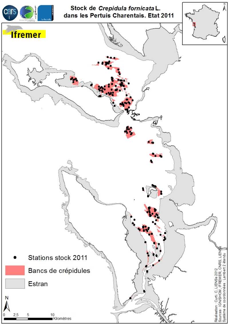
Stocks (abundance and biomass) of the slipper limpet Crepidula fornicata Linnaeus, 1758 in the Pertuis Charentais shallows were estimated in 2011 and mapped (Sauriau et al., 2011). The influence of the estimate includes the Pertuis Breton, the eastern part Pertuis Antioch Fouras peninsula and the Bay of Marennes-Oléron where the latter earlier estimates are available. Contours and surface areas of the crepidula were previously determined by acoustic imaging performed aboard the VO/Haliotis in 2008 and 2009, interpreted and validated by spot sampling in 2009 (Curti, 2009). Sampling stocks of 2011 is based on a stratified random sample of 40 banks with a proportional distribution of sampling of 200 stations between banks. The listing for each crepidula bank stocks (abundance in millions, biomass in tonnes) both living and dead, these shells may provide support to potential new colonization.
-

The repository of location in the Fisheries Information System is divided into 3 categories: places on land, areas at sea and regulatory areas at sea. Each of these is organised hierarchically. There are 93 levels of places in Harmonie: a metadata sheet exists for each of them with, when it exists, a geographical layer.
-
-
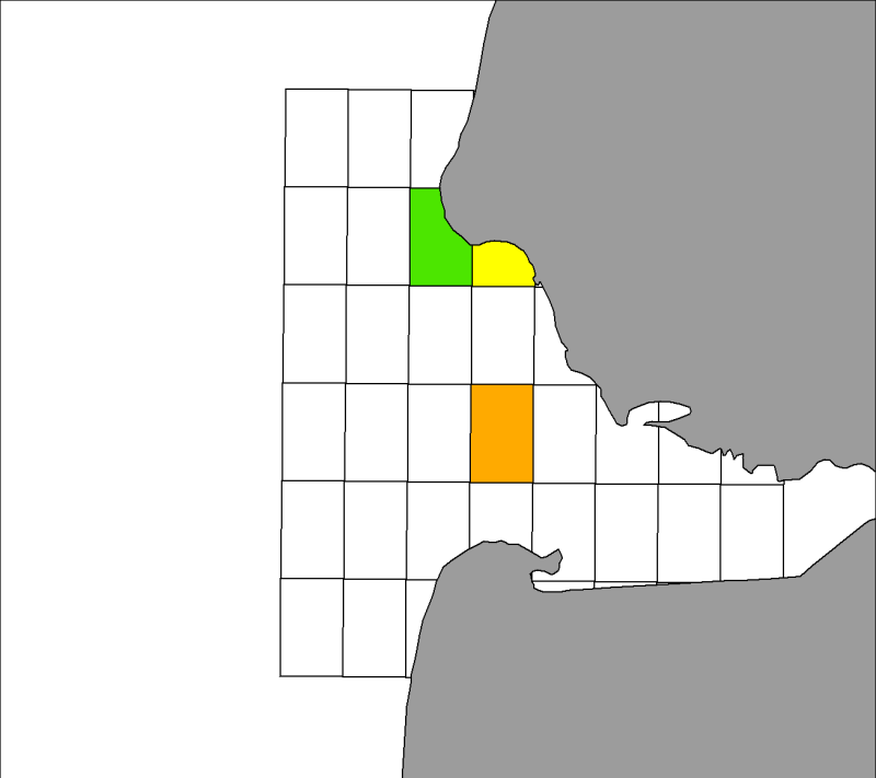
Seasonal spatial distribution of gray seals (Halichoerus grypus) on their haul out sites identified by the associations ADN and Picardy Nature in the Authie Bay from 2007 to 2009 inclusive.
-

The gear repository of the Fisheries Information System includes, on the one hand, the FAO fishing gears enriched with national specificities and, on the other hand, the sampling gears used during the fisheries surveys conducted by Ifremer and its partners.
-
-

A metier in the Fisheries Information System is a fishing practice defined by a fishing gear and a target species. They are used for statistical purposes to evaluate fishing strategies and efforts.
-

Size-weight relationships are specific to each scientific species and its environment. They allow the size of an individual to be determined from its weight or vice versa. These relationships are established statistically from a sample of individuals representative of the species.
-

The scientific species repository of the Fisheries Information System lists the species observed during fishing campaigns or within the framework of the observations of collection programmes (ObsVentes, ObsMer, Campaigns, etc.).