 Mon GéoSource
IFREMER SIH
Type of resources
Available actions
Topics
INSPIRE themes
Keywords
Contact for the resource
Provided by
Years
Representation types
Update frequencies
status
Scale
-
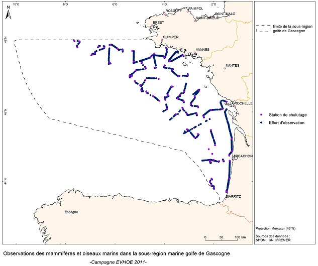
EVHOE est une enquête pluriannuelle dont les objectifs sont les suivants : - Etablir des séries chronologiques d'indices d'abondance pour les principales espèces dermiques et benthiques de la mer Celtique et du golfe de Gascogne. - Mesurer l'évolution interannuelle de leur recrutement. - Cartographier les distributions spatiales des espèces et leurs variations interannuelles, ainsi que rechercher l'origine de cette variabilité (paramètres biotiques et/ou abiotiques, impact de la pêche). - Dans le cadre du défi "Golfe de Gascogne", les données collectées sont essentielles pour comprendre les changements dans les communautés fauniques.
-
Acquisition de données et connaissances pour l’élaboration d’aides à la Gestion Intégrée des Populations de Bar de l’Atlantique du Nord-Est.
-
Dans le cadre de l’implantation d’une centrale électronucléaire sur le littoral de la commune de Flamanville, Electricité de France a confié à l’Ifremer les études écologiques et halieutiques aux abords du site. L’une des expertises consiste à réaliser chaque année deux campagnes de pêche des crustacés. Leurs objectifs est le suivi des fluctuations naturelles des principaux indicateurs retenus lors de la mise en route de la centrale et d’évaluer l’impact de celle-ci sur la pêcherie environnante.
-

Le projet NourDem vise à réaliser des campagnes annuelles de chalutage dans les trois estuaires de la Seine, de la Loire et de la Gironde.
-
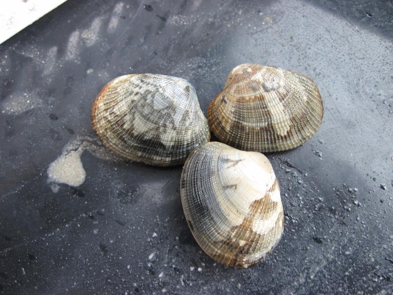
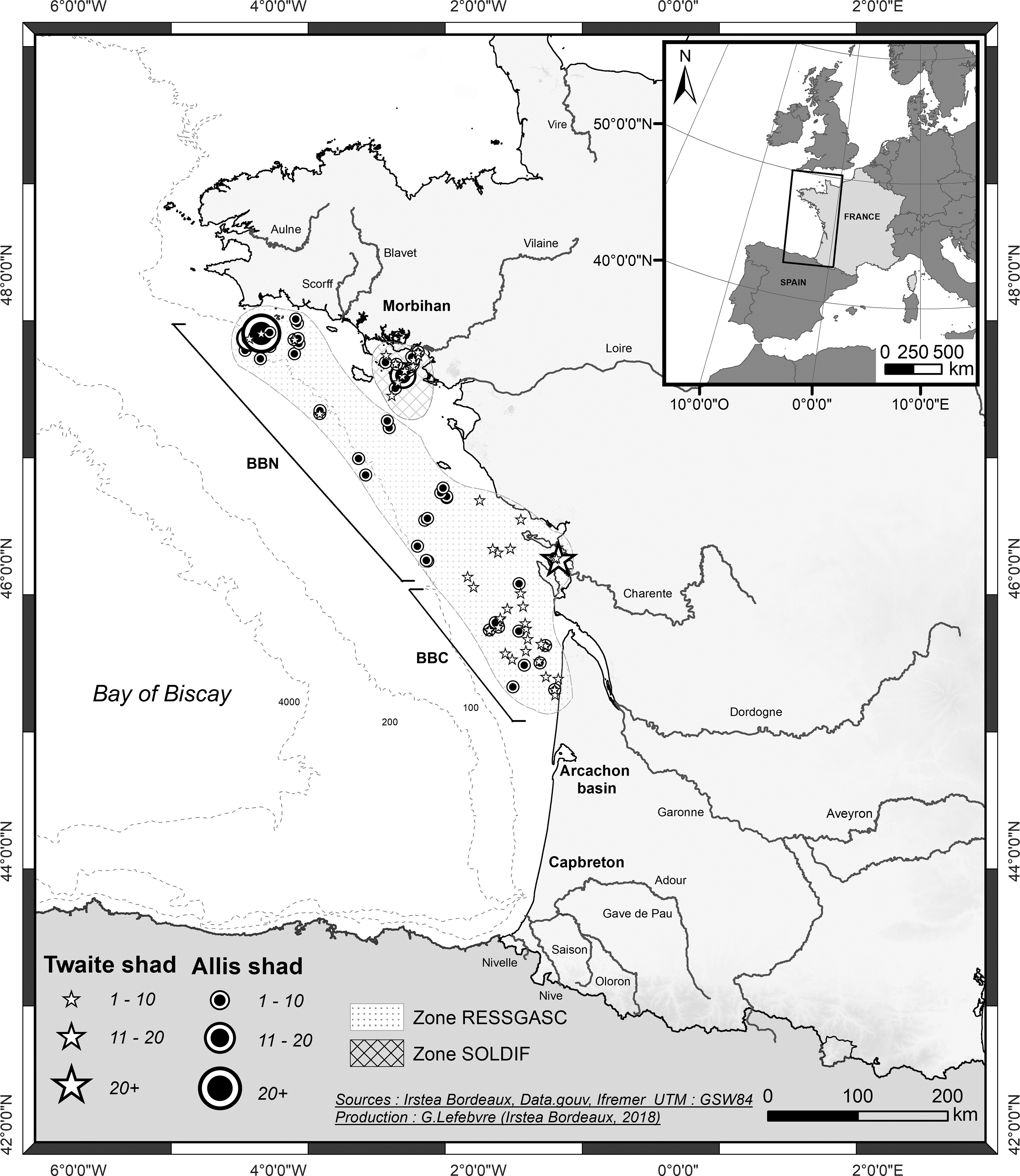
Depuis 2001, une évaluation annuelle des stocks de palourdes japonaise (Ruditapes philippinarum) et croisée d'Europe (Ruditapes decussatus) est réalisée en mars dans le golfe du Morbihan et la rivière Noyalo. Les objectifs de cette enquête sont : 1) l'estimation par évaluation directe, de la biomasse du stock et de sa répartition géographique; 2) estimer la biomasse exploitable et le potentiel d'exploitation des sites échantillonnés en particulier, dans les zones réservées à la pêche professionnelle; 3) établir un diagnostic, avec une vision à moyen terme, sur l'état du stock; 4) proposer la mise en œuvre de mesures de gestion appropriées. Deux campagnes ont également été réalisées en 1996 et 1997.
-

La collecte de données socio-économiques auprès des pêcheurs professionnels, permet de calculer des indicateurs économiques par segment de flotte et contribue notamment à évaluer les performances économiques par flottille et les impacts de la mise en place de mesures de gestion. Elle permet également d’évaluer le poids de la pêche française en Europe, la part de pêche dans l’économie nationale et régionale ainsi que l’attractivité du métier ou encore les impacts de la variation des coûts tel que le coût du carburant.
-
Les données VMS (Vessel Monitoring System) correspondent aux données du système communautaire de surveillance par satellite des navires de pêche qui fournit à intervalles réguliers des données sur la position, la route et la vitesse des navires aux autorités de pêche.
-
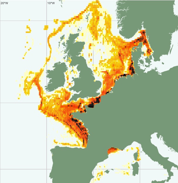
Les 62 campagnes RESSGASC permettent l'évaluation trimestrielle des quantités de diverses espèces (merlu, sole, langoustine, etc.) rejetées par les navires de pêche (individus n'ayant pas atteint la taille légale de débarquement). Ces informations, ainsi que les données collectées à partir de la structure démographique des débarquements (à l'aide d'échantillons provenant des criées), sont essentielles pour l'évolution des stocks de poissons commerciaux.
-
Les données de "Marées" du flux déclaratif correspondent aux données de captures et d'effort de pêche déclarées par les professionnels dans les journaux de bord (log-books) pour les navires dont la longueur hors-tout est supérieure ou égale à 10 mètres, et les fiches de pêche pour les navires dont la longueur hors-tout est inférieure à 10 mètres.
-
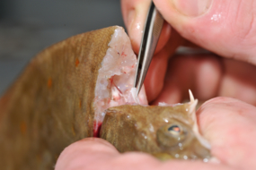
ObsBio, la collecte de paramètres biologiques individuels tels que la taille, le poids, le sexe, l'âge sont des données nécessaires pour connaître par élévation, la part des populations dans le recrutement des jeunes poissons, dans la mortalité naturelle et dans la mortalité par pêche