 Mon GéoSource
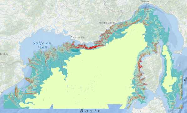
/Metropolitan France/Western Mediterranean
Type of resources
Available actions
Topics
INSPIRE themes
Keywords
Contact for the resource
Provided by
Years
Representation types
Update frequencies
status
Scale
-
Geomorphological analysis of the continental slope of the Mediterranean sea based on a 100m Data Terrain Model (DTM). This DTM is a synthesis of data acquired during sea surveys.
-
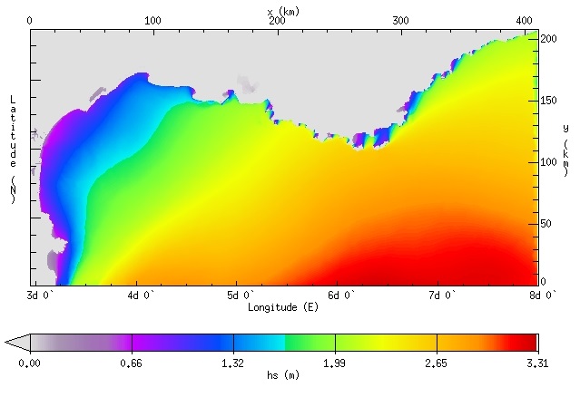
IOWAGA sea-states hindcast database generated by the wave model WAVEWATCH-III and forced by ECMWF winds on the North mediterranean unstructured grid over 2009-2010 period.
-
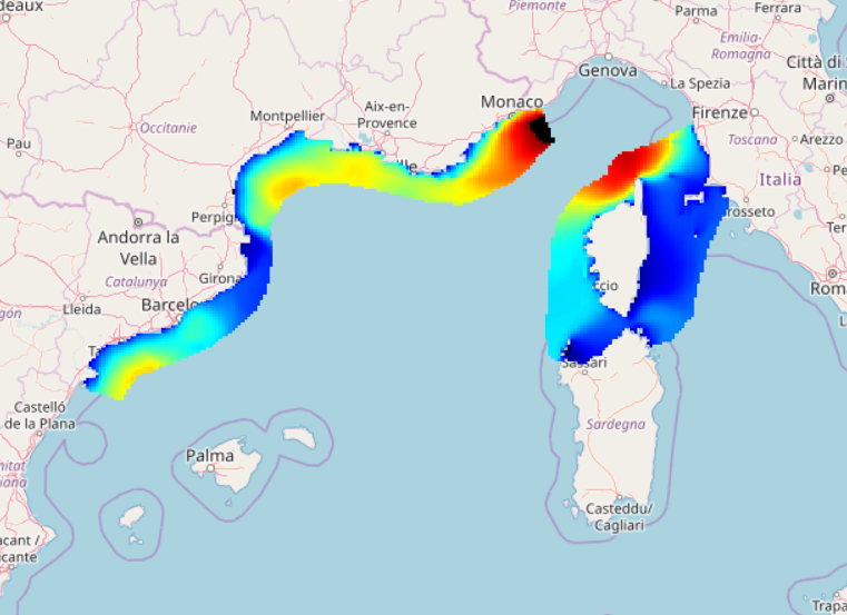
IOWAGA sea-states hindcast database generated by the wave model WAVEWATCH-III and forced by ECMWF winds on the North mediterranean grid over 2004-2017 period.
-
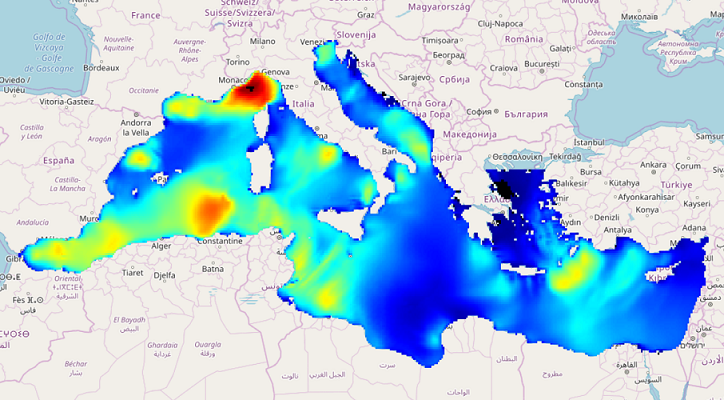
IOWAGA sea-states hindcast database generated by the wave model WAVEWATCH-III and forced by ECMWF winds on the Mediterranean grid over 2005-2017 period.
-
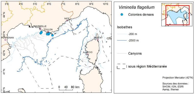
Species distribution is provided as a layer of points representing in situ observations of organisms observed during dives submersible into the canyons in the Mediterranean mainland.
-
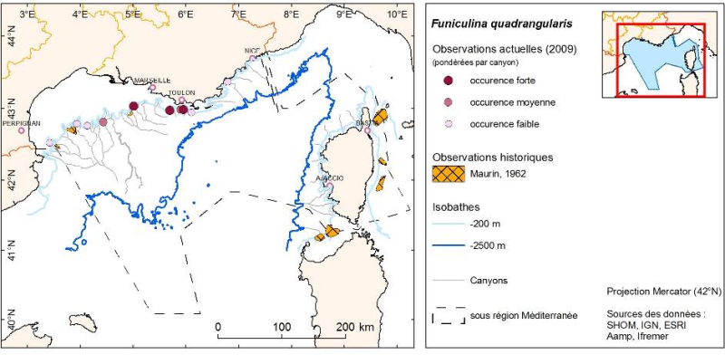
Layer of points representing the abundance weighted per canyon of observed organisms during submersible dives in the Mediterranean continental canyons.
-
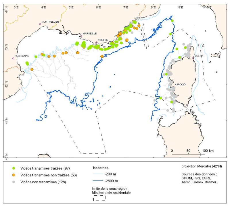
The data is provided as a layer of points representing submersible dives in the French Mediterranean.
-
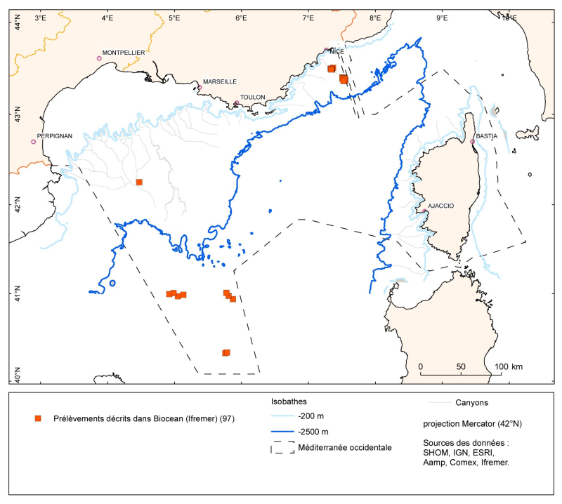
The data is provided as a layer of points representing the samples taken (operations) in the French Mediterranean. The lists of species identified corresponding to these sample points are in the Biocean database.
-
Occurrence data of strandings of marine mammals collected by the correspondents of the National Stranding Network (date, position, species) in metropolitan France in 2014-2020.
-
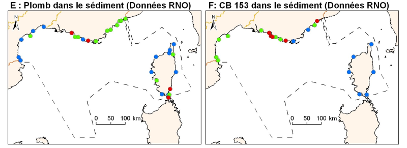
Concentrations of metals, organochlorines in surficial sediments (1st cm) in the Mediterranean coast, from RNO data.