 Mon GéoSource
Oceans
Type of resources
Available actions
Topics
INSPIRE themes
Keywords
Contact for the resource
Provided by
Years
Representation types
Update frequencies
status
Scale
Resolution
-
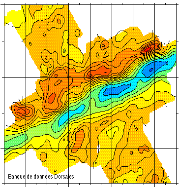
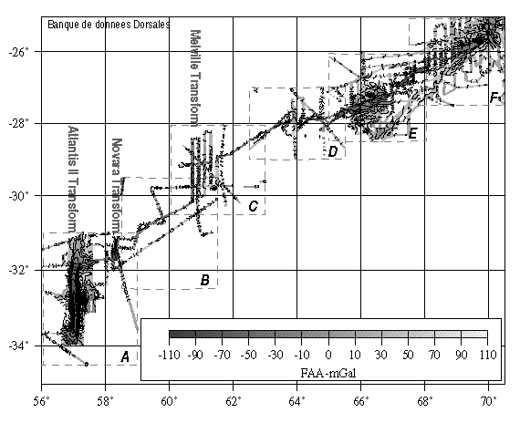
Gravimetry data of the ridge axis of Mohn's ridge (NE Atlantic) in order to study the mecanisms of the oceanic accretion.
-
Shellfish farming areas can have different meanings. Sometimes their identification is prescribed and used for health classification of production areas. In Euroshell project, the choice was made to map the production areas whose identification makes sense for both scientists and professionals. A limited number of areas is then showed, often corresponding to a hydrographic reality. Indeed, the shellfish industry is mainly installed in estuaries, river mouths, bays, fjords, estuaries or lagoons. This map shows the shellfish production sites, which include several areas. Some information is given on species produced, the number of companies and / or concessions and / or producers, the approximate amount of production.
-
Magnetic data of the ridge axis of Mohn's ridge (NE Atlantic) in order to study the mecanisms of the oceanic accretion.
-
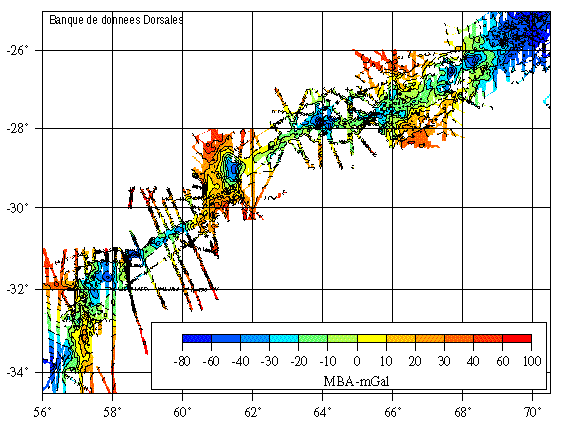
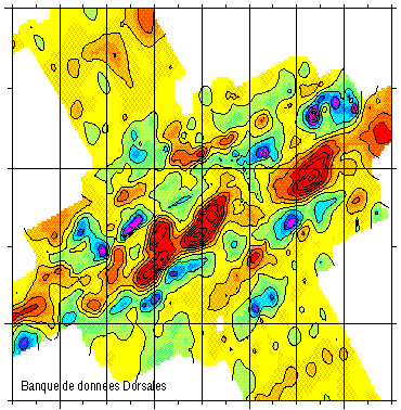
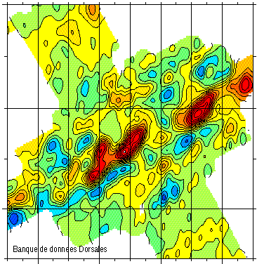
Compilation of gravimetric data between 1973 and 1994
-
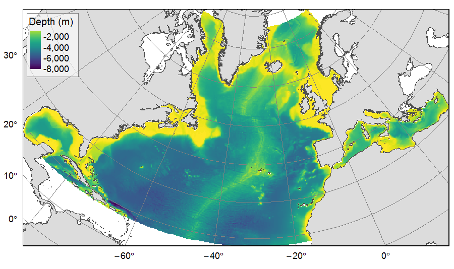
Distribution of three bathymetric terrain variables (depth, slope and Bathymetric Position Index) on the North Atlantic (18°N to 76°N and 36°E to 98°W). This dataset originated from three source layers (3km * 3km resolution) computed within the work package 3 of EU ATLAS project, and based on the EMODnet Digital Bathymetry portal and the General Bathymetric Chart of the Oceans (GEBCO). From these source layers, the mean depth (m), slope (degree) and BPI (no unit) were calculated for each 25km * 25km gridsquare. This dataset was built to feed a basin-wide spatial conservation planning exercise, targeting the deep sea of the North Atlantic. The goal of this approach was to identify conservation priority areas for Vulnerable Marine Ecosystems (VMEs) and deep fish species, based on the distribution of species and habitats, human activities and current spatial management.
-
Compilation of gravimetric data between 1973 and 1994
-

Distribution of three geomorphologic features (fracture zones, canyons, and seamounts) on the North Atlantic (18°N to 76°N and 36°E to 98°W). Source vector data originated from the GEBCO Gazetteer of Undersea Features Names for fractures, Harris & Whiteway (2011) for canyons, and Yesson et al. (2011) for seamounts. The presence (value=1) of fracture zones or seamounts and the total length of canyons (in km, independently for shelf-incising or blind canyons) was extracted in 25km * 25km gridsquares. This dataset was built to feed a basin-wide spatial conservation planning exercise, targeting the deep sea of the North Atlantic. The goal of this approach was to identify conservation priority areas for Vulnerable Marine Ecosystems (VMEs) and deep fish species, based on the distribution of species and habitats, human activities and current spatial management.
-

This backscatter data package is being made available as part of the de-risking study to be carried out in the Gulf of Lion for the award of a "commercial floating wind turbine" call for tenders by 2022. It includes data covering French territorial waters. Raw data have been acquired during oceanographic campaigns: AM-MED-1, BASAR1, BASAR2, BASAR3, CALMAR97, CALMAR99, RHOSOS et STRATAFORM 1.
-
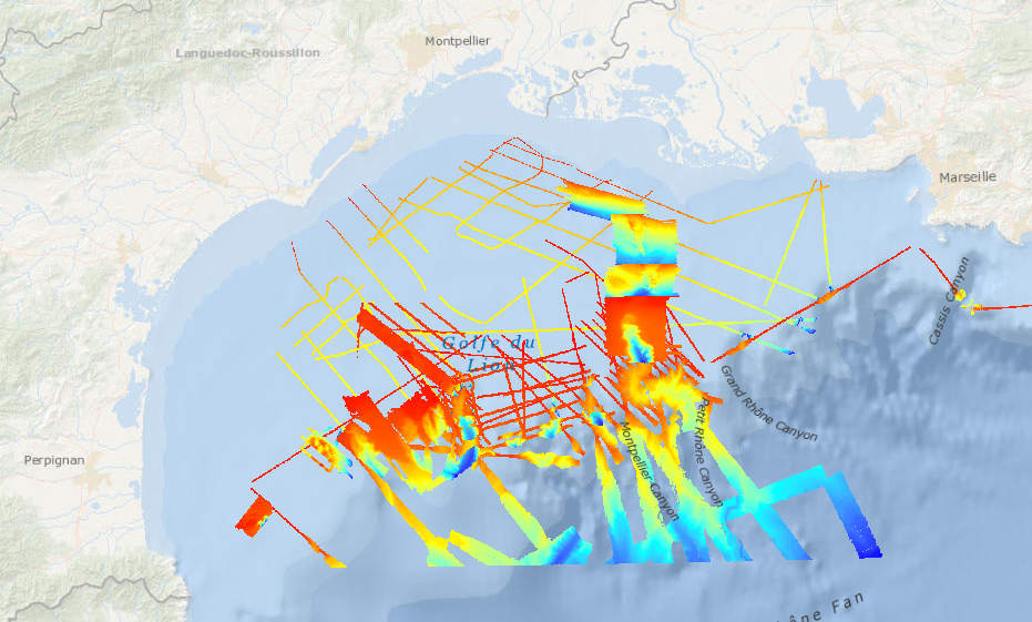
This bathymetric data package is being made available as part of the de-risking study to be carried out in the Gulf of Lion for the award of a "commercial floating wind turbine" call for tenders by 2022. It includes bathymetric digital models covering French territorial waters. Raw data have been acquired during oceanographic campaigns: AM-MED-1, BASAR2, BASAR3, RHOSOS et STRATAFORM 1.
-
Magnetic data of the ridge axis of Mohn's ridge (NE Atlantic) in order to study the mecanisms of the oceanic accretion.