 Mon GéoSource
/Biological Environment/Habitats
Type of resources
Available actions
Topics
INSPIRE themes
Keywords
Contact for the resource
Provided by
Years
Formats
Representation types
Update frequencies
status
Scale
Resolution
-
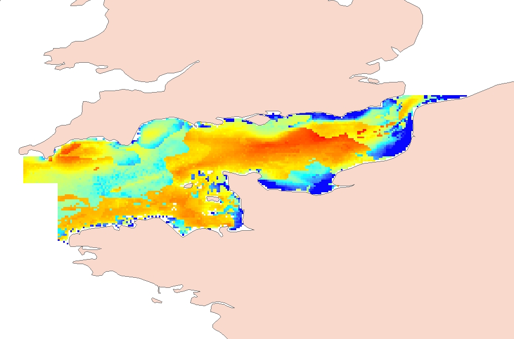
Process-driven seafloor habitat sensitivity (PDS) has been defined from the method developed by Kostylev and Hannah (2007), which takes into account physical disturbances and food availability as structuring factors for benthic communities. It is a conceptual model, relating species’ life history traits to environmental properties. Physical environment maps have been converted into a map of benthic habitat types, each supporting species communities with specific sensitivity to human pressures. It is based on two axes of selected environmental forces. The "Disturbance" (Dist) axis reflects the magnitude of change (destruction) of habitats (i.e. the stability through time of habitats), only due to natural processes influencing the seabed and which are responsible for the selection of life history traits. The "Scope for Growth" (SfG) axis takes into account environmental stresses inducing a physiological cost to organisms and limiting their growth and reproduction potential. This axis estimates the remaining energy available for growth and reproduction of a species (the energy spent on adapting itself to the environment being already taken into account). It can be related to the metabolic theory of the ecology. The process-driven sensitivity (PDS) can be seen as a risk map that combines the two previous axes and reflects the main ecological characteristics of the benthic habitats regarding natural processes. Areas with low disturbance are areas with a naturally low reworking of the sediment, allowing the establishment of a rich sessile epifauna community, with K-strategy species. Areas with low SfG means that the environmental factors, even though there are not limiting, are in lower values, i.e. that it imposes a cost for species to live. In areas combining low disturbance and low SfG, big suspension-feeder species with long life and slow growth can often be found: these species are more vulnerable in case of added disturbance. Details may be found in Foveau A, Vaz S, Desroy N, Kostylev VE (2017) Process-driven and biological characterisation and mapping of seabed habitats sensitive to trawling. PLoS ONE 12(10): e0184486. https://doi.org/10.1371/journal.pone.0184486
-
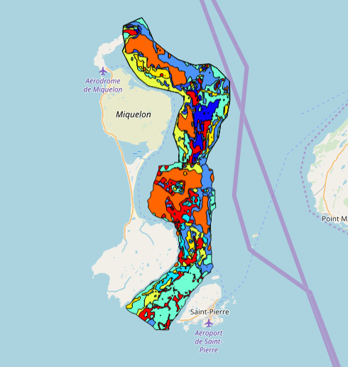
This data set was collected during 2 ENVISION-IFREMER field campaigns carried out in 2007 and 2011 to sustain a Pectinid aquaculture project. This was co-funded by ODEADOM and the public collectivity of Saint Pierre et Miquelon. This work aims to assess new seeding and rearing areas for the King scallop Placopecten magellanicus through a site selection process using the bottom type mapping data set obtained during the 2 ENVISION-IFREMER field campaigns. Furthermore, new estimates of potental scallop production is produced by this data treatment.
-
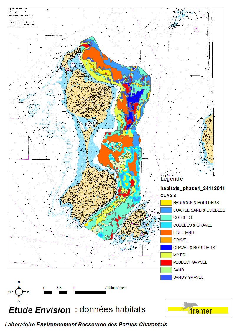
These data were collected during the 2007 and 2011 ENVISION-Ifremer campaigns to sustain a R & D project focusing on the Pectinid aquaculture development. This project was co-funded by the Saint Pierre et Miquelon public body and ODEADOM. This work aims to assess and select new potential rearing areas for the King scallop Placopecten magellanicus by using bottom type data resulting from 2 mapping campaigns carried out in 2007 and 2011 on the Eastern coast of Saint Pierre et Miquelon archipelago.
-
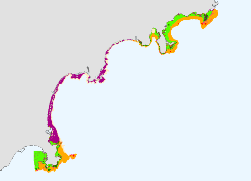
This mapping of marine biocenoses between 0 and 50m depth covers 75km of coastline between Antibes and Cap d'Ail.
-
Map of benthic habitat synthesis of the Natura 2000 site FR5300015 - Bay of Morlaix is the result of the fusion and harmonization of five cartographic data. They were generated according to mapping strategies, interpretation scales and on the basis of different cartographic supports.
-
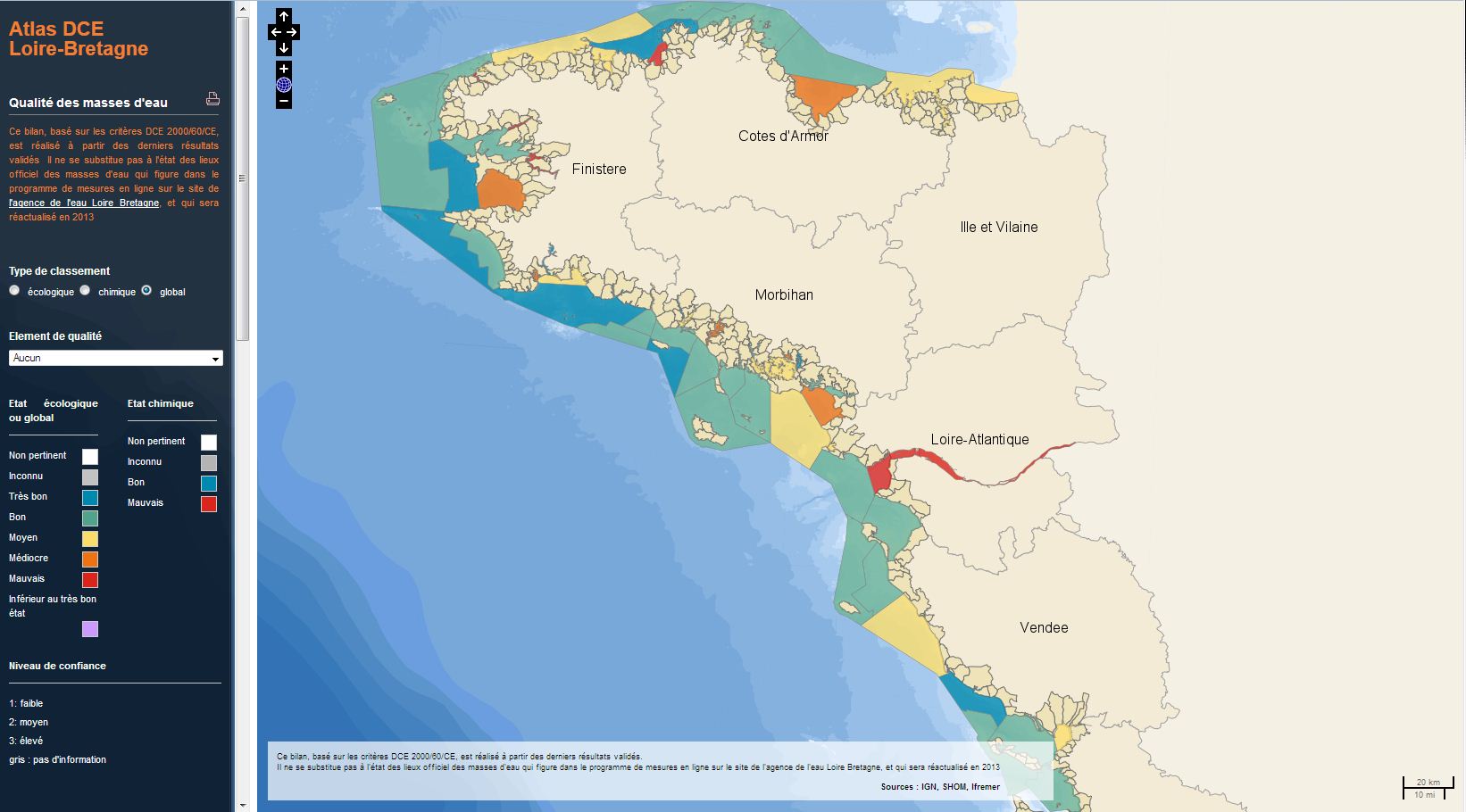
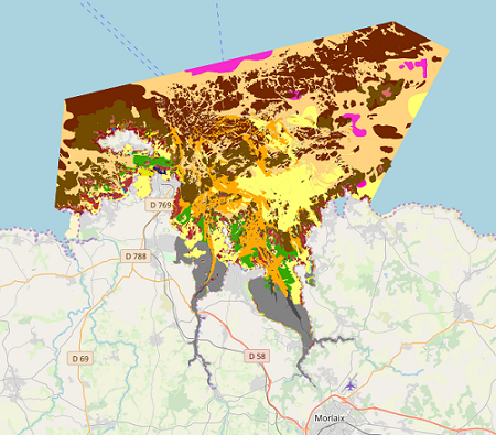
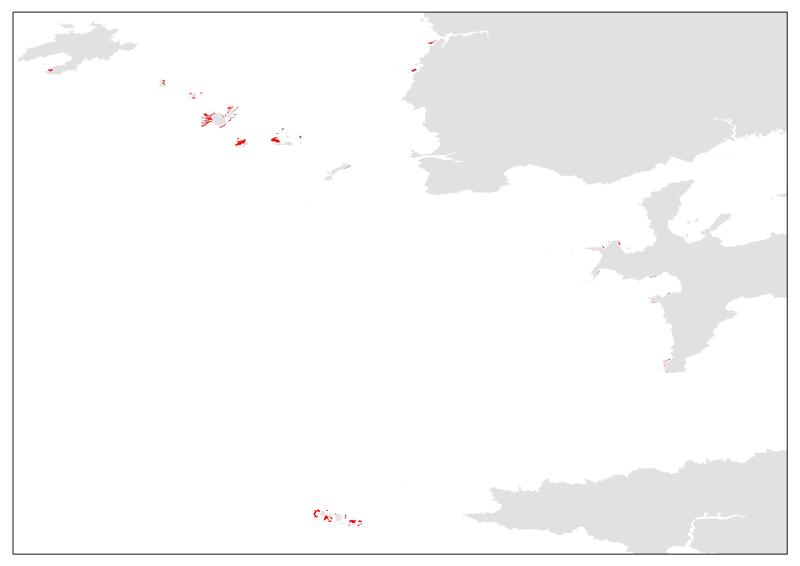
The analysis concerns the assessment of the overall state of the coastal and transitional waters of the Western Channel and the Bay of Biscay. It results from the combination of the ecological status and the chemical status of each water body according to the rules of the European Water Framework Directive (WFD). The most recent assessment of the state is presented in the DCE Loire-Bretagne atlas. Earlier reports are available in annual archives.
-
The term "boulder fields" covers areas of boulders of the lowest levels of the foreshore which are uncovered during low tides. They are not really part of the mediolittoral (intertidal zone) but what is now defined as the fringe tip (or emerging or upper part) of the infralittoral. More generally, boulder fields, formed by the fragmentation of the rocks in place, are located at the foot of rocky cliffs or between rocky headlands and flats. They are only accessible on foot during tidal coefficients greater than or equal to 95. Boulder fields naturally harbor a high biodiversity due to their position at the bottom of the foreshore, but the wealth of fauna and flora also depends greatly on the type of architectural habitat. Three broad categories of boulder fields are distinguished: Sediment blocks, blocks of bedrock and blocks on blocks.
-
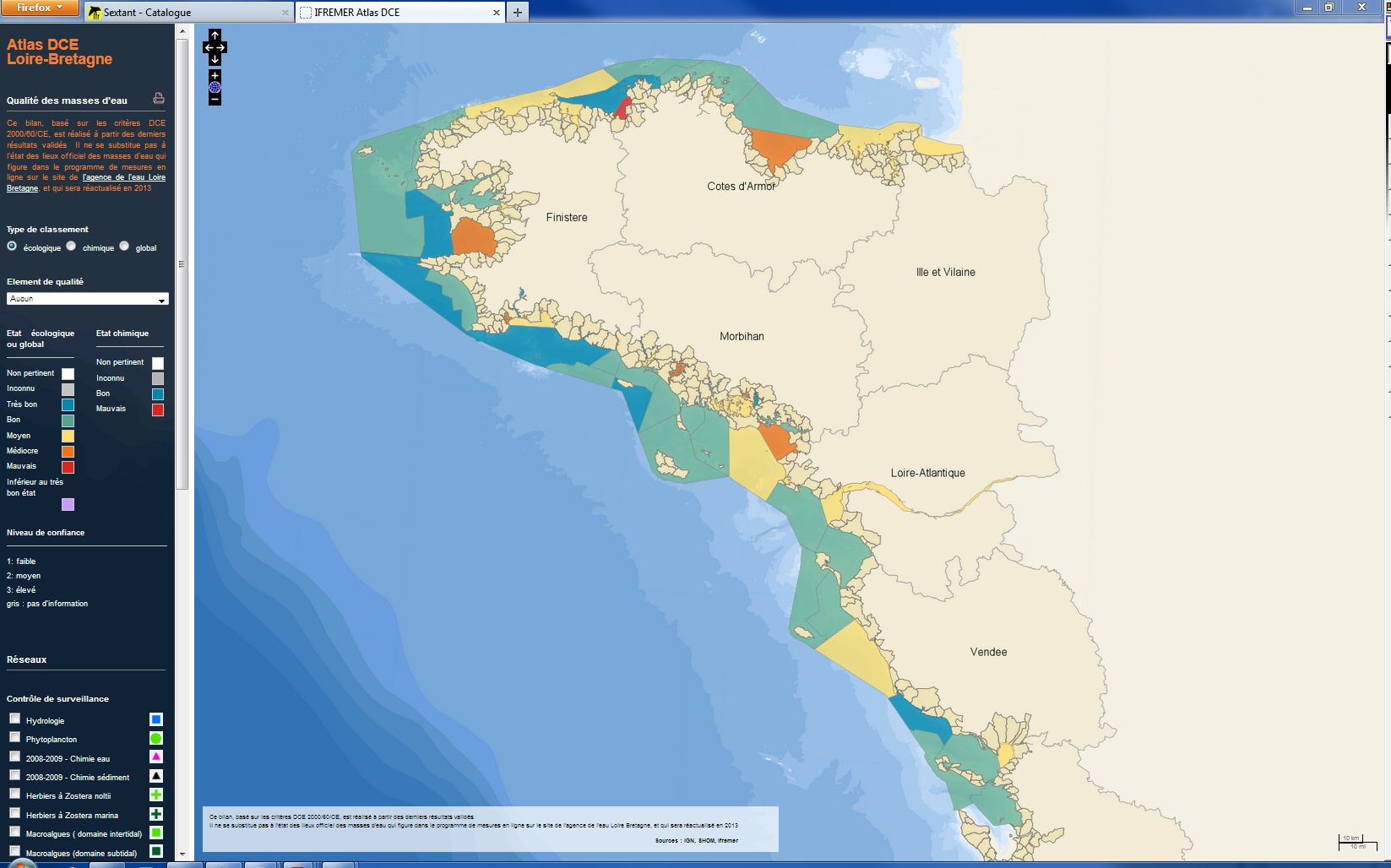
The analysis focuses on monitoring the ecological status of the coastal and transitional waters of the Western Channel and the Bay of Biscay. The ecological status of a coastal water body within the meaning of the European Water Framework Directive (WFD) is determined by the biological state, physicochemical state and hydromorphological state of the water mass, water. The statement is determined according to the rules described in the decree of 25 January 2010.
-
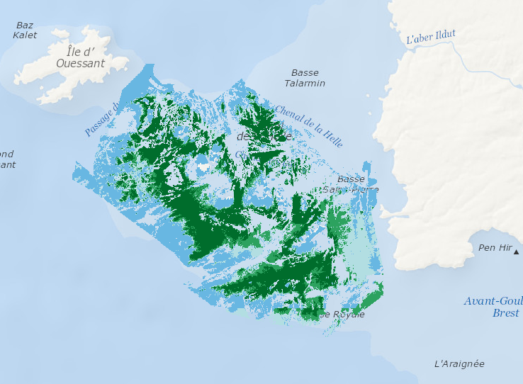
Data represents percentage cover of kelp forest as well as biomass of the 2 main species: L. digitata and L. hyperoborea. The used approach consists in firstly establishing surveys and appropriate processing methods in order to provide a detailed underwater topography of the area and to accurately delineate hard substrates (bedrock) potentially colonized by kelp. Secondly, a habitat suitability model is fitted for each species on some carefully selected field stations, measuring kelp presence/absence and biomass. Predictive maps are produced, based on hard substrate areas previously delineated.
-
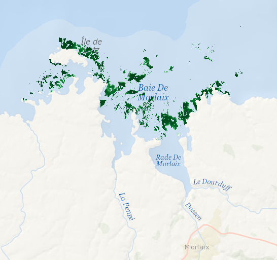
Data represents presence-absence prediction of kelp forest. Biological ground truth data were integrated with high resolution environmental datasets to develop statistical model that accurately predict the structure of Laminaria forests within the Bay of Morlaix. As a direct management output, high-resolution map (25 m2 grid) was produced.