 Mon GéoSource
Ifremer
Type of resources
Available actions
Topics
INSPIRE themes
Keywords
Contact for the resource
Provided by
Years
Formats
Representation types
Update frequencies
status
Service types
Scale
Resolution
-
Modelised adundance of several species eggs or prediction uncertainty.
-

Bathymetry of the French Guiana margin: the digital terrain model results from data compilation of 3 multibeam surveys conducted on the French research vessel RV L’Atalante. Grid resolution is 250 m. The DTM was processed as part of the French national program (EXTRAPLAC) for the delineation of the outer limit of the continental shelf beyond 200 nautical miles. - Guyaplac, 2003, R/V Atalante: Main source of the DTM was a cruise funded by the French National programme EXTRAPLAC. https://doi.org/10.17600/3010050 - Lobestory, 2004, R/V L'Atalante, https://doi.org/10.17600/4010030 - Cither1, 1993, R/V L'Atalante, https://doi.org/10.17600/93000010
-
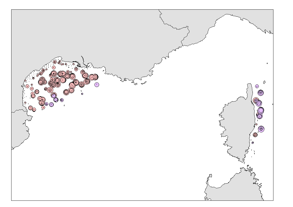
Density (number per km²) and biomass (g per km²) of Funiculina quadrangularis (Pennatulacea) and Isidella elongata (Alcyonacea) observed in bottom trawl scientific surveys (French MEDITS and NOURMED) by-catches from 2012 to 2019
-
Modelised adundance of several species eggs or prediction uncertainty.
-
Modelised adundance of several species eggs or prediction uncertainty.
-
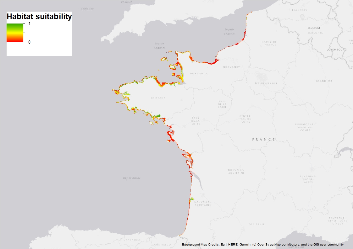
Ten Random Forest models were fitted in order to characterise the environmental niche and to predict the potential spatial distribution of Zostera marina along the French western seaboard. 3 rasters are provided: 1) Habitat suitability index (values ranging from 0 to 1 when conditions are estimated to be optimal), 2) standard deviation around the mean habitat suitability index, and 3) binary suitability estimates (0= not suitable, 1=suitable). These model estimates indicate areas where the species may occur and are overall consistent with field observations but note that these maps are model-based and do not correspond to actual field observations.
-
Modelised adundance of several species eggs or prediction uncertainty.
-
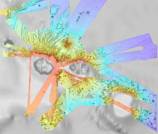
Bathymetry of the Crozet Islands, spatial resolution 100 meters. This Digital Terrain Model is a compilation of bathymetric data from several sources. Vertical reference : observed sea level Data process : Loubrieu Benoit, Pierre Delphine, Biville Romain, Le Duff Mathilde (2013). Digital Terrain Model for the HA04 hydroacoustic station, Crozet Islands, France. CB/GM/CTDI-BL2013-01 The data come from the cruises : - SCHLICH Roland (1998) KERIMIS-MD109 cruise, RV Marion Dufresne, https://doi.org/10.17600/98200010 - HUMLER Eric (2001) MD 121 / SWIFT cruise, RV Marion Dufresne, https://doi.org/10.17600/1200030 - METZL Nicolas, PIERRE Catherine (2001) VT 51 / OISO 6 cruise, RV Marion Dufresne, https://doi.org/10.17600/1200010 - ASLANIAN Daniel, HUMLER Eric, MICHEL Elisabeth (2002) MD 125 / SWIFT BIS-CARHOT cruise, RV Marion Dufresne, https://doi.org/10.17600/2200020 - MICHEL Elisabeth (2004) MD 136 / VIGO cruise, RV Marion Dufresne, https://doi.org/10.17600/4200110 - ROEST Walter (2005) MD 150 /DELCANO RISE-KERGUEPLAC2 cruise, RV Marion Dufresne, https://doi.org/10.17600/5200060 - VIALLY Roland, BRUNET Christian, ROYER Jean-Yves (2008) MD 165 / KERGUEPLAC 3 cruise, RV Marion Dufresne, https://doi.org/10.17600/8200010 - ROEST Walter, JOHNSON Sean (2010) MD176 Discovery Ridge-CrozetPlac cruise, RV Marion Dufresne, https://doi.org/10.17600/18001444 - CROSTA Xavier (2019) MD 218 / CROTALE cruise, RV Marion Dufresne, https://doi.org/10.17600/18000886 + transits of the R/V Marion Dufresne MD202 (2016) et MD207 (2017)
-
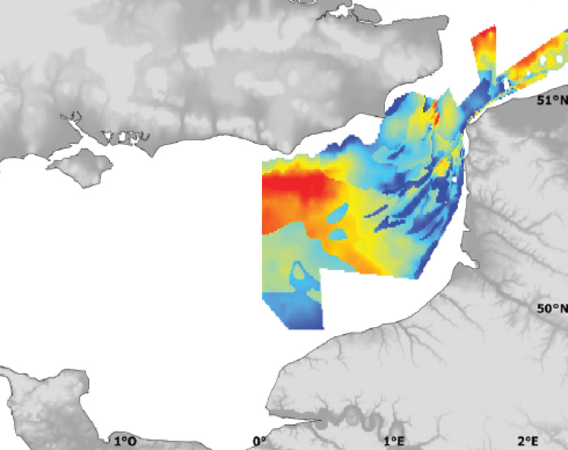
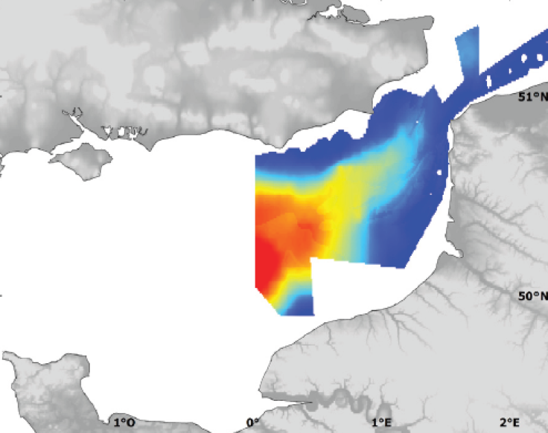
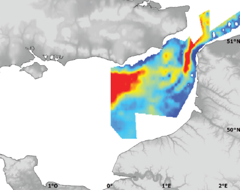
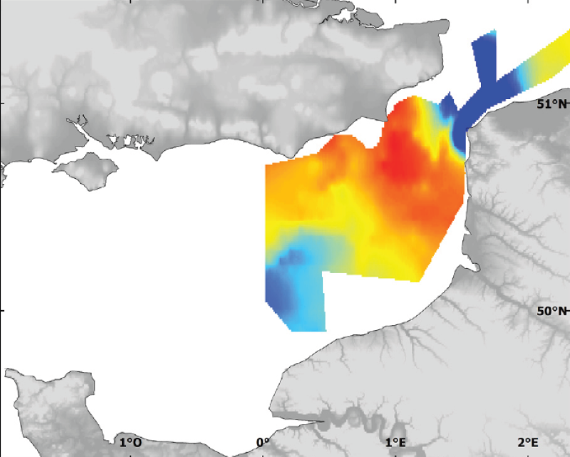
Seabed shear stress (in N.m-2) is a measure of the friction of water on the seabed due to waves and currents. The 90th percentile over the available period is used as layer for habitat models prediction.
-
Cold-water coral habitat mapping in submarine canyons of the bay of Biscay was realized by the deep sea laboratory of Ifremer. Data came from the EVHOE 2009 cruise in the framework of the CoralFish project and as part of an agreement between Ifremer and the Agence des Aires Marines Protégées. The method was based on image analyses. Images were acquired using the towed camera « SCAMPI » during the EVHOE 2009 cruise (from 18/10/2009 to 01/12/2009, chief scientists: Jean-Pierre LEAUTE and Michèle SALAUN). Observed habitats were defined according to the CoralFish typology (J.S. Davies, B. Guillaumont, F. Tempera, A. Vertino, L. Beuck, S.H. Ólafsdóttir, C.J. Smith, J.H. Fosså, I.M.J. van den Beld, A. Savini, A. Rengstorf, C. Bayle, J.-F. Bourillet, S. Arnaud-Haond, A. Grehan, 2017. A new classification scheme of European cold-water coral habitats: Implications for ecosystem-based management of the deep sea, In Deep Sea Research Part II: Topical Studies in Oceanography, Volume 145, 2017, Pages 102-109, ISSN 0967-0645, https://doi.org/10.1016/j.dsr2.2017.04.014).