 Mon GéoSource
2002
Type of resources
Available actions
Topics
INSPIRE themes
Keywords
Contact for the resource
Provided by
Years
Formats
Representation types
Update frequencies
status
Scale
Resolution
-
Relevé des entailles d’érosion marine dans le pied du versant externe du cordon dunaire que l'on nomme parfois « coup de cuillère » marine. Ces données sont issues de levés GPS effectués par l'ONF sur le littoral sableux aquitain au cours de l'hiver 2001-2002.
-
Relevé des entailles d’érosion marine dans le pied du versant externe du cordon dunaire que l'on nomme parfois « coup de cuillère » marine. Ces données sont issues de levés GPS effectués par l'ONF sur le littoral sableux aquitain au cours de l'hiver 2002-2003.
-
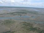
Relevé des fronts dunaires correspondant au contact plage/dune (avant – dune et falaise). Ces données sont issues de levés GPS effectués par l'ONF sur le littoral sableux aquitain au cours de l'été 2002.
-

État initial (2002) et études d’impact (2005, 2006, 2008) des peuplements benthiques et de la granulométrie dans le cadre du nettoyage du Banc de la Matelle (éradication des huîtres sauvages).
-
Suivi annuel haute fréquence en deux points du Bassin d'Arcachon des communautés planctoniques autotrophes en termes de biomasse, diversité, production primaire et de paramètres physiques et chimiques accompagnateurs.
-
État initial (2002) et études d’impact (2005, 2006) des peuplements benthiques et de la granulométrie dans le cadre de travaux de creusement d’une souille.
-
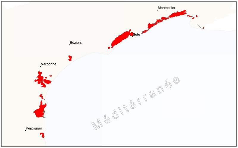
Etangs du Languedoc-Roussillon basés sur la Base de Données sur la CARtographie THématique des AGences de l'Eau et du ministère de l'Environnement qui est un référentiel national hydrographique: Languedoc-Roussillon, BD CARTHAGE
-
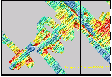
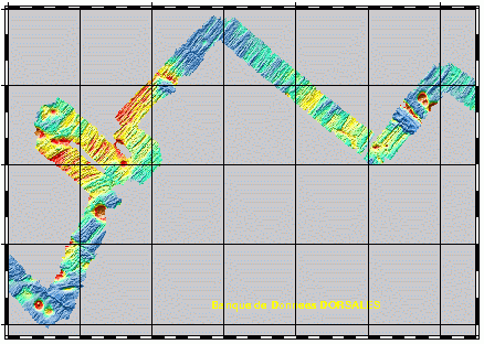
Etude géophysique et géochimique de la dorsale Pacifique-Antarctique, entre S65/W175 et S60/W150. Le premier objectif est de contribuer à la compréhension et à la modélisation des mécanismes de fonctionnement de la dorsale océanique à l'échelle de la cellule élémentaire d'accrétion (< 100 km). Le second est l'étude de la zonation du manteau supérieur à différentes échelles, via l'étude de la signature géochimique des roches provenant de la vallée axiale. Cette campagne s'inscrit dans le cadre du programme Inter-Ridge et résulte d'une collaboration entre IFREMER/DRO/GM, l'INSU (CNRS,IPG, GRGS), l'Université de Washington, la Scripps (Université Californie) et l'Université de Chiba (Japon).
-
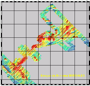
Etude géophysique et géochimique de la dorsale Pacifique-Antarctique, entre S65/W175 et S60/W150. Le premier objectif est de contribuer à la compréhension et à la modélisation des mécanismes de fonctionnement de la dorsale océanique à l'échelle de la cellule élémentaire d'accrétion (< 100 km). Le second est l'étude de la zonation du manteau supérieur à différentes échelles, via l'étude de la signature géochimique des roches provenant de la vallée axiale. Cette campagne s'inscrit dans le cadre du programme Inter-Ridge et résulte d'une collaboration entre IFREMER/DRO/GM, l'INSU (CNRS,IPG, GRGS), l'Université de Washington, la Scripps (Université Californie) et l'Université de Chiba (Japon).