Mon GéoSource
1000000
Type of resources
Available actions
Topics
INSPIRE themes
Keywords
Contact for the resource
Provided by
Years
Formats
Representation types
Update frequencies
status
Scale
Resolution
-
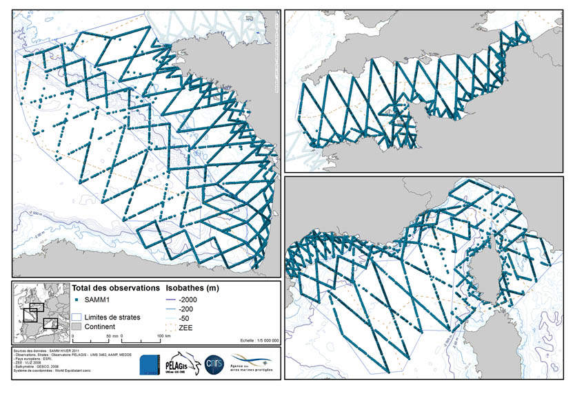
The associated data highlights the sampling programme for the data acquisition campaign of Observation on the Aerial Platform for the SAMM1campaign (Aerial Marine Megafauna Monitoring) conducted by the PELAGIS observatory.
-
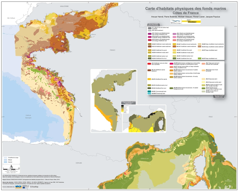
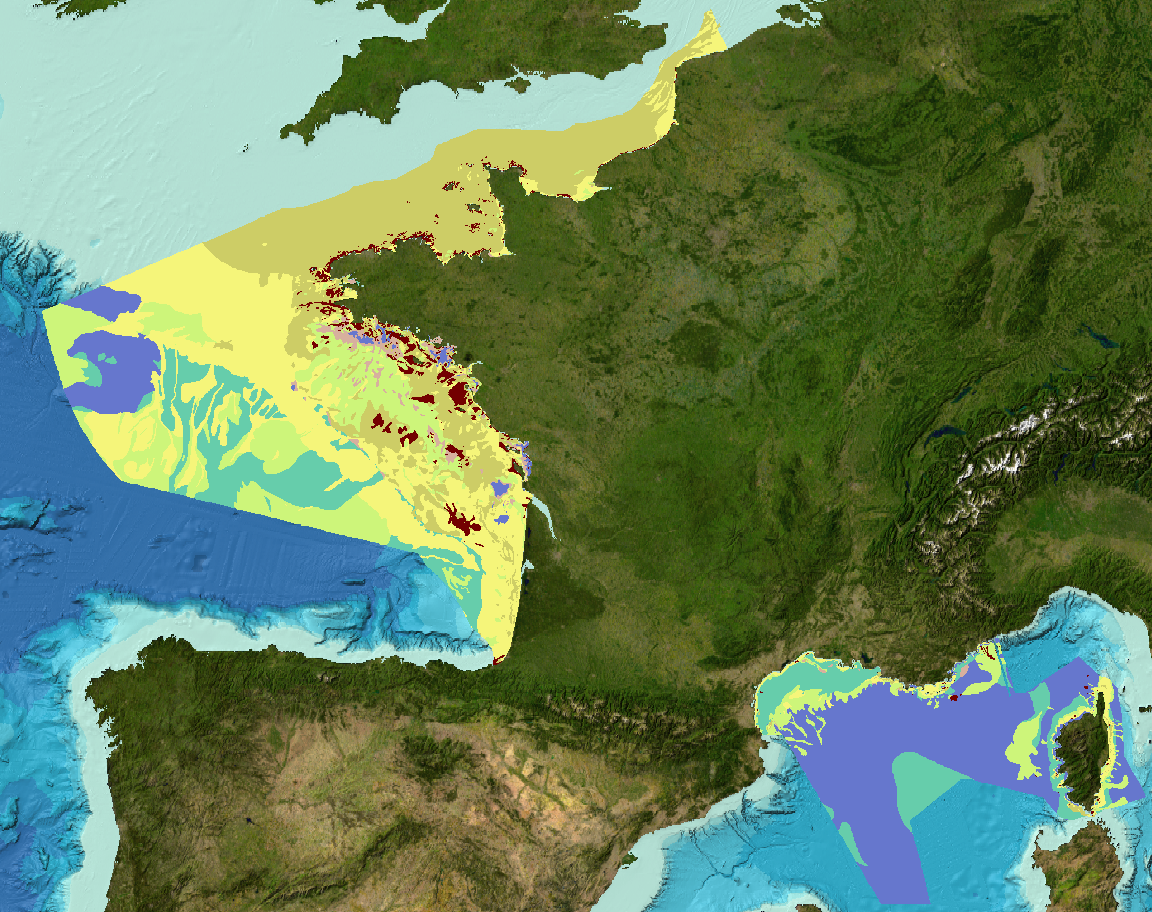
Eunis-classified physical habitats physiques resulting from the combination of three physical variables meshed at a resolution of 250 metres: nature of the substrates, biological area, shearing tension on the sea floor. Coasts of mainland France. Ifremer report "Hamdi Anouar, Vasquez Mickael, Populus Jacques (2010). Cartographie des habitats physiques Eunis - Côtes de France. Ifremer/AAMP agreement n° 09/12177764/FY. http://archimer.ifremer.fr/ doc/00026/13751/ "
-
The In Situ Analysis System (ISAS) was developed to produce gridded fields of temperature and salinity that preserve as much as possible the time and space sampling capabilities of the Argo network of profiling floats. Since the first global re-analysis performed in 2009, the system has been extended to accommodate all types of vertical profile as well as time series. ISAS gridded fields are entirely based on in-situ measurements. The system aims at monitoring the time evolution of ocean properties for climatological studies and allowing easy computation of climate indices. A careful delayed mode processing of the 2002-2015 dataset has been carried out using version 7 of ISAS and updating the statistics to produce the ISAS-15 analysis.
-
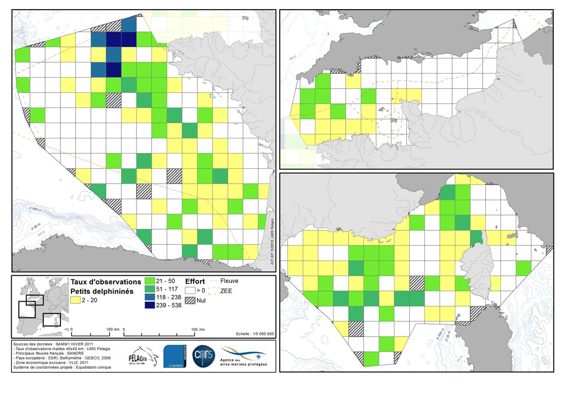
Occurrence rate by observation number for 100km of effort in each 40km mesh in the French mainland EZE in the winter of 2011/2012 and the summer of 2012. Description of the attribute table: survey : campaign Type: observation type Mesh: mesh size in kilometers _no_maille : mesh number The following fields correspond to the calculation of the occurrence rate for the observation number for 1000km of effort for each species or group of species : - [marsouin] common porpoise - [grdDauph] bottlenose dolphin - [lagenor] White-beaked dolphin - [pttDelph] : common dolphin and Striped dolphin - [globiceph] : Long-finned pilot whale + Risso's dolphin - [cakobab] : Sperm whale+ kogias + Beaked whales - [balenopt] : Fin whale + Minke whale + blue whale - [phoque] seal (grey + harbour)
-
-
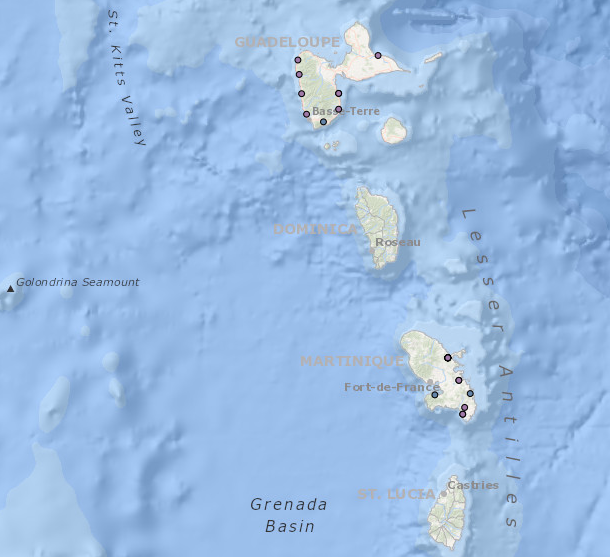
Occurrence data of strandings of marine mammals collected by the correspondents of the National Stranding Network (date, position, species) in metropolitan France in 2014-2020.
-
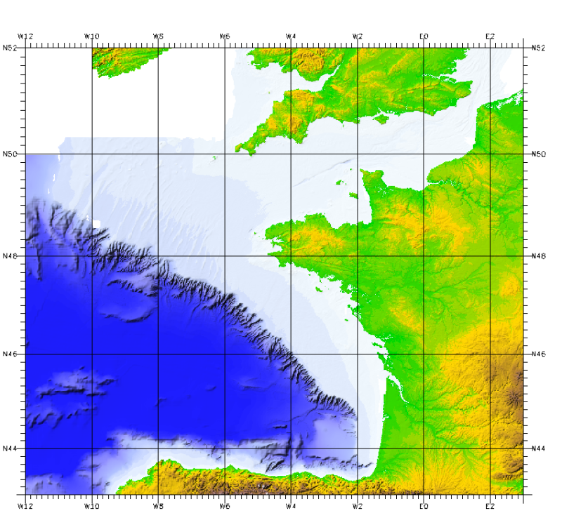
This bathymetric model is the result of compiling data and numerical models prior to 2008 in the Bay of Biscay. These datasets are available at a resolution of 500 m and 1000 m. Contours are also available for both digital terrain model (DTM). Public access granted under certain conditions.
-

Habitat typology obtained from the statistical analysis of underwater video data collected from the STAVIRO autonomous unbaited video technique (AMBIO project)
-
Sediment substrate map at 1 : 1 000 000 of the French metropolitan EEZ produced in the work-package 3 the European project EMODNet Geology, phase 2. And additionnal informations on index and confidence of original maps.
-