 Mon GéoSource
dataset
Type of resources
Available actions
Topics
INSPIRE themes
Keywords
Contact for the resource
Provided by
Years
Formats
Representation types
Update frequencies
status
Service types
Scale
Resolution
-
Abstract
-
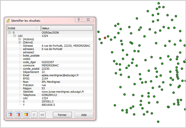
Géolocalisation des établissements publics locaux d’enseignement et de formation professionnelle agricoles : Position géographique des établissements en WGS84 (4326) sur l'ensemble du territoire (France métropolitaine et DOM COM). Attributs : Éléments de contact (nom,adresse, téléphone, mail..) et coordonnées géographiques officielles des établissements concernés. Mise à jour mensuelle. Information de précision des données : Dans la mesure du possible, la donnée est au bâtiment près ou à la rue; il existe cependant des cas où le centre de la commune est le point de référence (cf. champ "Précision").
-
Process-driven seafloor habitat sensitivity (PDS) has been defined from the method developed by Kostylev and Hannah (2007), which takes into account physical disturbances and food availability as structuring factors for benthic communities. It is a conceptual model, relating species’ life history traits to environmental properties. Physical environment maps have been converted into a map of benthic habitat types, each supporting species communities with specific sensitivity to human pressures. It is based on two axes of selected environmental forces. The "Disturbance" (Dist) axis reflects the magnitude of change (destruction) of habitats (i.e. the stability through time of habitats), only due to natural processes influencing the seabed and which are responsible for the selection of life history traits. The "Scope for Growth" (SfG) axis takes into account environmental stresses inducing a physiological cost to organisms and limiting their growth and reproduction potential. This axis estimates the remaining energy available for growth and reproduction of a species (the energy spent on adapting itself to the environment being already taken into account). It can be related to the metabolic theory of the ecology. The process-driven sensitivity (PDS) can be seen as a risk map that combines the two previous axes and reflects the main ecological characteristics of the benthic habitats regarding natural processes. Areas with low disturbance are areas with a naturally low reworking of the sediment, allowing the establishment of a rich sessile epifauna community, with K-strategy species. Areas with low SfG means that the environmental factors, even though there are not limiting, are in lower values, i.e. that it imposes a cost for species to live. In areas combining low disturbance and low SfG, big suspension-feeder species with long life and slow growth can often be found: these species are more vulnerable in case of added disturbance. Details may be found in Foveau A, Vaz S, Desroy N, Kostylev VE (2017) Process-driven and biological characterisation and mapping of seabed habitats sensitive to trawling. PLoS ONE 12(10): e0184486. https://doi.org/10.1371/journal.pone.0184486
-
-
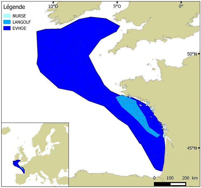
Distribution of benthic invertebrate species in Atlantic based on cumulative and interpolated relative abundance density data from fisheries surveys EVHOE (2008-2013), LANGOLF (2011-2013), NURSE (2000-2013), ORHAGO (2011-2015)
-
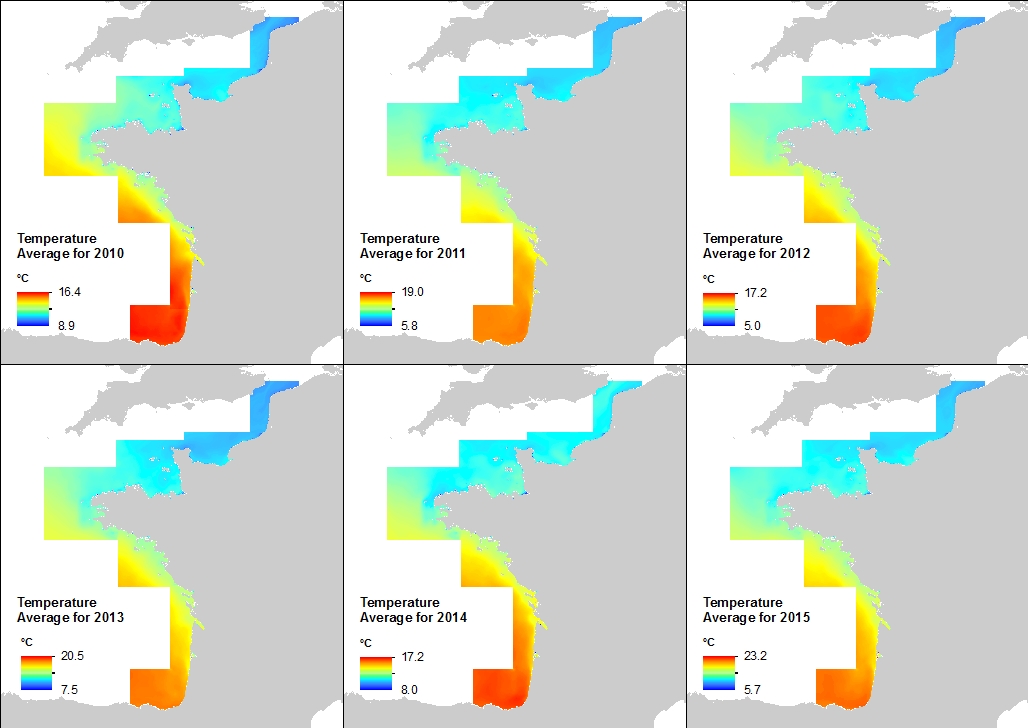
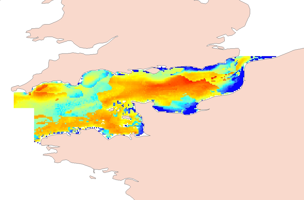
This annual statistics at 500m horizontal resolution was produced from the archived time series of MARS 3D physics model hindcast runs along French Atlantic Coast. The variable that is available here is Temperature. Values are expressed in Celsius degrees. In each pixel the value is an average of the values of the 40 vertical levels that are considered in the model.
-
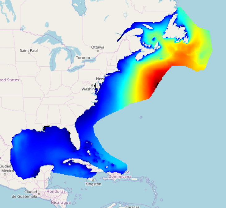
IOWAGA sea-states forecast best estimate generated by the wave model WAVEWATCH-III and forced by ECMWF winds on the North West Atlantic grid from 2017 to now
-
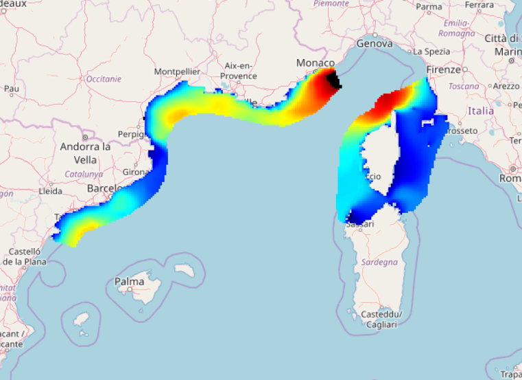
IOWAGA sea-states forecast best estimate generated by the wave model WAVEWATCH-III and forced by ECMWF winds on the North mediterranean grid from 2017 to now
-
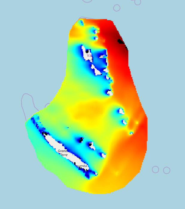
IOWAGA sea-states forecast best estimate generated by the wave model WAVEWATCH-III and forced by ECMWF winds on the New Caledonia grid from 2017 to now
-
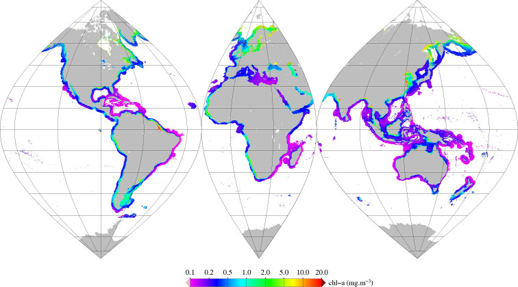
Monthly mean of chlorophyll-a (2002-2012) from Gohin (2002), for coastal areas, at global scale, for MERIS sensor, with POLYMER atmospheric corrections. Ref: F. Gohin , J. N. Druon & L. Lampert, A five channel chlorophyll concentration algorithm applied to SeaWiFS data processed by SeaDAS in coastal waters. IJRS Volume 23, 2002 - Issue 8 http://dx.doi.org/10.1080/01431160110071879 2002