 Mon GéoSource
50000
Type of resources
Available actions
Topics
INSPIRE themes
Keywords
Contact for the resource
Provided by
Years
Formats
Representation types
Update frequencies
status
Scale
Resolution
-
Physico-chemical monitoring stations are part of a network under the responsibility of the water agencies. Regarding the scope of strict thematic contribution "Hydrology," the monitoring stations do not come into account because they only measure the physico-chemical quality of the rivers. These stations are used only for calculations under fluvial inputs of pollutants / nutrients.
-
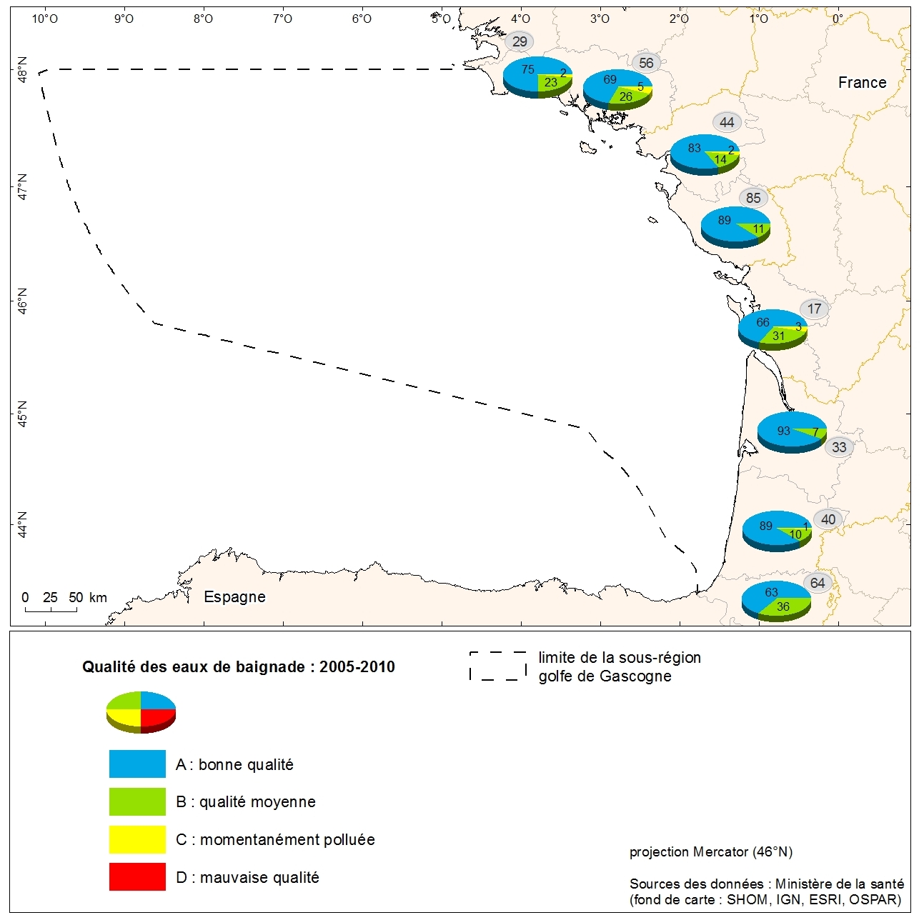
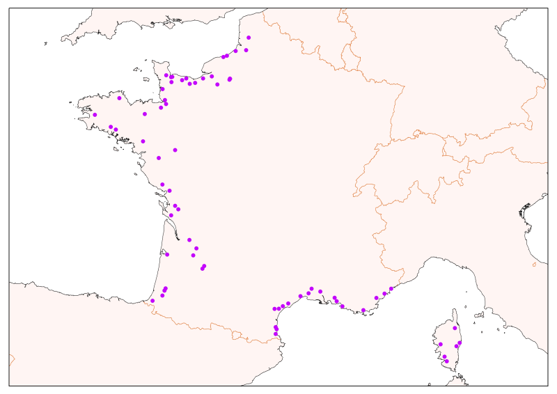
Grading the quality of metropolitan coastal bathing waters in 2010 from the Department of Health. Data collected from the Ministry of Health as part of the initial assessment of the MSFD. Referent expert: Aurélie Blanck.
-
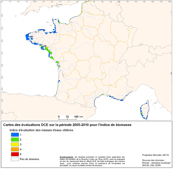
Under the EU Water Framework Directive (2000/60/EC), among the biological parameters involved in the assessment of coastal water bodies, the quality element "phytoplankton" is defined. This indicator Phytoplankton is made up of several indexes including a biomass index and an abundance index. Oxygen balance appearing among the elements of physicochemical quality selected for the classification of the ecological state of coastal water bodies. The quality element "benthic invertebrates" is also part of the biological parameters involved in the assessment of these water bodies.
-
-
Zones corresponding to the delimitation of major watersheds and related marine areas in the Seine-Normandy basin for the assessment of pressures on the different water masses on the Normandy coast and marine sub region English Channel - North Sea. Nutrient discharges from industries and communities.
-
-
Validated and aggregated data from current profilers measured continuously by hull-mounted ADCPs (Acoustic Doppler Current Profiler).
-
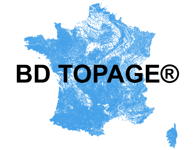
Le référentiel hydrographique vise à décrire les entités hydrographiques présentes sur le territoire français afin de constituer un référentiel national permettant de localiser des données relatives à l’eau. La BD TOPAGE® vise à passer d’un référentiel hydrographique français à moyenne échelle (la BD CARTHAGE®) à un référentiel à grande échelle (métrique), plus exhaustif, conforme à la directive INSPIRE et compatible avec le référentiel à grande échelle (RGE®) de l’IGN. La BD TOPAGE® vise à répondre aux besoins communs de l’ensemble des acteurs du SIE et doit leur permettre d’échanger et de mutualiser à toutes les échelles sur les éléments hydrographiques de surface du territoire national. Il est aussi motivé par l'obligation de mise en conformité à la directive INSPIRE. La BD TOPAGE® regroupe les jeux de données : - des cours d'eau ; - des plans d'eau ; - des surfaces élémentaires ; - des tronçons hydrographiques ; - des bassins hydrographiques ; - des bassins versant topographiques ; - des noeuds hydrographiques ; - des limites terre-mer.
-
source : DREAL HdF / DIDDEE (08/2019) Territoire à énergie positive pour la croissance verte (TEPCV)
-

Couche surfacique de référence, représentative de la géographie des enceintes de postes tracées à partir des limites de clôtures. Le tracé en Lambert 93 (projection associée au système géodésique RGF93), est obtenu au moyen d'un plan numérique géoréférencé ou d'une convention RTE/IGN.