 Mon GéoSource
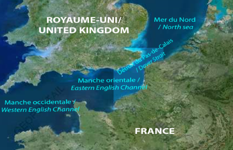
oceans
Type of resources
Available actions
Topics
INSPIRE themes
Keywords
Contact for the resource
Provided by
Years
Formats
Representation types
Update frequencies
status
Scale
Resolution
-
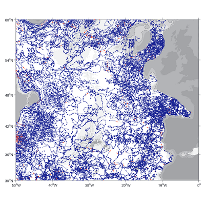
A world deep displacement dataset, named ANDRO, after a traditional dance of Brittany meaning a swirl, comprising more than 1300 000 deep displacements, has been produced from the Argo float trajectory data ('traj' files). ANDRO dataset was completed over the period 2000-2009, then was partially but yearly updated since 2010. For detailed information and status of the last released ANDRO product, please visit the dedicated Argo France web page: https://www.umr-lops.fr/SNO-Argo/Products/ANDRO-Argo-floats-displacements-Atlas One important feature of ANDRO is that the pressures measured during float drifts at depth, and suitably averaged are preserved in ANDRO. To reach this goal, it was necessary to reprocess most of the Argo raw data, because of the many different decoding versions (roughly 100) not always applied by the DACs to the displacement data because they were mainly interested in the p,t,S profiles. The result of our work was the production of comprehensive files, named DEP (for 'déplacement' in French), containing all the possibly retrievable float data.
-
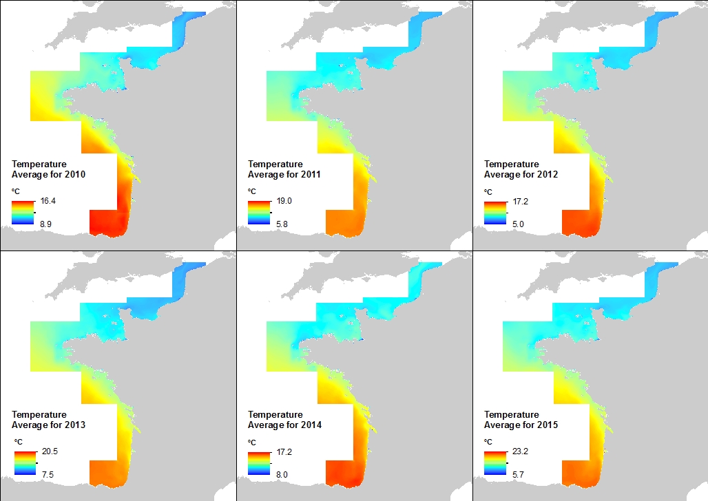
This annual statistics at 500m horizontal resolution was produced from the archived time series of MARS 3D physics model hindcast runs along French Atlantic Coast. The variable that is available here is Temperature. Values are expressed in Celsius degrees. In each pixel the value is an average of the values of the 40 vertical levels that are considered in the model.
-

This annual statistics at 500m horizontal resolution was produced from the archived time series of MARS 3D physics model hindcast runs along French Atlantic Coast. The variable that is available here is the Temperature. Values are expressed in Celcius degrees. The vertical level is the seabed.
-
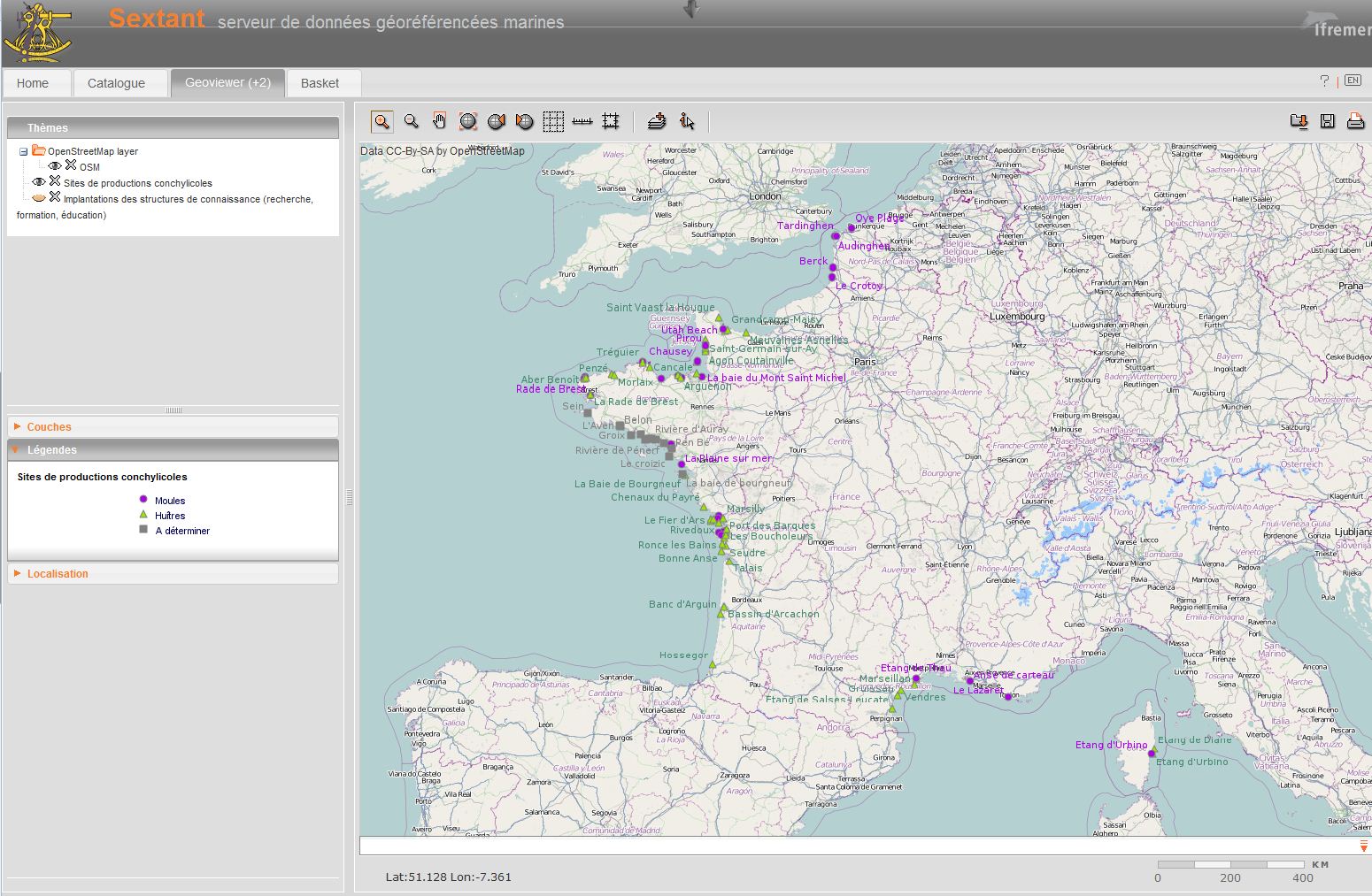
Localization of professional organizations linked to shellfish farming within Euroshell project
-
As part of the implementation of the monitoring programme of the Marine Strategy Framework Directive (MSFD), the monitoring of demersal fish and cephalopods in coastal soft environments was deemed a priority. Annual observation campaigns of coastal nurseries on soft bottoms were carried out by the Laboratoire Halieutique Méditerranée of the Ifremer station in Sète. The objectives of these campaigns are 1. To evaluate the density, biomass and distribution of fish and cephalopods by trawling, in particular benthic and demersal juveniles (red mullet, gurnard). To do this, around one hundred standardised trawl surveys were carried out over the entire coastal strip of the Gulf of Lion situated between 5m and 40m depth. 2. To systematically measure the size of the individuals collected in order to characterise the importance of the nursery function in the areas observed and to better understand the population dynamics of local species. 3. To gain a better understanding of the coastal zone ecosystem by systematically identifying all the species encountered (including benthic and pelagic invertebrates other than fish and cephalopods), the macro-waste observed and by characterising their hydrological habitats (CTD, oxygen, fluorescence, pH, turbidity, etc.).
-
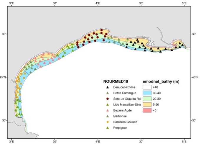
Shellfish farming areas can have different meanings. Sometimes their identification is prescribed and used for health classification of production areas. In Euroshell project, the choice was made to map the production areas whose identification makes sense for both scientists and professionals. A limited number of areas is then showed, often corresponding to a hydrographic reality. Indeed, the shellfish industry is mainly installed in estuaries, river mouths, bays, fjords, estuaries or lagoons. This map shows the shellfish production sites, which include several areas. Some information is given on species produced, the number of companies and / or concessions and / or producers, the approximate amount of production.
-
Polygons which delimited the geographical studied area of the CHARM I project and the CHARM II project. Polygons which delimited the geographical suggested area of the CHARM III project.
-

This backscatter data package is being made available as part of the de-risking study to be carried out in the Gulf of Lion for the award of a "commercial floating wind turbine" call for tenders by 2022. It includes data covering French territorial waters. Raw data have been acquired during oceanographic campaigns: AM-MED-1, BASAR1, BASAR2, BASAR3, CALMAR97, CALMAR99, RHOSOS et STRATAFORM 1.
-
attenuation coefficient (KPAR, m-1)
-
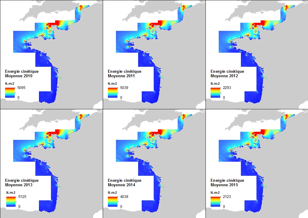
This annual statistics at 500m horizontal resolution was produced from the archived time series of MARS 3D physics model hindcast runs along French Atlantic Coast. The variable that is available here is the Kinetic Energy induced by currents caused by tide, water density gradients and action of winds. The formula used for the Kinetic Energy calculation is 0.5mv², where m is the density of seawater (1027 kg.m-3) and v is the current-induced velocity. Values are expressed in N.m-2 (Newton per square meter). The vertical level is the sea surface.