 Mon GéoSource
Western Mediterranean
Type of resources
Available actions
Topics
INSPIRE themes
Keywords
Contact for the resource
Provided by
Years
Representation types
Update frequencies
status
Scale
-
-
Polygons defined for the sampling points distribution in the Medits campaigns. MEDITS, 2007. International bottom trawl survey in the Mediterranean (Medits). Instruction manual. Version 5. Ifremer, Nantes. http://archimer.ifremer.fr/doc/00002/11321/. 60 p.
-
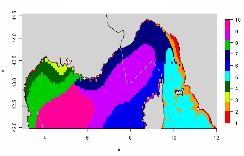
The distribution of hydrological landscapes is determined by a method of comparing multi-tables, to identify groups of individuals with similar variability of hydrological conditions during the year. The data used provides monthly tables showing the five selected physical parameters (SS, Phi, SST, MES et CHLA), calculated over the entire geographical area, a common resolution of 0.05°. This method identifies 10 hydrological landscapes showing a similar annual variability of hydrological conditions.
-
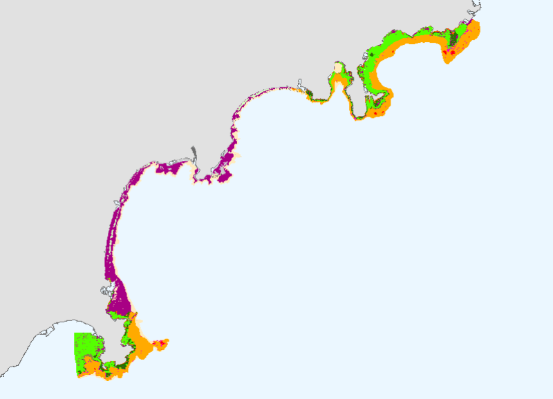
This mapping of marine biocenoses between 0 and 50m depth covers 75km of coastline between Antibes and Cap d'Ail.
-
Censuses of nutrient salt monitoring stations in the western Mediterranean sub-region (1962 to 2010)
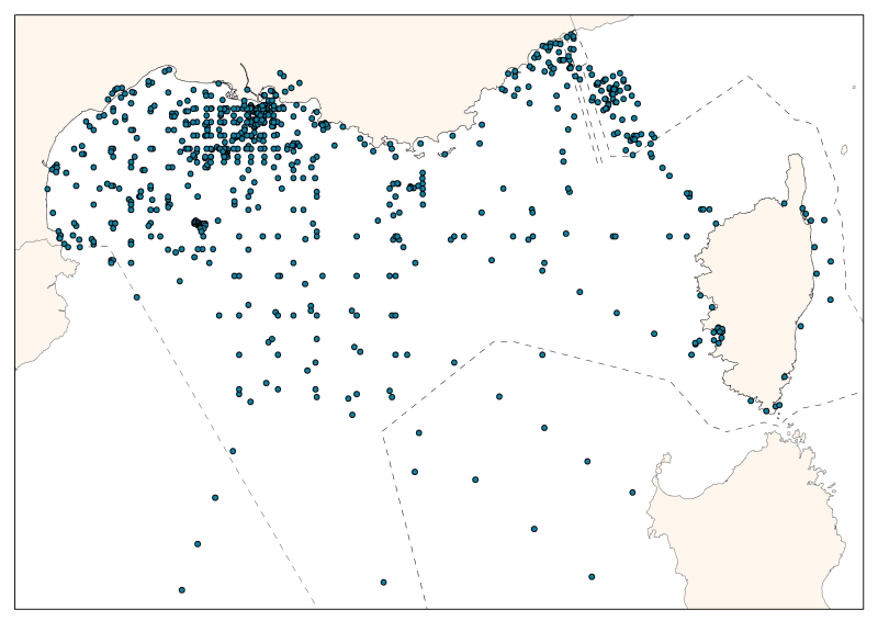
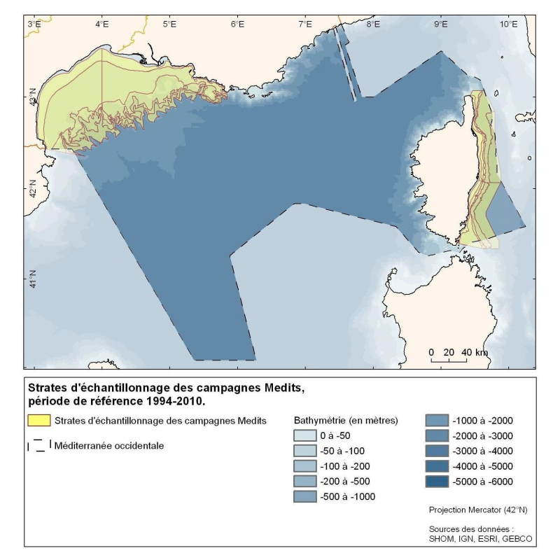
The consolidated database shows the spatial distribution of sampling effort by French and Monaco oceanographic campaigns. The measures are divided between the mouth of the Rhone, the Gulf of Lions, and Ligurian and Provence seas. The database contains 55 campaigns or time series, over 5 decades from 1962 to 2010. 28 are oceanographic campaigns of spatial strategy (some were revisited), 14 of temporal strategy, 2 of spatio-temporal strategy, and 1 one-time campaign. In total, it has 24,886 entries including: 19,027 nitrate data - 13,826 nitrite data - 11,452 ammonium data – 20,936 phosphates data – 14,605 silicates data. The majority (92%) of associated temperature and salinity data is available.
-

-

-
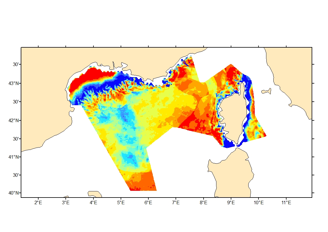
Process-driven seafloor habitat sensitivity (PDS) has been defined from the method developed by Kostylev and Hannah (2007), which takes into account physical disturbances and food availability as structuring factors for benthic communities. It is a conceptual model, relating species’ life history traits to environmental properties. Physical environment maps have been converted into a map of benthic habitat types, each supporting species communities with specific sensitivity to human pressures. It is based on two axes of selected environmental forces. The "Disturbance" (Dist) axis reflects the magnitude of change (destruction) of habitats (i.e. the stability through time of habitats), only due to natural processes influencing the seabed and which are responsible for the selection of life history traits. The "Scope for Growth" (SfG) axis takes into account environmental stresses inducing a physiological cost to organisms and limiting their growth and reproduction potential. This axis estimates the remaining energy available for growth and reproduction of a species (the energy spent on adapting itself to the environment being already taken into account). It can be related to the metabolic theory of the ecology. The process-driven sensitivity (PDS) can be seen as a risk map that combines the two previous axes and reflects the main ecological characteristics of the benthic habitats regarding natural processes. Areas with low disturbance are areas with a naturally low reworking of the sediment, allowing the establishment of a rich sessile epifauna community, with K-strategy species. Areas with low SfG means that the environmental factors, even though there are not limiting, are in lower values, i.e. that it imposes a cost for species to live. In areas combining low disturbance and low SfG, big suspension-feeder species with long life and slow growth can often be found: these species are more vulnerable in case of added disturbance.
-
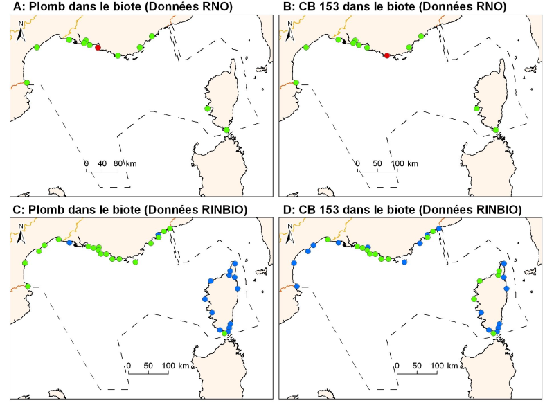
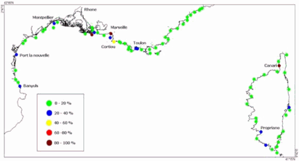
Concentrations of metals, organochlorines in mussels and oysters from the Mediterranean coast, from RNO RINBIO data.
-
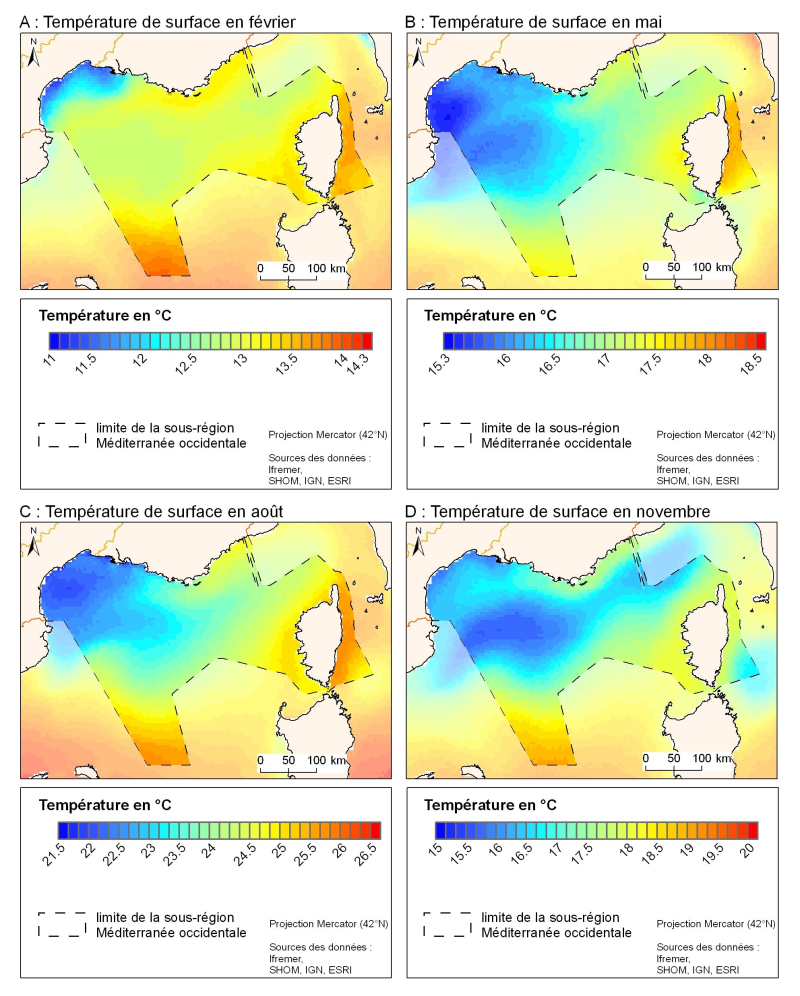
The spatial resolution from satellite climatology provides a more detailed description of spatio-temporal variations of surface temperature in the northern part of the western basin. Climatology exists for the surface temperature based on satellite infrared measurements which provides a spatial resolution on the order of kilometres.