 Mon GéoSource
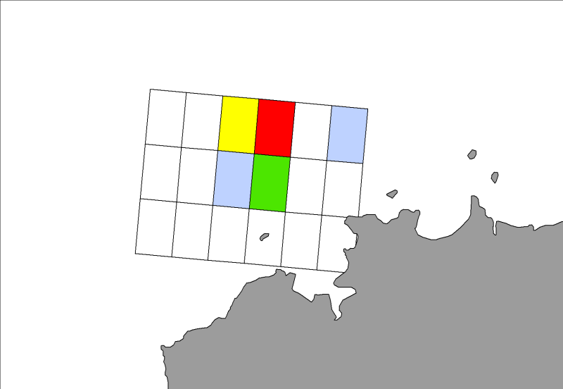
Celtic Seas
Type of resources
Available actions
INSPIRE themes
Provided by
Representation types
Update frequencies
status
Scale
-
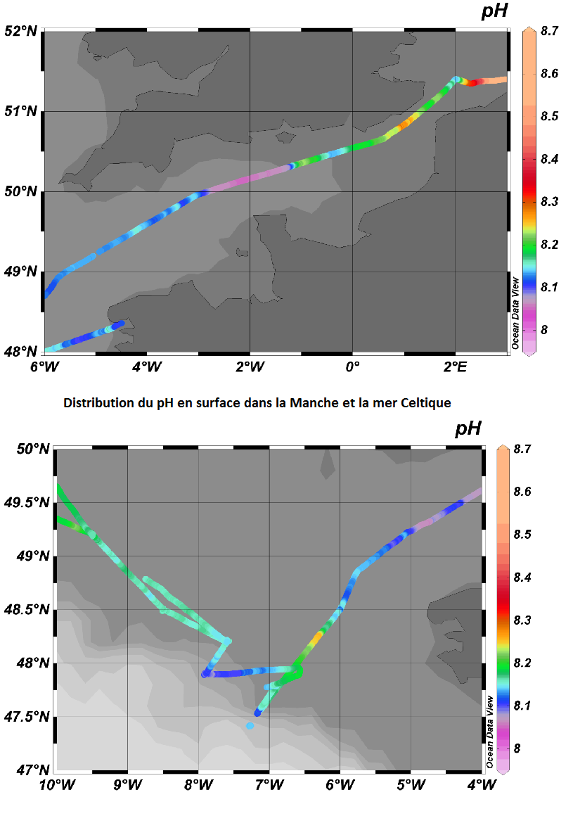
Variations spatio-temporelles des flux air-mer de CO2 et du pH dans les sous-région marine Manche-mer du Nord et mer Celtique
-
Distribution des espèces invertébrés benthiques en Atlantique établie à partir des données de densité d'abondance relative cumulées et krigées, issues des campagnes halieutiques EVHOE (2008-2013), LANGOLF (2011-2013), NURSE (2000-2013), ORHAGO (2011-2015)
-
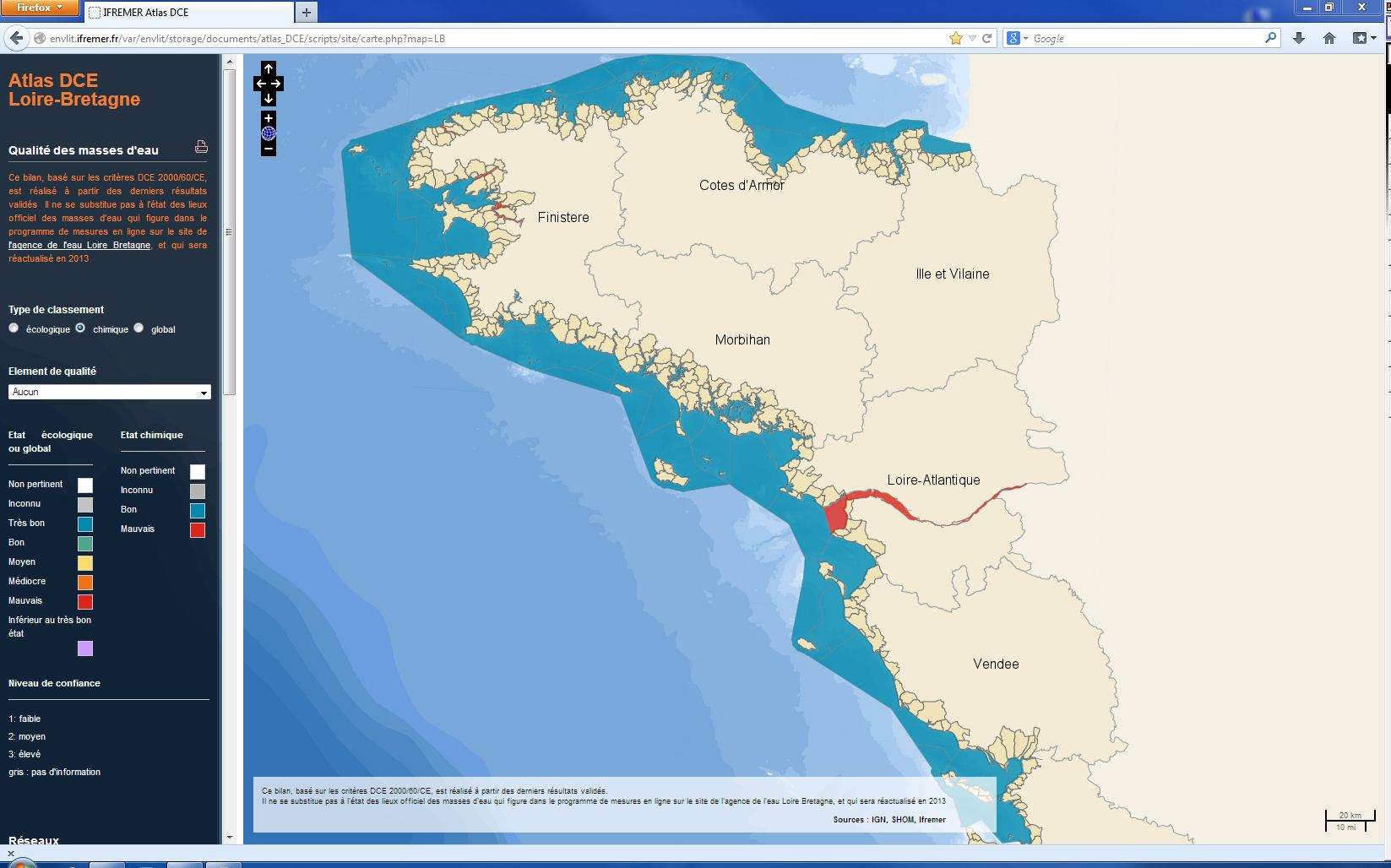
L’état chimique d'une masse d'eau littorale (eau côtière ou eau de transition) est déterminé par le plus déclassant des états définis pour les métaux lourds, les pesticides, les polluants industriels et les autres polluants pris en compte par la DCE. L'évaluation est faite 1 fois par plan de gestion (une fois tous les six ans). L'évaluation la plus récente de l’état de l'état chimique est présentée dans l’atlas DCE Loire-Bretagne. Les états antérieurs sont accessibles dans des archives annuelles.
-
Le terme "champs de blocs" couvre les zones de blocs des plus bas niveaux de l'estran découvrant aux basses mers. Il ne font pas partie véritablement du médiolittoral mais de ce que l'on définit désormais comme la frange émergée (ou émergente ou encore partie supérieure) de l'infralittoral. De manière plus générale, les champs de blocs, constitués par la fragmentation des roches en place, sont situés au pied de falaises rocheuses ou entre les pointes rocheuses et platiers. Ils ne sont accessibles à pied que lors de coefficients de marée supérieurs ou égaux à 95. Les champs de blocs abritent naturellement une biodiversité élevée du fait de leur situation en bas d’estran, mais leur richesse faunistique et floristique dépend aussi beaucoup du type architectural de l’habitat. Trois grandes catégories de champs de blocs sont distinguées : les blocs sur sédiments, les blocs sur roche en place et les blocs sur blocs.
-
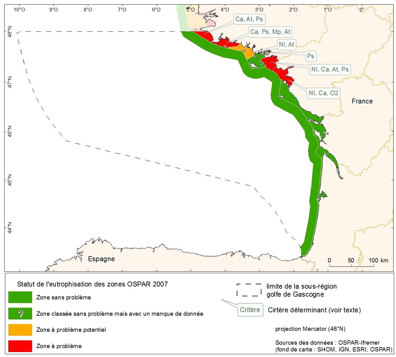
Statut d'eutrophisation des zones OSPAR 2007 sur la métropole. Donnée collectée dans le cadre de l'évaluation initiale de la DCSMM.
-
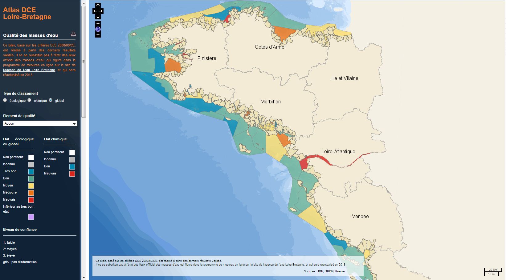
L’analyse porte sur l'évaluation de l'état global des masses d'eaux côtières et de transition de la Manche ouest et du golfe de Gascogne. Il résulte de la combinaison de l'état écologique et de l'état chimique de chaque masse d'eau selon les règles de la directive cadre européenne sur l'eau (DCE). L’évaluation la plus récente de l’état est présentée dans l’atlas DCE Loire-Bretagne. Les états antérieurs sont accessibles dans des archives annuelles.
-
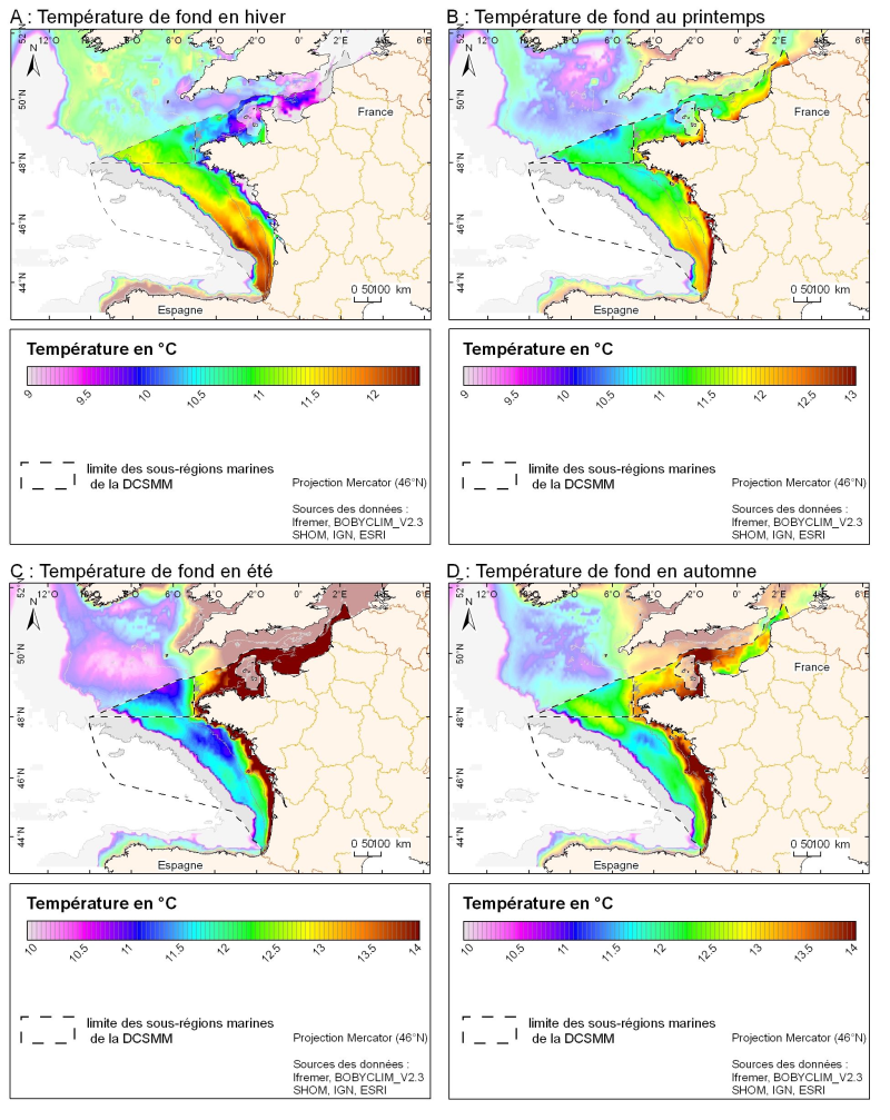
Champ de température (en °C) saisonnié 3D obtenu par analyse objective (interpolation) de la donnée brute in situ, à proximité du fond. Dans le cadre du Défi Golfe de Gascogne et du programme d'Océanographie Côtière Operationnelle Prévimer, les services SISMER et DYNECO-PHYSED de l'IFREMER ont constitué une base de données hydrologiques unique du Golfe de Gascogne, à partir de mesures CTD, Bouteilles, XBT/ MBT et Profileurs provenant de plusieurs centres de données mondiaux, afin de réaliser un atlas climatologique de la région en température et salinité.
-
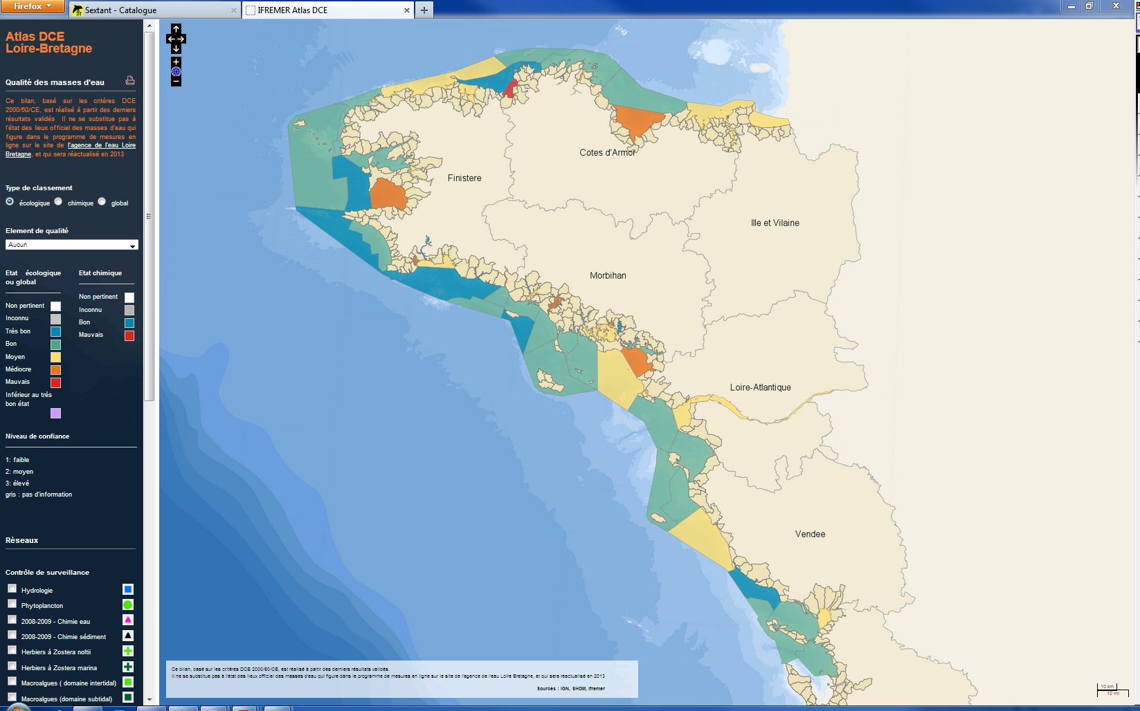
L’analyse porte sur le suivi de l'état écologique des masses d'eaux côtières et de transition de la Manche ouest et du golfe de Gascogne . L'état écologique d'une masse d'eau littorale au sens de la directive cadre européenne sur l'eau (DCE) est déterminé par l'état biologique, l'état physico-chimique et l'état hydromorphologique de la masse d'eau. L'état est déterminé selon les règles décrites dans l'arrêté du 25 janvier 2010.
-
Distribution spatiale trimestrielle des phoques gris (Halichoerus grypus) recensés par l'ONCFS sur leurs reposoirs terrestres des roches de Portsall en 2010.
-
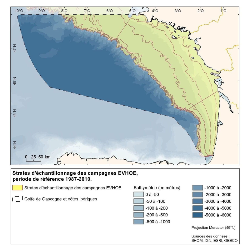
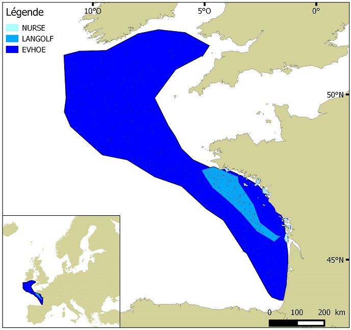
Polygones définis pour la répartition des points d'échantillonnage des campagnes Evhoe dans le golfe de Gascogne et en mer Celtique