 Mon GéoSource
notPlanned
Type of resources
Available actions
Topics
INSPIRE themes
Keywords
Contact for the resource
Provided by
Years
Formats
Representation types
Update frequencies
status
Scale
Resolution
-
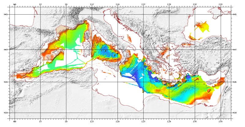
Bathymetric model (DTM) of the Mediterranean. MediMap group. Bathymetry data acquired by multibeam sounders during campaigns Almofront.leg1 and Almofront.leg2, Almofront, Bretane, Seamewe2, Heralis, Medee, Anaxiprobe, Almofront2 - leg1 and leg2, Prismed2, Marmara, Fanil, Tvic5 et 6, Progres, Maradja, Blac, Nautinil, Medor-Simed1 / 2 / 3 / 4 / 5, Maradja2, Sardinia, Prisme, Assemblage and Thertou. Integration of partner organizations DTM. This DTM is available at two cell sizes : 500 m and 1000 m.
-
-
-
Geomorphological analysis of the continental slope of the Mediterranean sea based on a 100m Data Terrain Model (DTM). This DTM is a synthesis of data acquired during sea surveys.
-
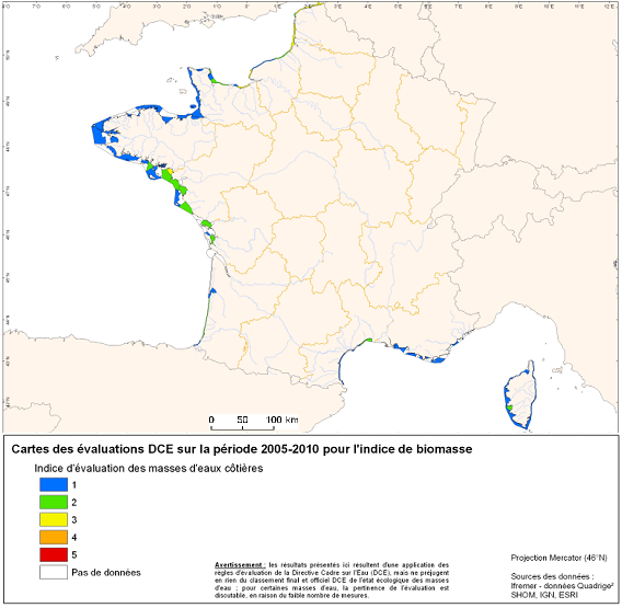
Under the EU Water Framework Directive (2000/60/EC), among the biological parameters involved in the assessment of coastal water bodies, the quality element "phytoplankton" is defined. This indicator Phytoplankton is made up of several indexes including a biomass index and an abundance index. Oxygen balance appearing among the elements of physicochemical quality selected for the classification of the ecological state of coastal water bodies. The quality element "benthic invertebrates" is also part of the biological parameters involved in the assessment of these water bodies.
-
-
Location distribution per grid cell of 8 young harbor seals (Phoca vitulina), followed by Argos tags (between 2005 and 2008) along the English Channel coast following rehabilitation at the care center CHENE.
-
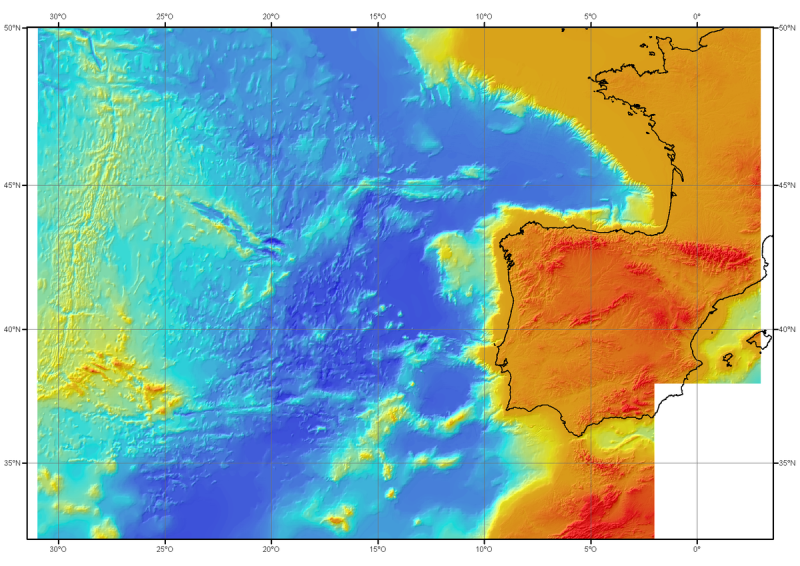
Bathymetric model (DTM) of the North-East Atlantic, generated from conventional multibeam bathymetry data, prior to the year 2000. The grid spacing is 1000 meters. Bibliographic reference : Sibuet J.C. & al., (2004) - Carte bathymétrique de l'Atlantique nord-est et du golfe de Gascogne : implications cinématiques. Bull. Soc. géol. Fr.T. 175, n°5, pp. 429-442
-
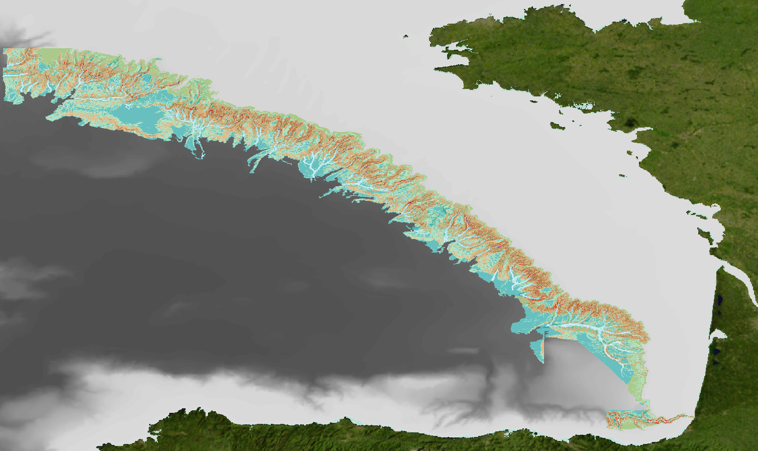
Geomorphological analysis of the continental slope of the Bay of Biscay based on a 100m Data Terrain Model (DTM). This DTM is a synthesis of data acquired during sea surveys ZEE 1, ZEE 2, Sedimanche, Sedifan 1, Sedifan 2, EssNaut 2009, EssReson08, ValidOp, BOBGeo 1, BOBGeo 2, EssInf.
-
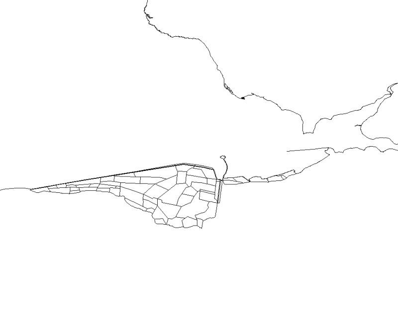
This map, realised with polygons, represents the polderized plot of bay of the Mount Saint-Michel.