 Mon GéoSource
/Physical Environment/Bathymetry/Digital Terrain Model
Type of resources
Available actions
Topics
INSPIRE themes
Keywords
Contact for the resource
Provided by
Representation types
Update frequencies
status
Scale
Resolution
-
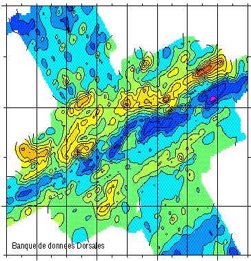
Geophysical and geochemical study of the Pacific-Antarctic ridge between S65/W175 and S60/W150. The first objective was to contribute to the understanding and modelling of the mechanisms of ocean ridge functioning on the scale of the basic accretion unit (< 100 km). The second was to study the zoning of the upper mantle on various scales, through investigating the geochemical signature of rocks from the axial valley. This cruise falls under the framework of the Inter-Ridge programme and is the result of cooperation between IFREMER/DRO/GM, INSU (CNRS,IPG, GRGS), Washington State University, Scripps (University of California) and the University of Chiba (Japan).
-
-
Reconnaissance geophysique, geologique, petrographique et geochimique systematique.Transit valorisé Le Cap-Singapour
-
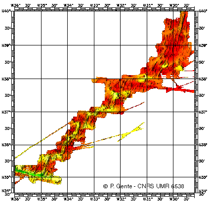
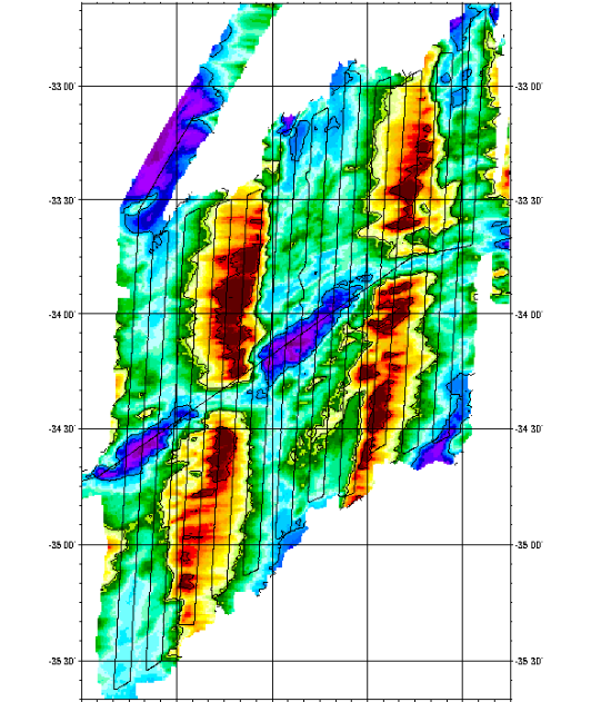
Bathymetry data of the ridge axis of Mohn's ridge (NE Atlantic) in order to study the mecanisms of the oceanic accretion.
-
Reconnaissance geophysique, geologique, petrographique et geochimique systematique.Transit valorisé Le Cap-Singapour
-
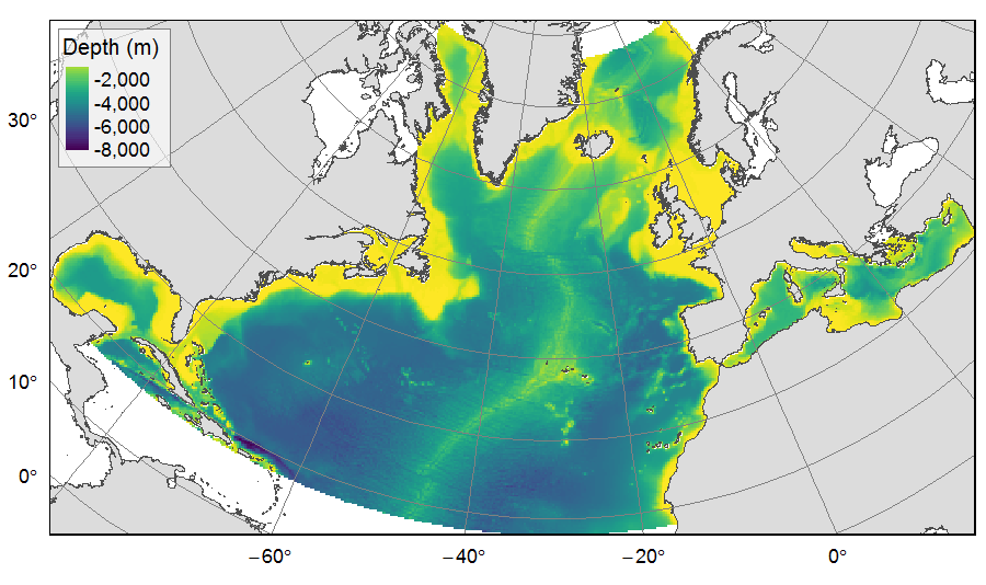
Distribution of three bathymetric terrain variables (depth, slope and Bathymetric Position Index) on the North Atlantic (18°N to 76°N and 36°E to 98°W). This dataset originated from three source layers (3km * 3km resolution) computed within the work package 3 of EU ATLAS project, and based on the EMODnet Digital Bathymetry portal and the General Bathymetric Chart of the Oceans (GEBCO). From these source layers, the mean depth (m), slope (degree) and BPI (no unit) were calculated for each 25km * 25km gridsquare. This dataset was built to feed a basin-wide spatial conservation planning exercise, targeting the deep sea of the North Atlantic. The goal of this approach was to identify conservation priority areas for Vulnerable Marine Ecosystems (VMEs) and deep fish species, based on the distribution of species and habitats, human activities and current spatial management.
-
Geophysical and geochemical study of the Pacific-Antarctic ridge between S65/W175 and S60/W150. The first objective was to contribute to the understanding and modelling of the mechanisms of ocean ridge functioning on the scale of the basic accretion unit (< 100 km). The second was to study the zoning of the upper mantle on various scales, through investigating the geochemical signature of rocks from the axial valley. This cruise falls under the framework of the Inter-Ridge programme and is the result of cooperation between IFREMER/DRO/GM, INSU (CNRS,IPG, GRGS), Washington State University, Scripps (University of California) and the University of Chiba (Japan).
-
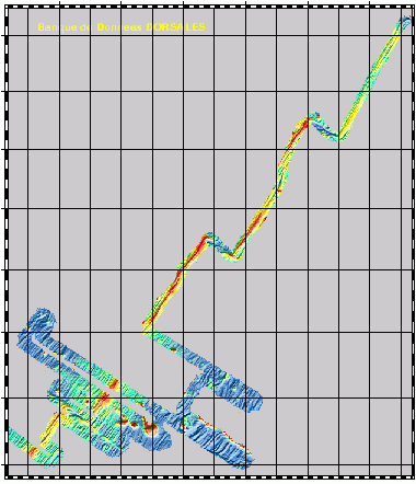
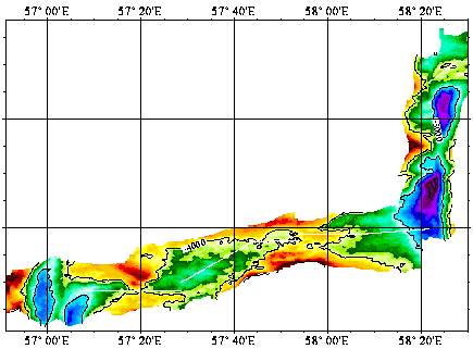
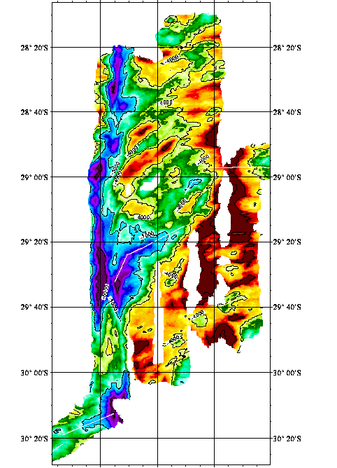
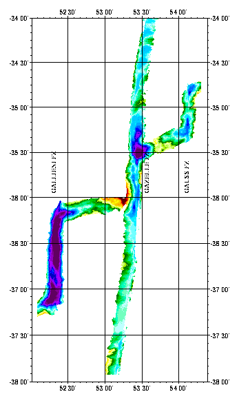
Geophysical survey of 2 sections of the South West Indian Ridge from the axis to a distance of about 100 km, corresponding to more than 10Ma. Profiles were 4 miles apart to ensure correct interpretation of gravimetry and magnetism data. The first zone studied was located around 38S and 50E, and was along a straight axis with shallow depths. The second zone was located around 34S and 56E, and was along a highly fragmented and very oblique axis.
-
Reconnaissance geophysique, geologique, petrographique et geochimique systematique.Transit valorisé Le Cap-Singapour
-
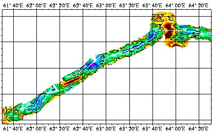
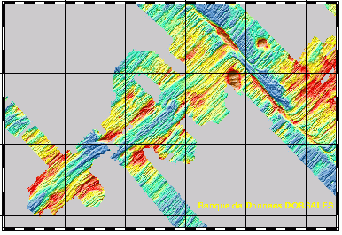
Geophysical (bathymetry, gravimetry, magnetism, seismics and multichannel reflection) and geological (dredging) studies of the northern part of the Kerguelen plateau (Indian Ocean). Survey of ODP drilling sites (leg 183). The Kerguelen underwater plateau is still puzzling today, when trying to understand its origin and explain the way it was formed. To try to answer these questions, new deep ocean drilling was to be done on the Kerguelen shelf in late 1998 and early 1999.