 Mon GéoSource
/Metropolitan France/Western Mediterranean
Type of resources
Available actions
INSPIRE themes
Provided by
Years
Representation types
Update frequencies
status
Scale
-
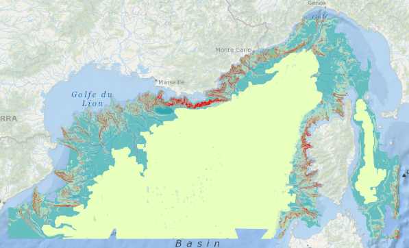
Analyse géomorphologique de la pente continentale de la façade méditerranéenne réalisée sur la base d'un modèle numérique de terrain (MNT) bathymétrique au pas 100m produit à partir de la compilation des données acquises lors de plusieurs campagnes à la mer.
-
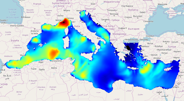
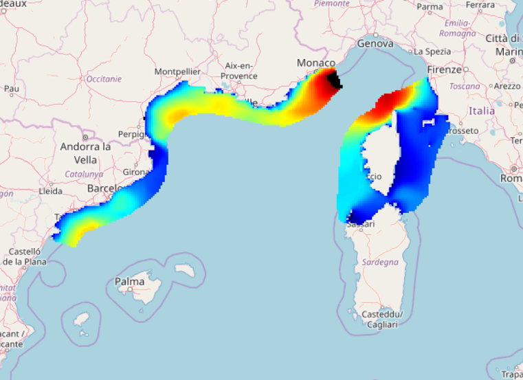
IOWAGA sea-states hindcast database generated by the wave model WAVEWATCH-III and forced by ECMWF winds on the North mediterranean unstructured grid over 2009-2010 period.
-
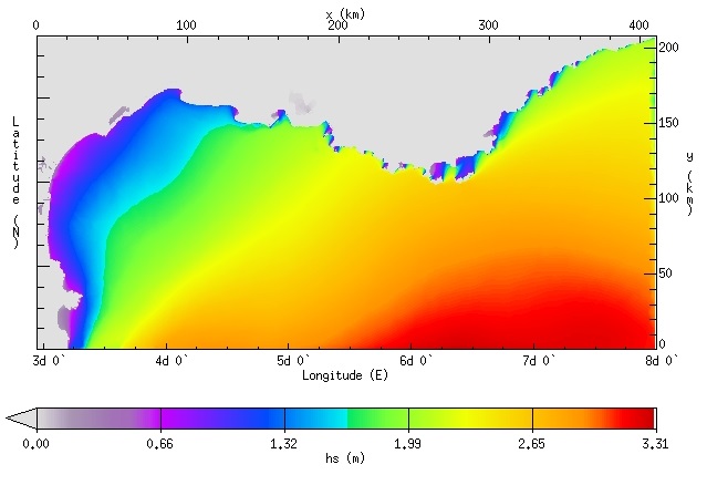
IOWAGA sea-states hindcast database generated by the wave model WAVEWATCH-III and forced by ECMWF winds on the Mediterranean grid over 2005-2017 period.
-
IOWAGA sea-states hindcast database generated by the wave model WAVEWATCH-III and forced by ECMWF winds on the North mediterranean grid over 2004-2017 period.
-
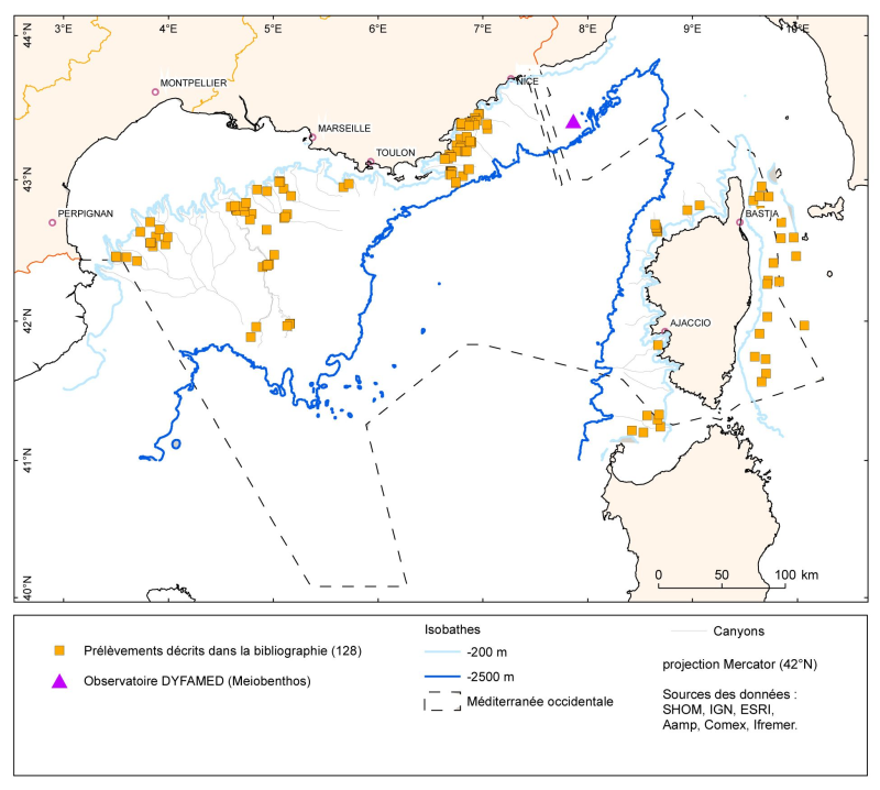
Les données sont fournies sous forme de couche de points représentant les prélèvements (opérations) benthiques en Méditerranée française. Les listes d'espèces identifiées correspondant à ces points de prélèvements sont dans les références bibliographiques indiquées dans la couche.
-
Densité (nombre par km²) et biomasse (g par km²) des captures accessoires de Funiculina quadrangularis (Pennatulacea) et Isidella elongata (Alcyonacea) observées lors des campagnes scientifiques de chalutage de fond (MEDITS partie française et NOURMED) de 2012 à 2019
-

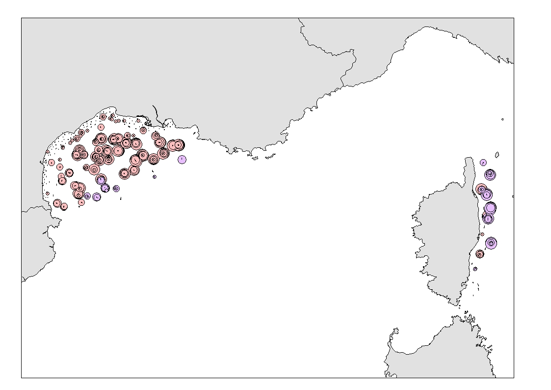
Couche de polygones représentant la répartition des organismes décrite dans la bibliographie et obtenue par prélèvement dans les canyons de Méditerranée française.
-
Les données VMS (Vessel Monitoring System) correspondent aux données du système communautaire de surveillance par satellite des navires de pêche qui fournit à intervalles réguliers des données sur la position, la route et la vitesse des navires aux autorités de pêche.
-
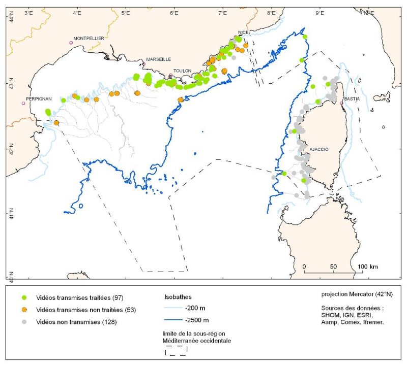
Les données sont fournies sous forme de couche de points représentant les plongées en submersible en Méditerranée française.
-
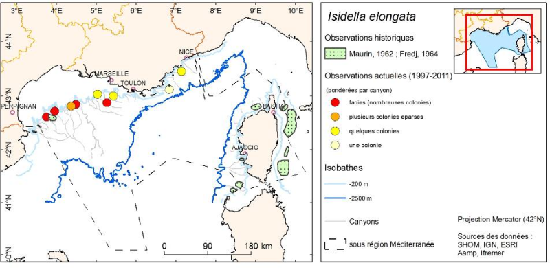
Couche de points représentant les abondances pondérées par canyon des organismes observés pendant des plongées en submersible dans les canyons de Méditerranée continentale.