 Mon GéoSource
/Processed data/Composite products
Type of resources
Available actions
Topics
INSPIRE themes
Keywords
Contact for the resource
Provided by
Years
Formats
Representation types
Update frequencies
status
Scale
Resolution
-
Stocks of Crepidula fornicata Linnaeus, 1758 in the Pertuis Charentais. Environmental state for 2011
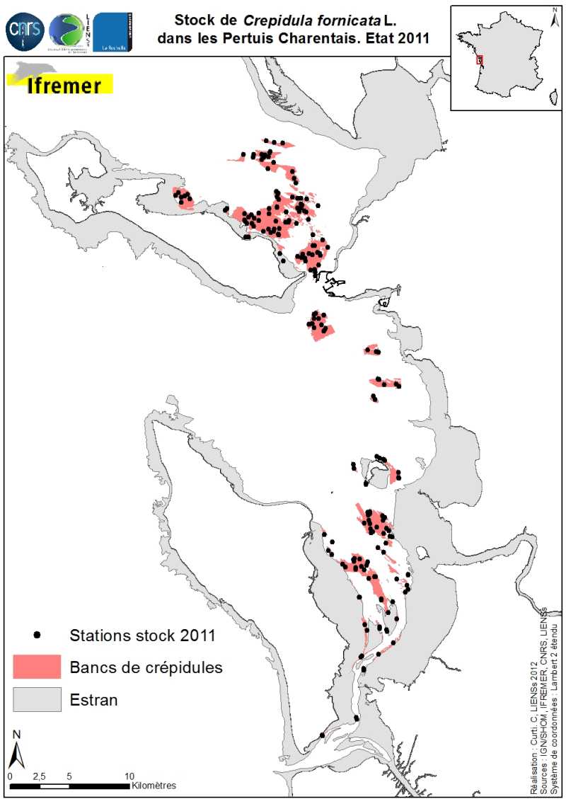
Stocks (abundance and biomass) of the slipper limpet Crepidula fornicata Linnaeus, 1758 in the Pertuis Charentais shallows were estimated in 2011 and mapped (Sauriau et al., 2011). The influence of the estimate includes the Pertuis Breton, the eastern part Pertuis Antioch Fouras peninsula and the Bay of Marennes-Oléron where the latter earlier estimates are available. Contours and surface areas of the crepidula were previously determined by acoustic imaging performed aboard the VO/Haliotis in 2008 and 2009, interpreted and validated by spot sampling in 2009 (Curti, 2009). Sampling stocks of 2011 is based on a stratified random sample of 40 banks with a proportional distribution of sampling of 200 stations between banks. The listing for each crepidula bank stocks (abundance in millions, biomass in tonnes) both living and dead, these shells may provide support to potential new colonization.
-
Reconnaissance geophysique, geologique, petrographique et geochimique systematique.Transit valorisé Le Cap-Singapour
-
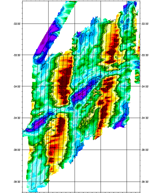
Compilation of gravimetric data between 1973 and 1994
-
Reconnaissance geophysique, geologique, petrographique et geochimique systematique.Transit valorisé Le Cap-Singapour
-
Geophysical and geochemical study of the Pacific-Antarctic ridge between S65/W175 and S60/W150. The first objective was to contribute to the understanding and modelling of the mechanisms of ocean ridge functioning on the scale of the basic accretion unit (< 100 km). The second was to study the zoning of the upper mantle on various scales, through investigating the geochemical signature of rocks from the axial valley. This cruise falls under the framework of the Inter-Ridge programme and is the result of cooperation between IFREMER/DRO/GM, INSU (CNRS,IPG, GRGS), Washington State University, Scripps (University of California) and the University of Chiba (Japan).
-
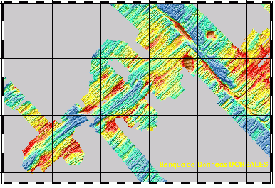
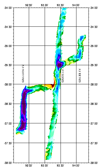
Geophysical survey of 2 sections of the South West Indian Ridge from the axis to a distance of about 100 km, corresponding to more than 10Ma. Profiles were 4 miles apart to ensure correct interpretation of gravimetry and magnetism data. The first zone studied was located around 38S and 50E, and was along a straight axis with shallow depths. The second zone was located around 34S and 56E, and was along a highly fragmented and very oblique axis.
-
Compilation of gravimetric data between 1973 and 1994
-
Reconnaissance geophysique, geologique, petrographique et geochimique systematique.Transit valorisé Le Cap-Singapour
-
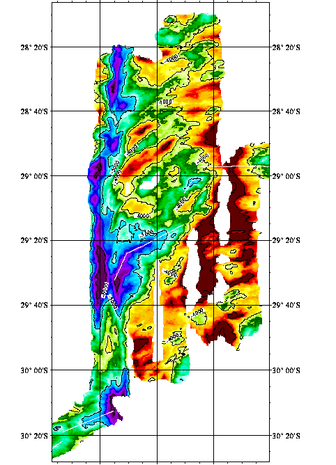
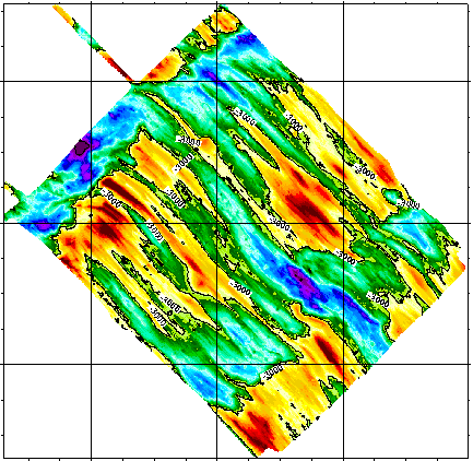
Geophysical (bathymetry, gravimetry, magnetism, seismics and multichannel reflection) and geological (dredging) studies of the northern part of the Kerguelen plateau (Indian Ocean). Survey of ODP drilling sites (leg 183). The Kerguelen underwater plateau is still puzzling today, when trying to understand its origin and explain the way it was formed. To try to answer these questions, new deep ocean drilling was to be done on the Kerguelen shelf in late 1998 and early 1999.
-
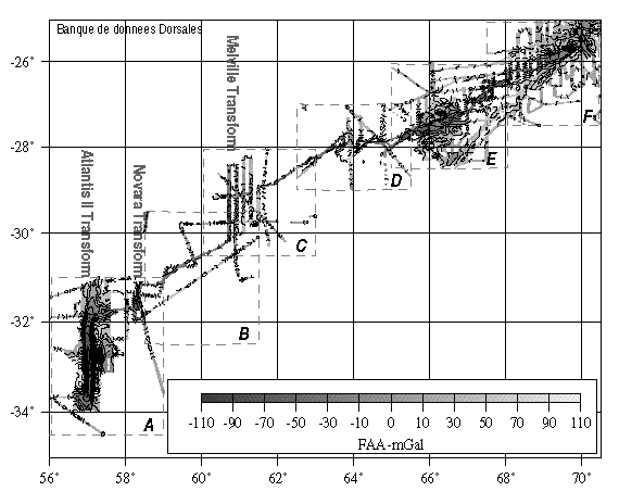
Reconnaissance geophysique, geologique, petrographique et geochimique systematique du point triple de Rodriguez ou convergent trois dorsales medio-oceanique. Exploration geophysique, geologique, petrographiqueet geochimique d'un segment de la zone axiale de chacune des trois dorsales. Reconnaissance, dans le bassin de Wharton, d'une dorsale fossile.