 Mon GéoSource
/Milieu biologique/Espèces/Espèces rares, protégées ou en voie de disparition
Type of resources
Available actions
Topics
INSPIRE themes
Keywords
Contact for the resource
Provided by
Years
Formats
Representation types
Update frequencies
status
Scale
Resolution
-
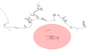
Zone de protection du narcisse de Saint-Nicolas (archipel des Glénan). Cette zone s'étend sur 6 milles autour de l'île de Saint-Nicolas.
-
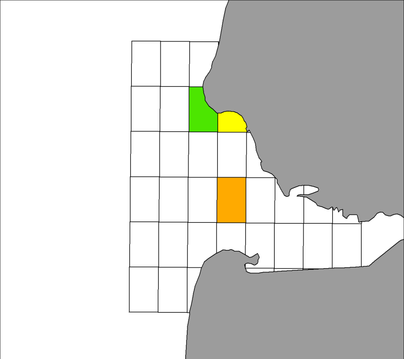
Distribution spatiale trimestrielle des phoques gris (Halichoerus grypus) recensés par les associations ADN et Picardie Nature sur leurs reposoirs terrestres dans la baie d'Authie, de 2007 à 2009 inclus.
-
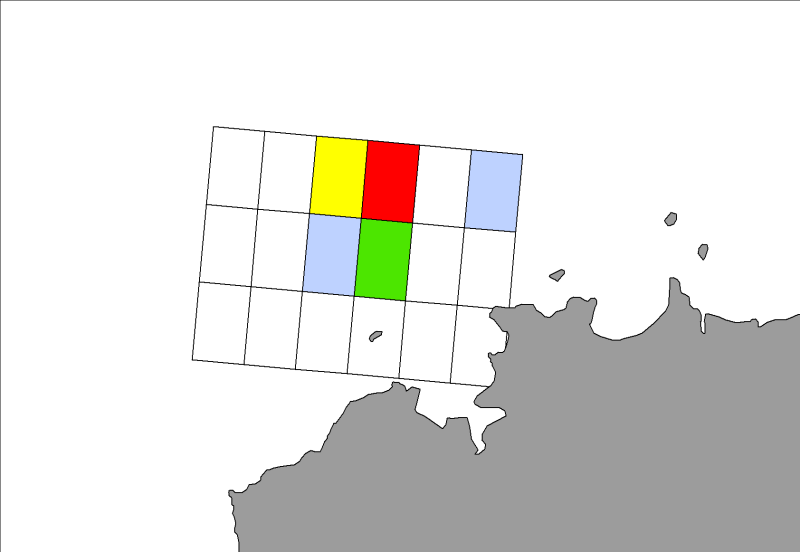
Distribution spatiale trimestrielle des phoques gris (Halichoerus grypus) recensés par l'ONCFS sur leurs reposoirs terrestres des roches de Portsall en 2010.
-
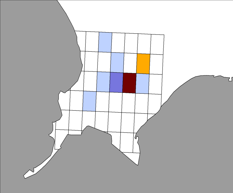
Distribution spatiale trimestrielle des phoques veaux marins (Phoca vitulina) recensés par Aérobaie et la Réserve Naturelle du Domaine de Beauguillot sur leurs reposoirs terrestres dans la baie des Veys, de 2007 à 2009 inclus.
-
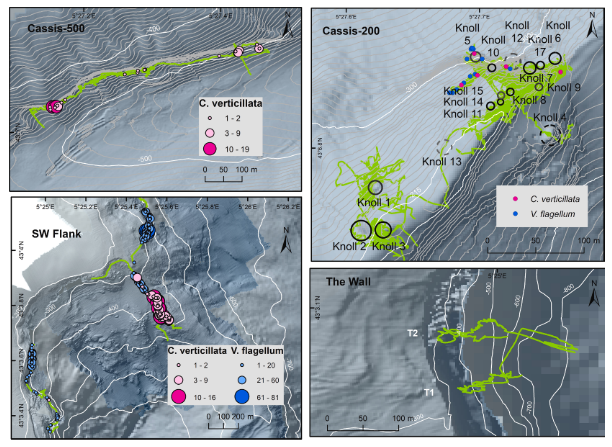
Distribution des gorgonaires Callogorgia verticillata observées pendant la campagne VIDEOCOR_2017 dans le canyon de Cassidaigne (L'Europe 2017, H-ROV Ariane). Données liées à la publication Fabri et al., 2019. https://doi.org/10.1016/j.pocean.2019.102172
-

Carte, sous forme de polygones, représentant les zones de la baie du Mont Saint-Michel fréquentées par la macreuse noire (Melanitta nigra) en période d'hivernage. Cette espèce atteint régulièrement le niveau d'importance internationale en baie du Mont Saint-Michel.
-
Distribution des coraux d’eaux froides Madrepora oculata (Scleréctiniaires) obtenue pendant la campagne VIDEOCOR1 en 2017 dans le canyon de Cassidaigne, Méditerranée Ouest. Les colonies de coraux ont été filmées/photographiées au cours de la campagne VIDEOCOR1 par le H-ROV Ariane (L’Europe, 2017). Les images ont été utilisées pour réaliser des modèles 3D de chaque zone. Chaque colonie de Madrepora oculata a été positionnée à la main sur les modèles géoréférencés. Données liées à la publication Fabri et al., 2019. https://doi.org/10.1016/j.pocean.2019.102172
-

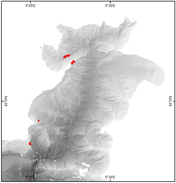
Distribution connue de corail rouge Corallium rubrum (Alcyonacea) dans le canyon de Cassidaigne, Méditerranée Ouest. Les colonies de corail rouge ont été filmées/photographiées au cours de la campagne VIDEOCOR1 par le H-ROV Ariane (L’Europe, 2017). Les images ont été utilisées pour réaliser des modèles 3D de chaque zone. Chaque colonie de Corallium rubrum a été positionnée à la main sur les modèles géoréférencés. Données liées à la publication Fabri et al., 2019. https://doi.org/10.1016/j.pocean.2019.102172
-
Carte, sous forme de polygones, représentant les zones de la baie du Mont Saint-Michel fréquentées par le Puffin des Baléares (Puffinus mauretanicus) pendant la mue et le stationnement inter-nuptial. Cette espèce est inscrite à l'Annexe 1 de la directive Oiseaux.
-
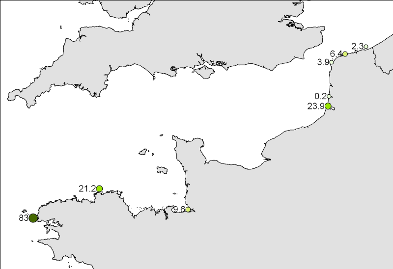
Nombre moyen de phoques gris (Halichoerus grypus) recensés par trimestre sur les différentes colonies le long du littoral français, de 2007 à 2010