 Mon GéoSource
biota
Type of resources
Available actions
Topics
INSPIRE themes
Keywords
Contact for the resource
Provided by
Years
Formats
Representation types
Update frequencies
status
Scale
Resolution
-
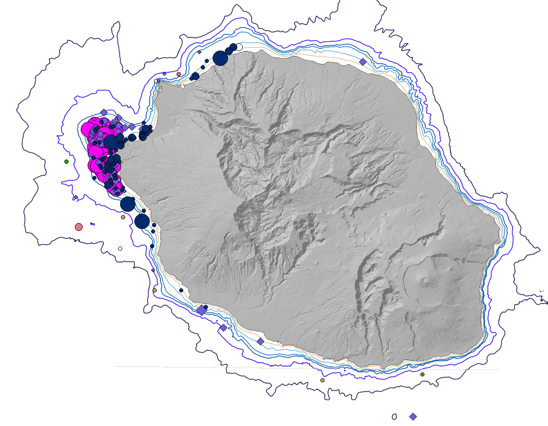
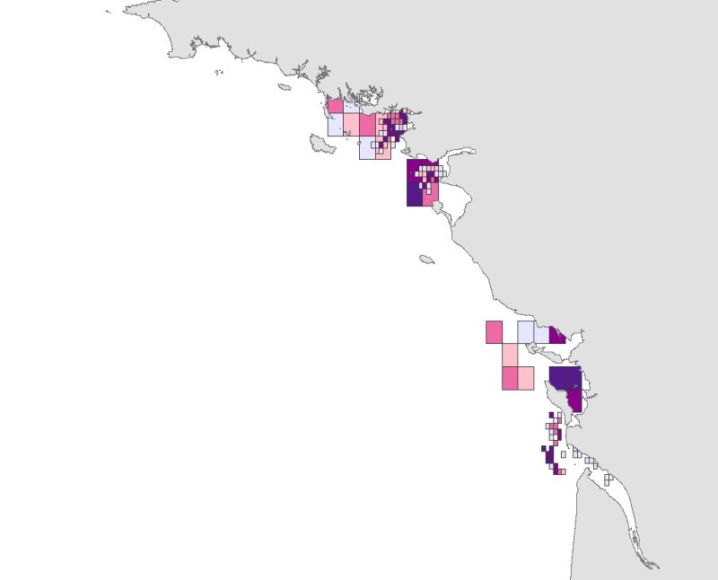
Cartographie des positions des observations des différentes espèces de cétacés autour de l'île de La Réunion en 2016
-
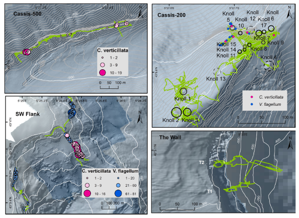
Distribution des gorgonaires Callogorgia verticillata observées pendant la campagne VIDEOCOR_2017 dans le canyon de Cassidaigne (L'Europe 2017, H-ROV Ariane). Données liées à la publication Fabri et al., 2019. https://doi.org/10.1016/j.pocean.2019.102172
-
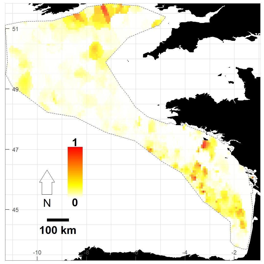
Distribution du taxon Pagurus prideaux établie à partir des données de densité d'abondance relative cumulées et krigées issues des campagnes halieutiques EVHOE (2008-2013), LANGOLF (2011-2013), NURSE (2000-2013), ORHAGO (2011-2015)
-
Espaces Naturels Sensibles gérés par le CG 80
-
Base de données géographique des haies 2009 et 2013. Fichier correspondant aux haies issus de la photo-interprétation des missions aériennes de 2009 et 2013 sur les territoires du Nord et du Pas-de-Calais, créé dans le cadre du projet de coopération transfrontalier INTERREG IV A des 2 Mers : ARCH ("Assessing Regional Changes to Habitats").
-
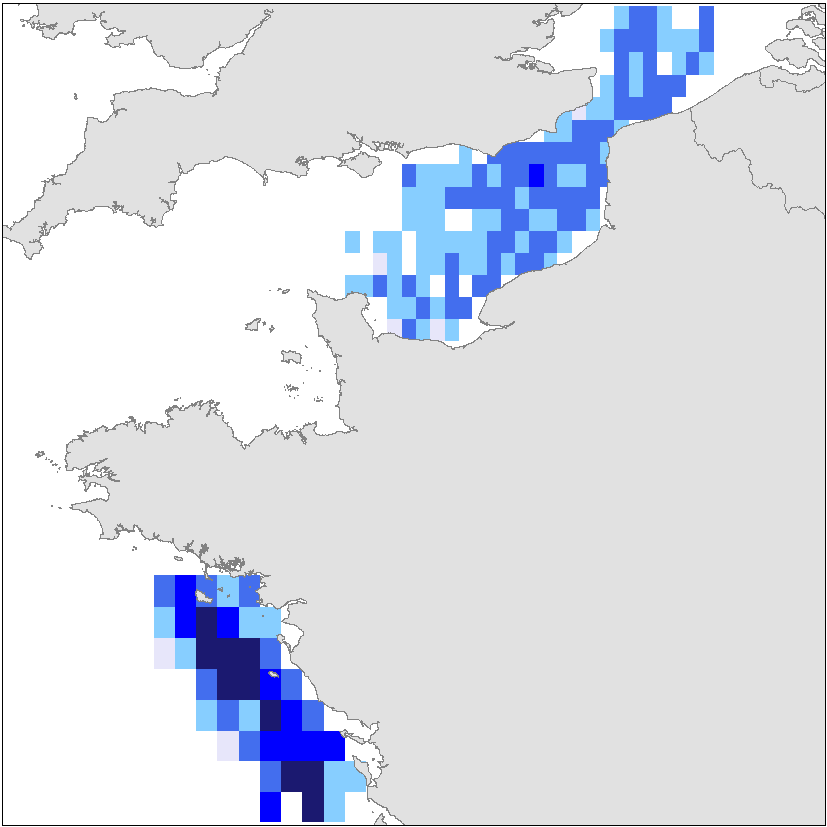
L'abondance de juvéniles de céteau (Dicologlossa cuneata) est exprimée en nombre d’individus par km² et observée lors des campagnes halieutiques de l'Ifremer utilisant un engin de pêche ”traînant de fond” : Nurse Loire et Gironde (2000-2003), Nurse Vilaine (2003-2009), PECOS (2004-2006). Données utilisées dans le cadre d'une étude visant à l'identification de zones de moindres contraintes pour l'exploitation de granulats marins (étude confiée par le Ministère chargé de l'écologie).
-
Distribution du taxon Rossia macrosoma établie à partir des données de densité d'abondance relative cumulées et krigées issues des campagnes halieutiques EVHOE (2008-2013), LANGOLF (2011-2013), NURSE (2000-2013), ORHAGO (2011-2015)
-
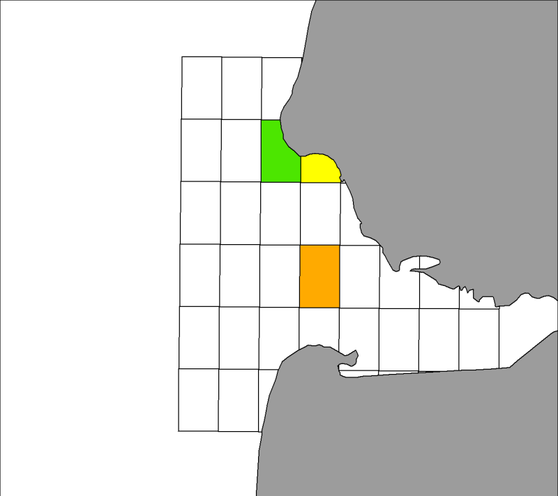
Distribution spatiale trimestrielle des phoques gris (Halichoerus grypus) recensés par les associations ADN et Picardie Nature sur leurs reposoirs terrestres dans la baie d'Authie, de 2007 à 2009 inclus.
-
Sensibilité des ressources halieutiques aux activités d'extraction de granulats marins, critère "frayère". Cette donnée est une synthèse des frayères (abondance des œufs) des ressources halieutiques observées lors des campagnes scientifiques halieutiques sur la période 2005 – 2010 et calculée dans le cadre d'une étude visant à l'identification de zones de moindres contraintes pour l'exploitation de granulats marins (étude confiée par le Ministère chargé de l'Écologie).
-
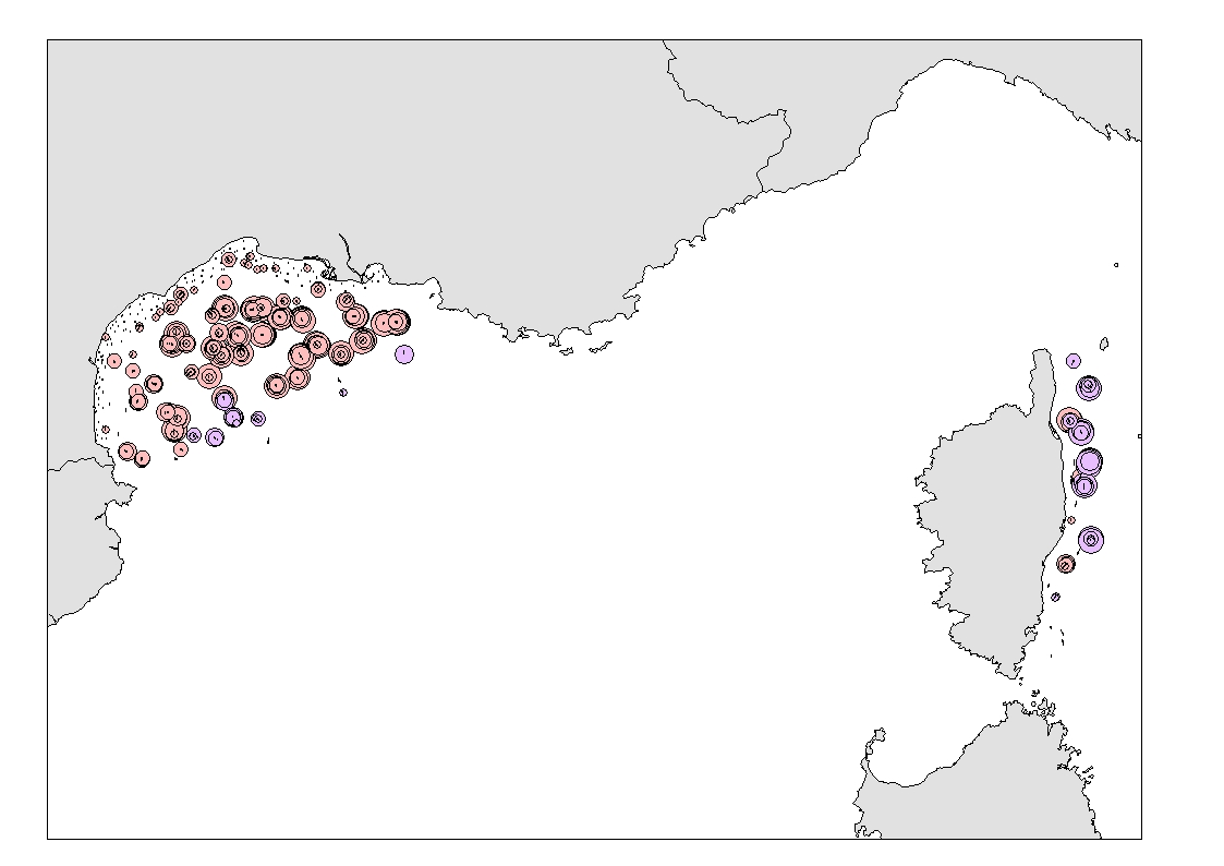
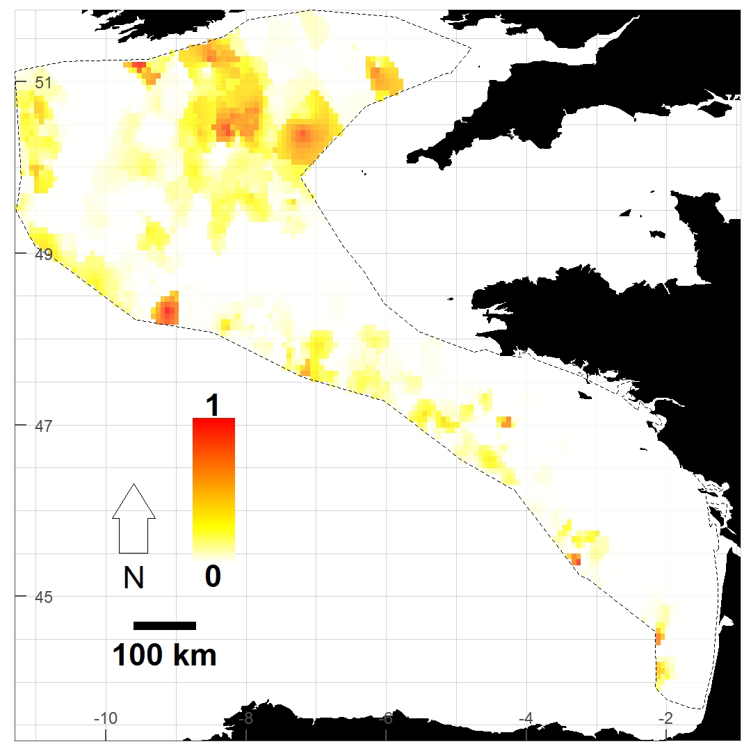
Densité (nombre par km²) et biomasse (g par km²) des captures accessoires de Funiculina quadrangularis (Pennatulacea) et Isidella elongata (Alcyonacea) observées lors des campagnes scientifiques de chalutage de fond (MEDITS partie française et NOURMED) de 2012 à 2019