 Mon GéoSource
50000
Type of resources
Available actions
Topics
INSPIRE themes
Keywords
Contact for the resource
Provided by
Years
Formats
Representation types
Update frequencies
status
Scale
Resolution
-
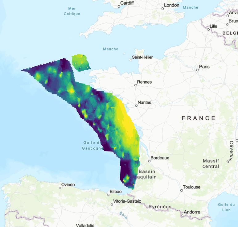
Indice de présence du marsouin commun en Atlantique-Manche (champ "Marsouin_A").
-
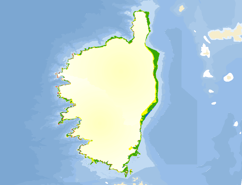
La cartographie des peuplements et des types de fonds du littoral de Corse apparaît comme un outil indispensable de gestion intégrée des zones côtières. La caractérisation de ces peuplements et types de fonds est issue de la thèse de V. PASQUALINI de 1997.
-
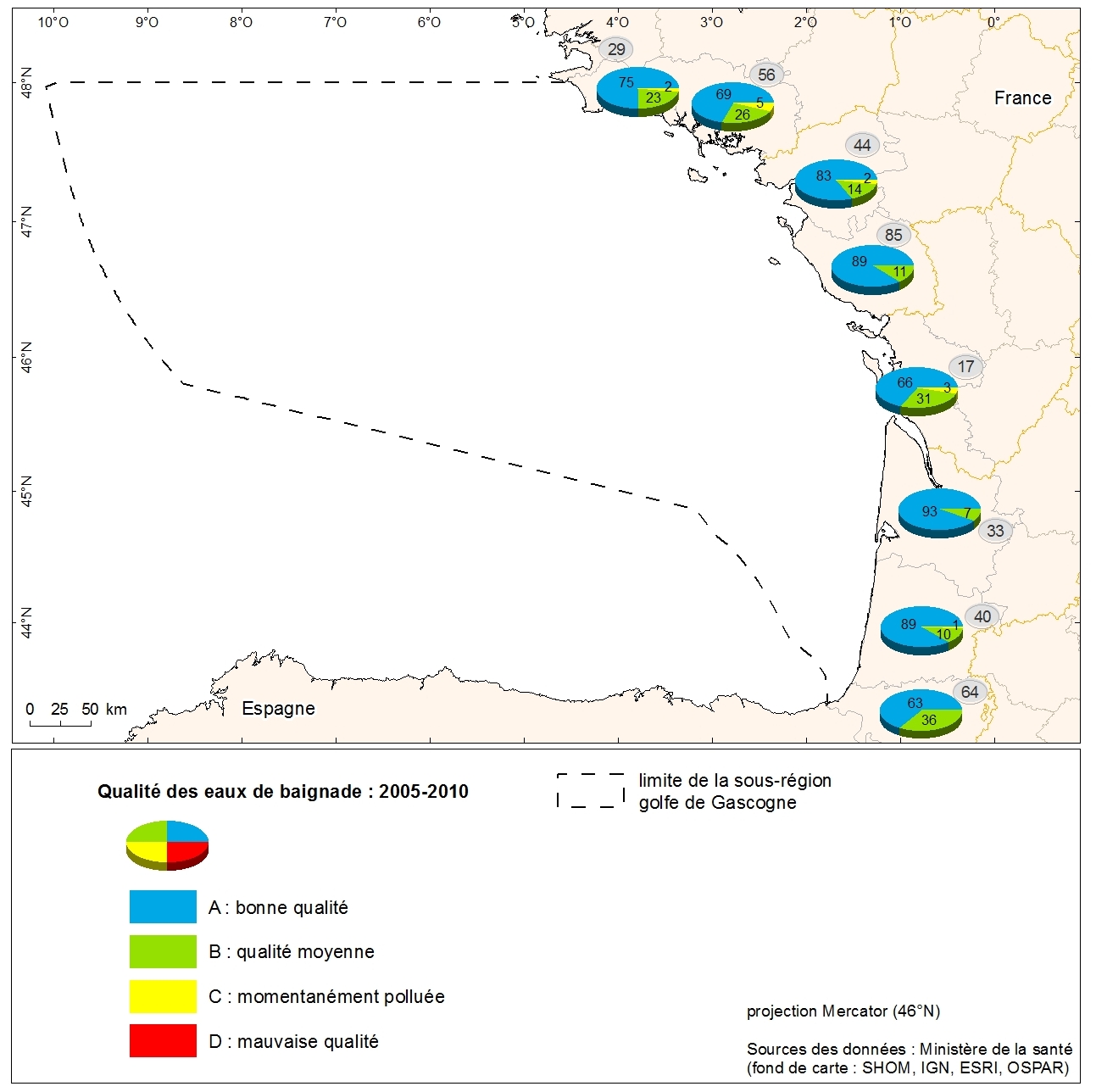
Classement de la qualité des eaux de baignade littorales métropolitaines en 2010 issu du Ministère de la santé. Donnée collectée auprès du Ministère de la santé dans le cadre de l'évaluation initiale de la DCSMM. Référent expert : Aurélie Blanck.
-
source : DREAL HdF / SEN (17/03/2021) Contrat de Territoire Eau et Climat (CTEC) Également appelés Contrats Globaux sur Seine-Normandie
-
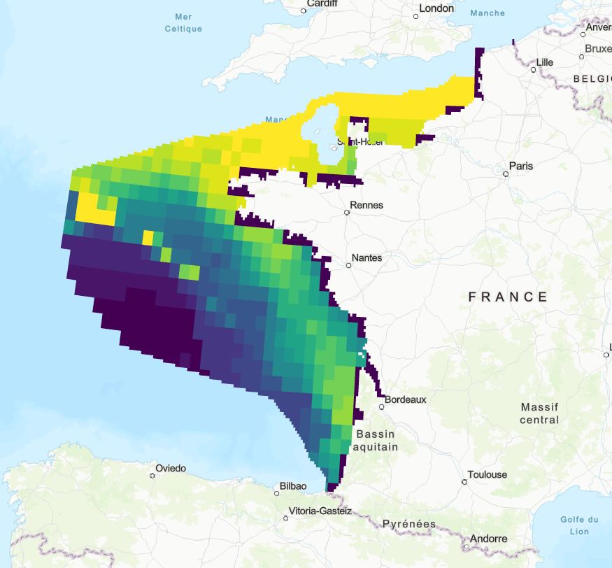
Sensibilité environnementale vis-à-vis de l'éolien en mer des zones de croissance de poissons en Atlantique (champ : "Croissances_Sensibilite").
-
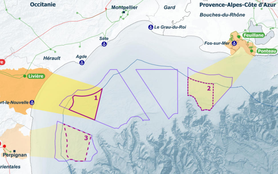
Zones annexées à la Décision ministérielle du 17 mars 2022 consécutive au débat public portant sur le projet d’éoliennes flottantes en Méditerranée et leur raccordement. Le premier parc d’environ 250 mégawatts et son extension seront situés au sein de la zone 1. Le second parc d’environ 250 mégawatts et son extension seront situés soit au sein de la zone 2, soit au sein de la zone 3. La zone 2 est considérée comme préférentielle pour l’accueil de ce parc et de son extension.
-
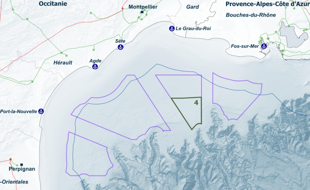
Zones annexées à la Décision ministérielle du 17 mars 2022 consécutive au débat public portant sur le projet d’éoliennes flottantes en Méditerranée et leur raccordement. Des études environnementales seront également menées sur la zone 4 dans une perspective de planification.
-
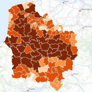
Part (%) de de la Surface Agricole Utile (SAU) calculée par canton (cantons regroupés ou pseudo-cantons) en Hauts-de-France. La surface agricole utile (SAU) est un instrument statistique destiné à évaluer le territoire consacré à la production agricole, différente de la SAT (surface agricole totale). La SAU est composée de : * terres arables (grande culture, cultures maraîchères, prairies artificielles...) ; * surfaces toujours en herbe (prairies permanentes, alpages) ; * cultures pérennes (vignes, vergers...). Elle n'inclut pas les bois et forêts. Elle comprend en revanche les surfaces en jachère, c’est-à-dire les terres retirées de la production (gel des terres). Ces terres sont comprises dans les terres arables.
-

Les petites régions agricoles ont été définies (en 1946) pour mettre en évidence des zones agricoles homogènes. La Région Agricole (RA) couvre un nombre entier de communes formant une zone d'agriculture homogène. La Petite Région Agricole (PRA) est constituée par le croisement du département et de la RA. La dernière actualisation date de 1981.
-
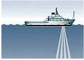
Données de courantométrie mesurées en continu par un ADCP de coque (Acoustic Doppler Current Profiler), validées et agrégées.